A raster data index and query method

A query method and raster data technology, which is applied in still image data indexing, structured data retrieval, still image data retrieval, etc., can solve the problem of costing storage space, achieve stable storage capacity, completely constant calculation amount, and high performance Effect

Active Publication Date: 2018-06-19
吉奥时空信息技术股份有限公司
View PDF2 Cites 0 Cited by
  • Summary
  • Abstract
  • Description
  • Claims
  • Application Information

AI Technical Summary

Problems solved by technology

For example, an itinerary index segment [3-3] actually only records the existence of one tile, but it takes two integers (64bit) of storage space

Method used


Image

  • A raster data index and query method
  • A raster data index and query method
  • A raster data index and query method

Examples


Embodiment

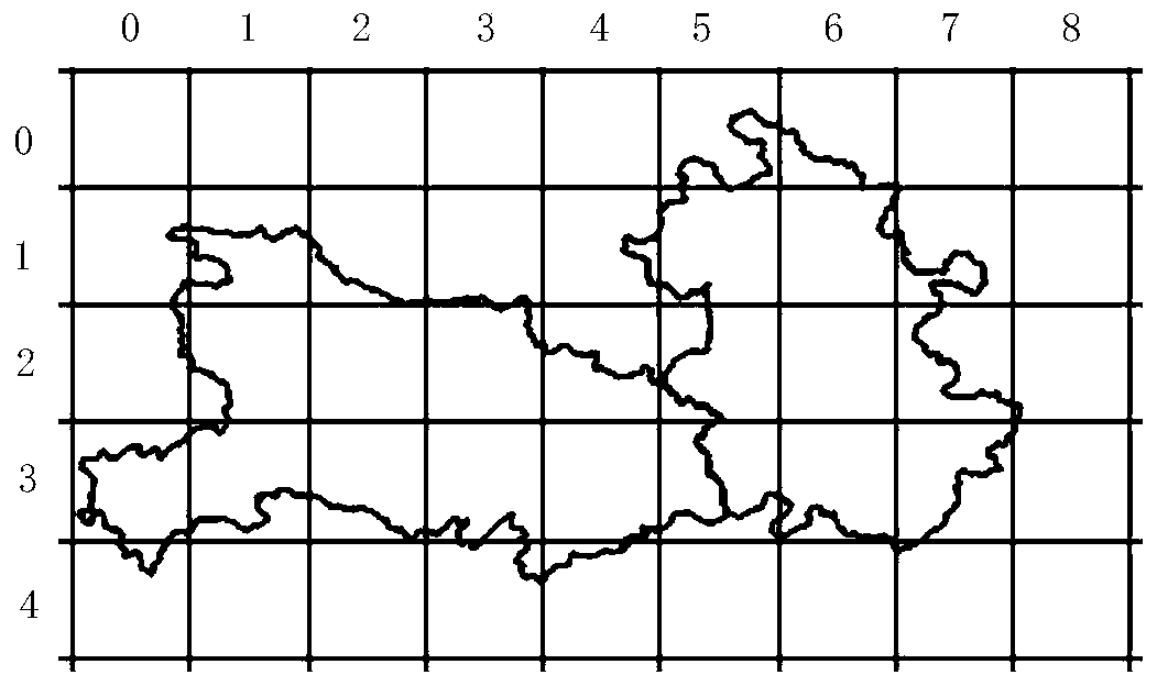
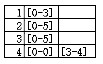
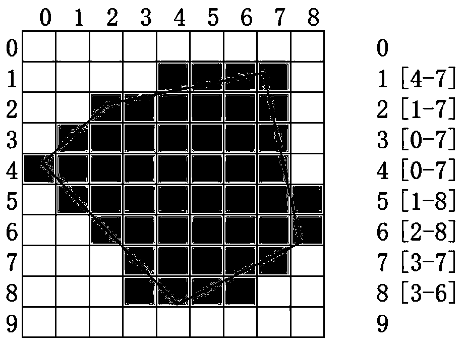
[0040] A digital image (raster image) is a data format that records image information in the form of a row-column grid. A digital image usually takes one pixel as the smallest unit. The grid record form of a digital image is very similar to tile data. A tile Similar to a pixel in a digital image.

[0041] A digital image can use at least one bit to record the information of one pixel to form black and white image data. The existence or non-existence of tile data can be recorded with one bit like a digital image monochrome image.

[0042] In a digital image, a monochrome bitmap continuously stores multiple pixels in a row in a single byte, such as, Figure 5 As shown, the storage of the cell (tile) state in the present invention adopts a cell in the range of continuous 4X4=16 or 8X8=64 to store with a standard computer unsigned integer (unsigned short, 16bit or unsigned long, 64bit) . Such as Figure 6-7 shown.

[0043] Any 4×4 or 8×8 cell (tile) can be considered as a cel...


PUM


Abstract

The present invention relates to an index and query method, belongs to the field of geographic information data process, and specifically relates to a raster data index and query method. The method comprises: dividing tile data into a plurality of same sized cell groups, wherein the tile data inside the cell groups are adjacent in position; and using a state integer to represent a tile data state inside the cell groups, wherein the state integer belongs to computer integers, and each bit is corresponded to a tile data state inside the cell groups. The raster data index and the query method is high in storage density and stable in storage capacity, consistent in data structure stored on the premise of continuous or incontinuous tile data, and completely constant in calculation amount; the method has a higher performance when a retrieval with spatial correlation is achieved; and the method can make full use of a computer data structure, so that the calculation amount is lower and the efficiency is higher.

Description

technical field [0001] The invention relates to an index and query method, which belongs to the field of geographic information data processing, in particular to a raster data index and query method. Background technique [0002] With the rapid development of Internet technology and GIS technology, tile maps based on Internet technology have been widely used. [0003] The tile itself is a very simple data structure, and the tiles of the same level are kept tiled, so various calculations can be easily performed using simple linear calculation formulas, and there is also a linear ratio relationship between different levels of tiles . The very easy-to-calculate feature of tiled maps makes it basically unnecessary to use indexes when using TMS (Tiled Map Service) provided on the Internet, or it can be said that the various calculation formulas of tiles are indexes. [0004] Therefore, tile data does not require special indexes to improve efficiency in normal use cases. But in...

Claims


Application Information

Patent Timeline
Patent Type & Authority Patents(China)
IPC IPC(8): G06F17/30
CPCG06F16/29G06F16/51
Inventor 刘奕夫贺楷锴
Owner 吉奥时空信息技术股份有限公司
Why Eureka
Try Eureka