Weather forecast manufacturing method and system based on real-time achievement exhibition
A technology for weather forecasting and production methods, which is applied in meteorology, weather condition forecasting, climate sustainability, etc., and can solve problems such as unclear distribution of local towns or counties, affecting the production of weather forecast information, and inaccurate forecast results, etc. , to achieve the effects of reducing national economic losses, protecting people's lives and property, and making it simple
- Summary
- Abstract
- Description
- Claims
- Application Information
AI Technical Summary
Problems solved by technology
Method used
Image
Examples
Embodiment 1
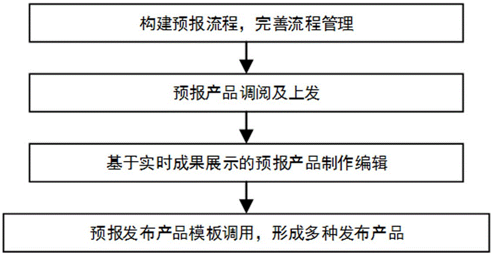
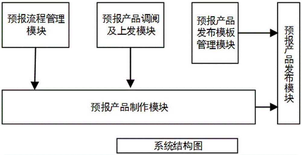
[0058] In the input area, the regions that need to forecast the weather are displayed based on a list, and a forecast information input module is provided for each area. The display area displays cloud maps, radar maps, and administrative division maps separately, and the weather types are grouped in the input area. Or edit the temperature, etc. The administrative division map in the display area will be colored in different colors according to the weather type in the input area. Users can compare and view the weather distribution of the administrative division map, radar map, cloud map, etc. to determine whether the forecast is reasonable .
Embodiment 2
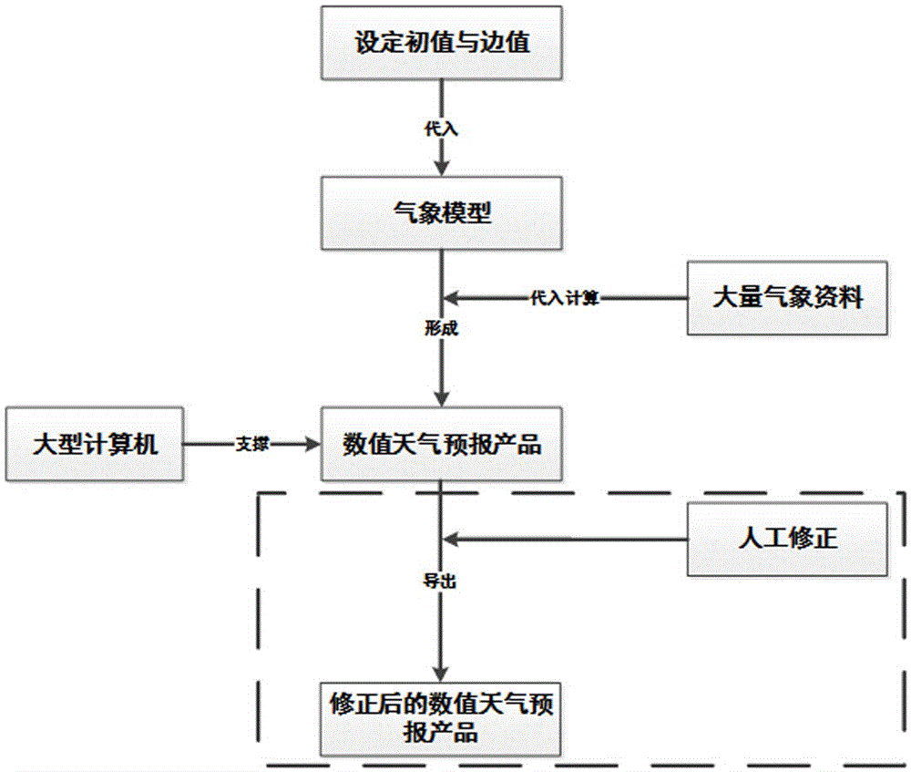
[0060] If the result is calculated by a large computer, the system will load the predicted result of the computer system by default, and the result can be adjusted for the input area. The display area can be set to the original forecast result, the modified forecast result, satellite cloud map, radar map Layer display, by correcting the forecast results in the input area, comparing the forecast results with the original forecast results, and then combining satellite cloud images, radar images and other layer information to determine whether the forecast revision results are accurate.
Embodiment 3
[0062] The input area is combined with the gis platform to realize the input of forecast information, and through the superposition of the radar layer, satellite cloud image layer and administrative area distribution layer, the accurate forecast of regional weather is realized. The input area realizes the optional operation of the radar layer and the satellite cloud image layer. At the same time, the superposition of the administrative division context is carried out on the page. When a certain administrative division is selected, the system provides weather forecast options, and different weather types according to different weather types. For the color filling, corresponding text records will be added to the corresponding text forecast materials. At this time, the display area can be set as the forecast information distribution map, cloud map, and radar map respectively, and the accuracy of the forecast result can be determined by comparing the information distribution of the...
PUM
 Abstract
Description
Claims
Application Information
 - Generate Ideas
- Intellectual Property
- Life Sciences
- Materials
- Tech Scout
- Unparalleled Data Quality
- Higher Quality Content
- 60% Fewer Hallucinations
Browse by: Latest US Patents, China's latest patents, Technical Efficacy Thesaurus, Application Domain, Technology Topic, Popular Technical Reports.
© 2025 PatSnap. All rights reserved.Legal|Privacy policy|Modern Slavery Act Transparency Statement|Sitemap|About US| Contact US: help@patsnap.com


