Mangrove extraction method based on hierarchical decision tree
An extraction method, mangrove technology, applied in the direction of instruments, character and pattern recognition, computer components, etc., can solve the problem of less consideration of wetland characteristics, and achieve the effect of accurate and rapid extraction
- Summary
- Abstract
- Description
- Claims
- Application Information
AI Technical Summary
Problems solved by technology
Method used
Image
Examples
Embodiment 1
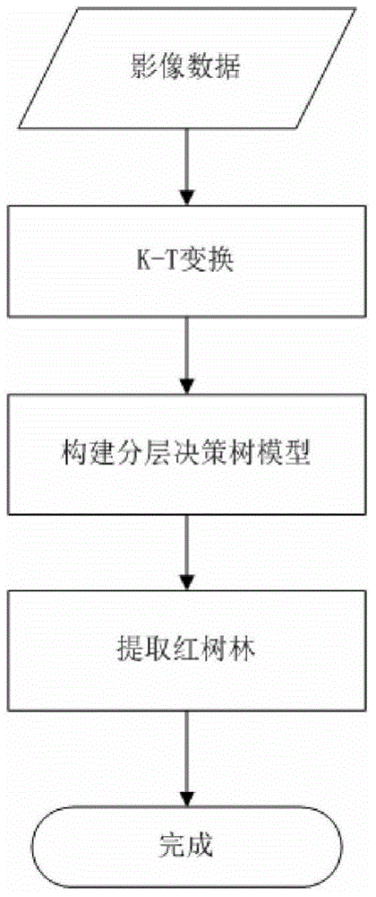
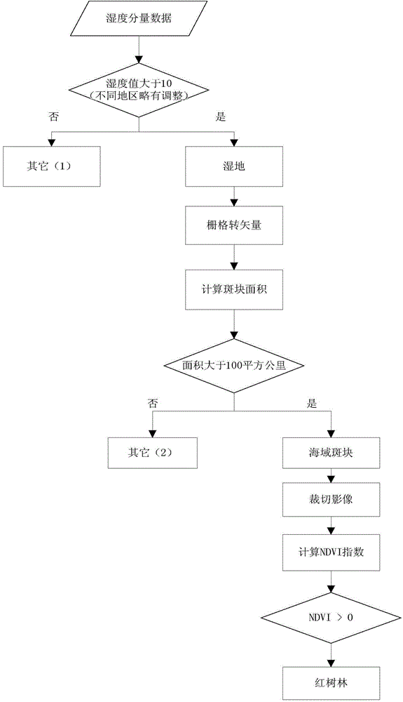
[0014] Example 1: Such as figure 1 , figure 2 As shown, a mangrove extraction method based on a hierarchical decision tree includes the following steps:
[0015] Perform KT transformation on remote sensing images, extract humidity components, refer to auxiliary data based on humidity components, such as field GPS sampling points, Google images, etc., select appropriate thresholds to extract wetlands; analyze the geographic distribution characteristics of mangrove wetlands, and filter by area criteria Excluding non-mangrove areas; further use the vegetation index method to select appropriate thresholds to extract mangroves based on the spectral characteristics of the mangroves. In the process of mangrove extraction, the key is to select an appropriate threshold and establish a decision tree model to extract mangrove wetlands. Test the accuracy of the classification results from different angles, and adjust the threshold to re-classify if problems are found, until a satisfactory ...
Embodiment 2
[0041] Example 2: Such as figure 1 As shown, the implementation case of this method mainly includes the following steps:
[0042] 1. Data acquisition steps;
[0043] Download Landsat TM / ETM image data through the USGS website and the Earth Observation Data Sharing website of the Chinese Academy of Sciences.
[0044] Obtain GPS sample data of typical mangrove distribution areas through field surveys.
[0045] 2. Remote sensing image preprocessing steps;
[0046] With 1:100,000 digital topographic map, combined with field high-precision GPS control point data, geometric correction is performed on the acquired remote sensing image, and the correction error is controlled within one pixel.
[0047] For ETM image data, the principal component method is used to image fusion of panchromatic band data and multispectral data.
[0048] 3. Dynamic threshold method to extract wetland steps;
[0049] Perform K-T transformation on the corrected image to obtain the humidity component. Refer to the auxili...
PUM
 Abstract
Description
Claims
Application Information
 - Generate Ideas
- Intellectual Property
- Life Sciences
- Materials
- Tech Scout
- Unparalleled Data Quality
- Higher Quality Content
- 60% Fewer Hallucinations
Browse by: Latest US Patents, China's latest patents, Technical Efficacy Thesaurus, Application Domain, Technology Topic, Popular Technical Reports.
© 2025 PatSnap. All rights reserved.Legal|Privacy policy|Modern Slavery Act Transparency Statement|Sitemap|About US| Contact US: help@patsnap.com


