
Satellite clock error real-time estimation method based on area multi-reference-station joint resolving

A satellite clock error and reference station technology, which is applied to radio-controlled timers, satellite radio beacon positioning systems, measuring devices, etc., can solve the problems of reducing the calculation speed and affecting the real-time performance of clock error estimation.

Inactive Publication Date: 2014-04-16
SOUTHEAST UNIV
View PDF2 Cites 21 Cited by
  • Summary
  • Abstract
  • Description
  • Claims
  • Application Information

AI Technical Summary

Problems solved by technology

Precise satellite clock errors are generally estimated through regional or global GNSS observation networks. However, as the number of observations increases, the number of estimated parameters will increase in a certain proportion, which slows down the calculation speed and affects the real-time performance of clock error estimation.

Method used


Image

  • Satellite clock error real-time estimation method based on area multi-reference-station joint resolving
  • Satellite clock error real-time estimation method based on area multi-reference-station joint resolving
  • Satellite clock error real-time estimation method based on area multi-reference-station joint resolving

Examples


example

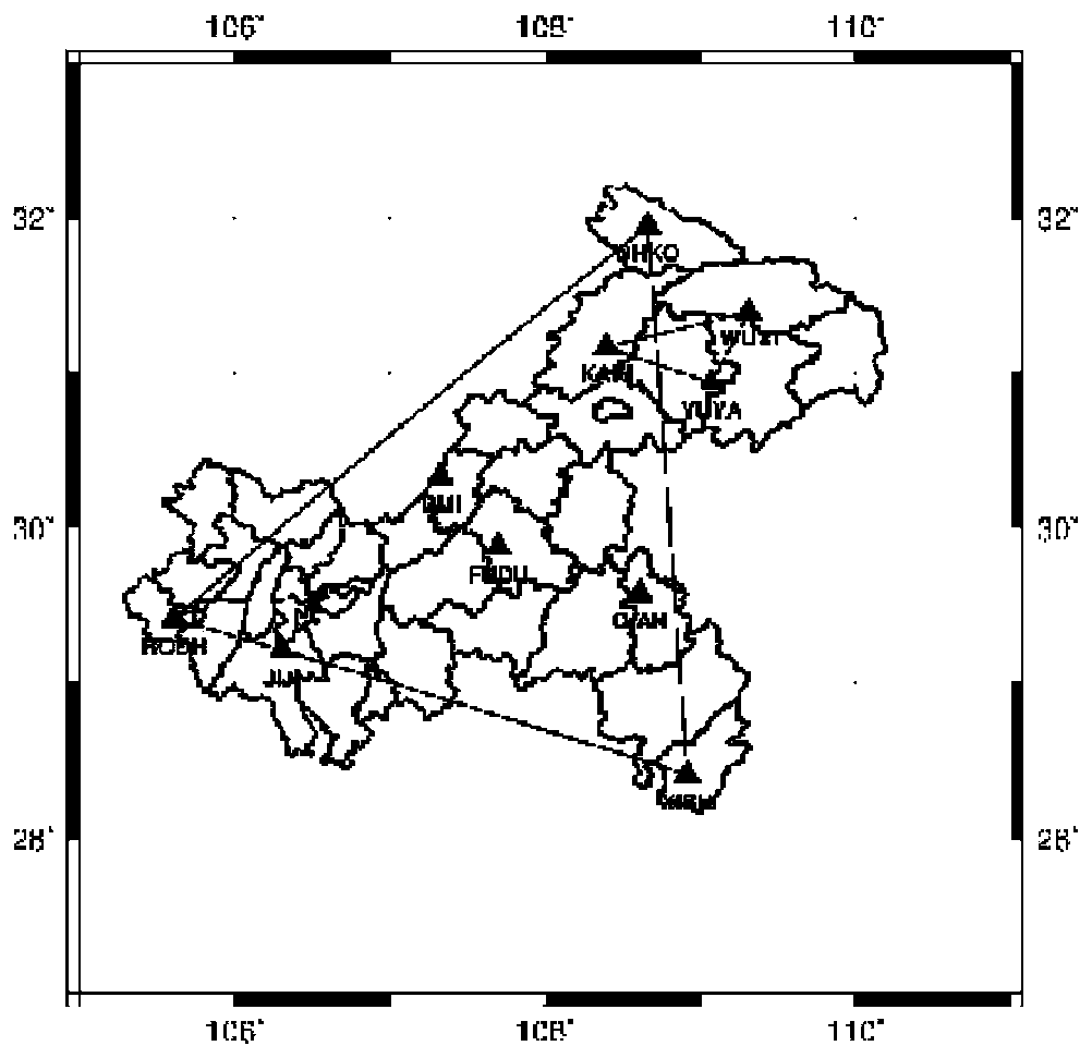
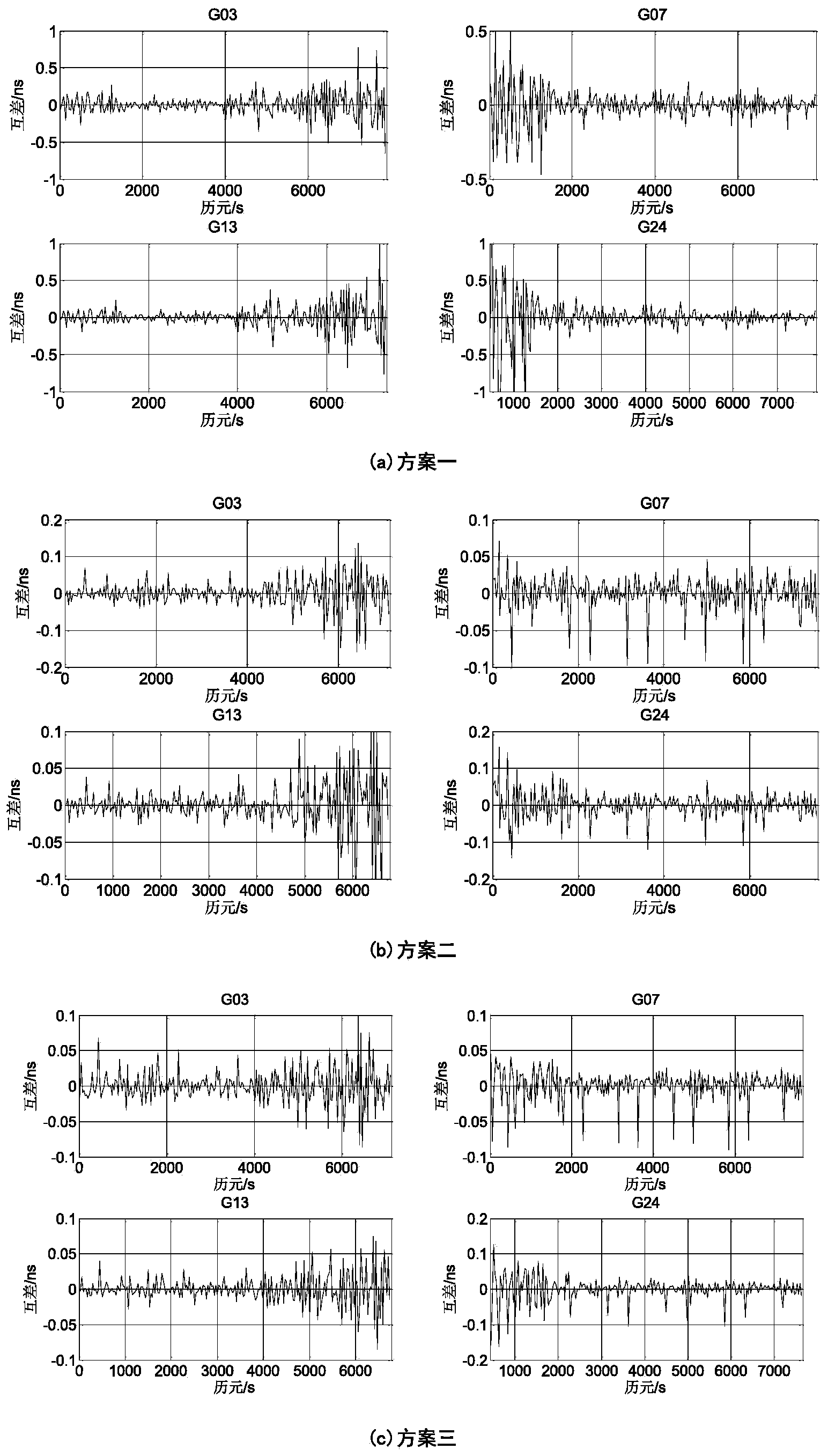
[0071] In order to truly and effectively reflect the accuracy of the solution results, the present invention uses the observation data of 10 continuous operation reference stations evenly distributed in the network of Chongqing Land and Resources GNSS Network Information System (CQCORS) on November 10, 2010, to solve the problem first. Synchronously observe the relative clock difference between epochs of the satellites, and select the corresponding reference satellite (here, satellite No. 19 is selected) to eliminate the influence of different reference clocks on the clock error estimation, compare the calculated results with the corresponding IGS results, and use The following formula counts the RMS value of the difference time series:

[0072] RMS = Σ i = 1 n ( ...


PUM


Abstract

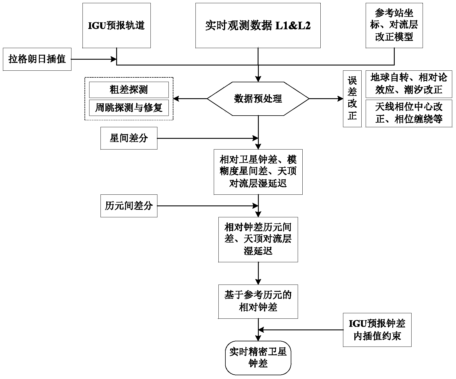
The invention provides a satellite clock error real-time estimation method based on area multi-reference-station joint resolving. The precision and timeliness of real-time precise single point positioning is improved. The method is based on a satellite and epoch difference technology, GNSS carrier phase observed values collected by area reference stations in real time and an IGU ephemeris provided by an international GNSS IGS center are utilized, the relative satellite clock error relative to a reference epoch is obtained through the multi-reference-station joint resolving , and the relative lock error values of all the epochs are obtained with the IGU precast clock error and interpolated values in the IGU precast clock error. According to the method, the operating quantity is small, the resolving speed is high, and a high-precision real-time satellite clock error product can be obtained fast through a small number of reference station carrier phase observed values. The method is based on the multi-reference-station GNSS data joint processing, the instability of single base station resolving is avoided, and the negative influence on the clock error estimation by convection zone parameter time and space correlation is reduced.

Description

technical field [0001] The invention belongs to the technical field of GNSS ground enhancement, and in particular relates to a method for real-time estimation of precise satellite clock error of a regional GNSS network. Background technique [0002] High-precision satellite clocks are the basis of navigation and positioning systems. At present, the important factors restricting the promotion of real-time precise point positioning technology are still the accuracy of precision satellite clock error calculation and its release cycle. The real-time satellite precise orbit product can be obtained from the IGS ultra-fast ephemeris (IGU). The IGU ephemeris is updated every 6 hours, and the orbit accuracy is about 5cm, which meets the requirements of real-time precise single-point positioning. However, the accuracy of IGU's forecast clock error is only about 3ns, and the resulting positioning error will reach the sub-meter level or even meter level, and the error will increase lin...

Claims


Application Information

Patent Timeline
IPC IPC(8): G04R20/02G01S19/27
Inventor 潘树国夏炎陈伟荣高旺时小飞王胜利何帆吴波
Owner SOUTHEAST UNIV
Learn More