
Parallel method for large-area drainage basin extraction

A large-area and watershed technology, applied in the parallel field of watershed extraction, can solve problems such as decision-making errors, national and people's economic losses, and increased computing costs, and achieve the effects of reducing the impact of computing efficiency, expanding application breadth, and ensuring load balancing

Inactive Publication Date: 2015-03-04
NANJING NORMAL UNIVERSITY
View PDF2 Cites 2 Cited by
  • Summary
  • Abstract
  • Description
  • Claims
  • Application Information

AI Technical Summary

Problems solved by technology

Jianya Gong (Jianya Gong, Jibo Xie, Extraction of drainage networks from large terrain datasets using high throughout computing[J].Computers & Geosciences,35(2009):337-346.) Using high throughput calculation, using watershed boundaries as data The division strategy extracts watershed networks in parallel from large terrain datasets, but resampling data from a multi-scale perspective to obtain watershed boundary divisions undoubtedly increases computational overhead and cannot be used for load balancing control
[0007] The TAUDEM program of Utah State University in the United States uses the MPICH2 parallel library to realize the parallel extraction and analysis of hydrological information, but it only supports the TIFF data format, and lacks the consideration of system load balancing and computing security and stability generated by the granularity of data division in a parallel environment. and other problems, so this method is often difficult to be directly applied to the actual DEM digital terrain analysis
[0008] The shortcomings of the existing watershed extraction methods mentioned above have brought great difficulties in terrain analysis and engineering applications for large areas, and may even cause decision-making errors in relevant departments in engineering applications such as soil and water conservation and prevention in the Loess Plateau. causing huge economic losses to the country and the people

Method used


Image

  • Parallel method for large-area drainage basin extraction
  • Parallel method for large-area drainage basin extraction
  • Parallel method for large-area drainage basin extraction

Examples


Embodiment Construction

[0046] The present invention will be described in further detail below in conjunction with the accompanying drawings and specific embodiments.

[0047] In the present invention, data division, fusion strategy and parallel I / O mechanism under data parallel mode:

[0048] 1. Data partition strategy

[0049] (1) Division method

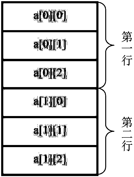
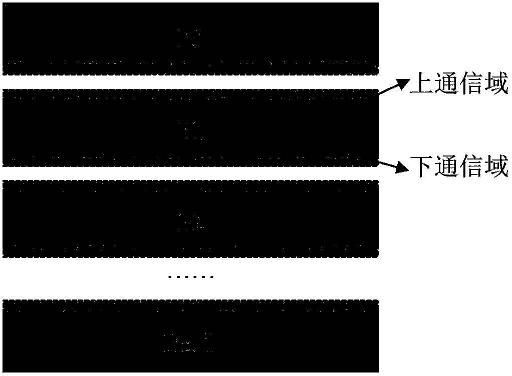
[0050] Row Band Communication Partition (RBCP): When DEM data is calculated, it is in the form of a matrix of m rows × n columns, which can be organized in a two-dimensional array. The storage form of DEM data based on two-dimensional arrays at the physical layer is row-by-row storage (such as figure 1 shown) and load balancing is an important factor for each computing node to achieve maximum computing efficiency in the parallel computing process. Considering two aspects, when the present invention divides DEM data, it uses row band redundancy division. The row-band communication domain division refers to the way of dividing the DEM into bands includi...


PUM


Abstract

The invention discloses a parallel method for large-area drainage basin extraction of massive DEM data. The parallel method comprises the following steps of: step 1, optimally partitioning granularity evaluation; step 2, carrying out swale filling and calculating in accordance with data partitioning and fusion strategies; step 3, carrying out water flow direction parallel calculation in accordance with the data partitioning and fusion strategies on the basis of swale filling results; step 4, carrying out confluence accumulation parallel calculation in accordance with the data partitioning and fusion strategies on the basis of water flow direction data; step 5, setting confluence thresholds and carrying out river network water system parallel calculation in accordance with the data partitioning and fusion strategies on the basis of water flow direction data and confluence accumulation data; and step 6, carrying out sub-drainage basin partitioning parallel calculation in accordance with the data partitioning and fusion strategies on the basis of the river network water system and water flow direction data so as to accomplish the drainage basin extraction. With the adoption of the method, the granularity in data partitioning and an I / O (Input / Output) mechanism are sufficiently considered, and the self data characteristics on the serial algorithm parallel analysis can be considered as well.

Description

technical field [0001] The present invention relates to a watershed extraction parallel technology of a digital elevation model (DEM), specifically a watershed extraction parallel method based on data division, fusion strategy and serial algorithm parallel analysis mechanism for massive DEM data in a large area. Background technique [0002] Digital elevation model products (Digital Elevation Models, abbreviated as DEM) are the most important spatial information data in the geographic information system (Geographical Information System, abbreviated as GIS) geographic database and the core data system for terrain analysis. , transportation, military, water conservancy, agriculture, environment, resource management, planning and tourism and many other fields. For example, in the surveying and mapping department, it is mainly used for 3D terrain modeling, visual domain analysis, engineering earthwork estimation, geometric correction of remote sensing images, etc.; In the field ...

Claims


Application Information

Patent Timeline
Patent Type & Authority Patents(China)
IPC IPC(8): G06F9/38G06F9/50G06F17/50
Inventor 刘学军汤国安江岭宋效东祝士杰
Owner NANJING NORMAL UNIVERSITY
Learn More