
Global navigation satellite system receiver and position measurement method

A global navigation satellite and satellite receiving technology, applied in satellite radio beacon positioning systems, measurement devices, radio wave measurement systems, etc., can solve the problem of reducing measurement accuracy, inconsistent latitude and longitude coordinates, and the inability of the center pole to ensure that the plane of the satellite receiving antenna is vertical. And other issues

Active Publication Date: 2012-07-04
HERONAV BEIJING TECH DEV
View PDF3 Cites 28 Cited by
  • Summary
  • Abstract
  • Description
  • Claims
  • Application Information

AI Technical Summary

Problems solved by technology

[0005] However, in the actual coordinate measurement process, the centering pole cannot be guaranteed to be perpendicular to the plane of the satellite receiving antenna, which makes the latitude and longitude coordinates of the satellite receiving antenna inconsistent with the latitude and longitude coordinates of the north point, reducing the measurement accuracy

Method used


Image

  • Global navigation satellite system receiver and position measurement method
  • Global navigation satellite system receiver and position measurement method
  • Global navigation satellite system receiver and position measurement method

Examples


Embodiment Construction

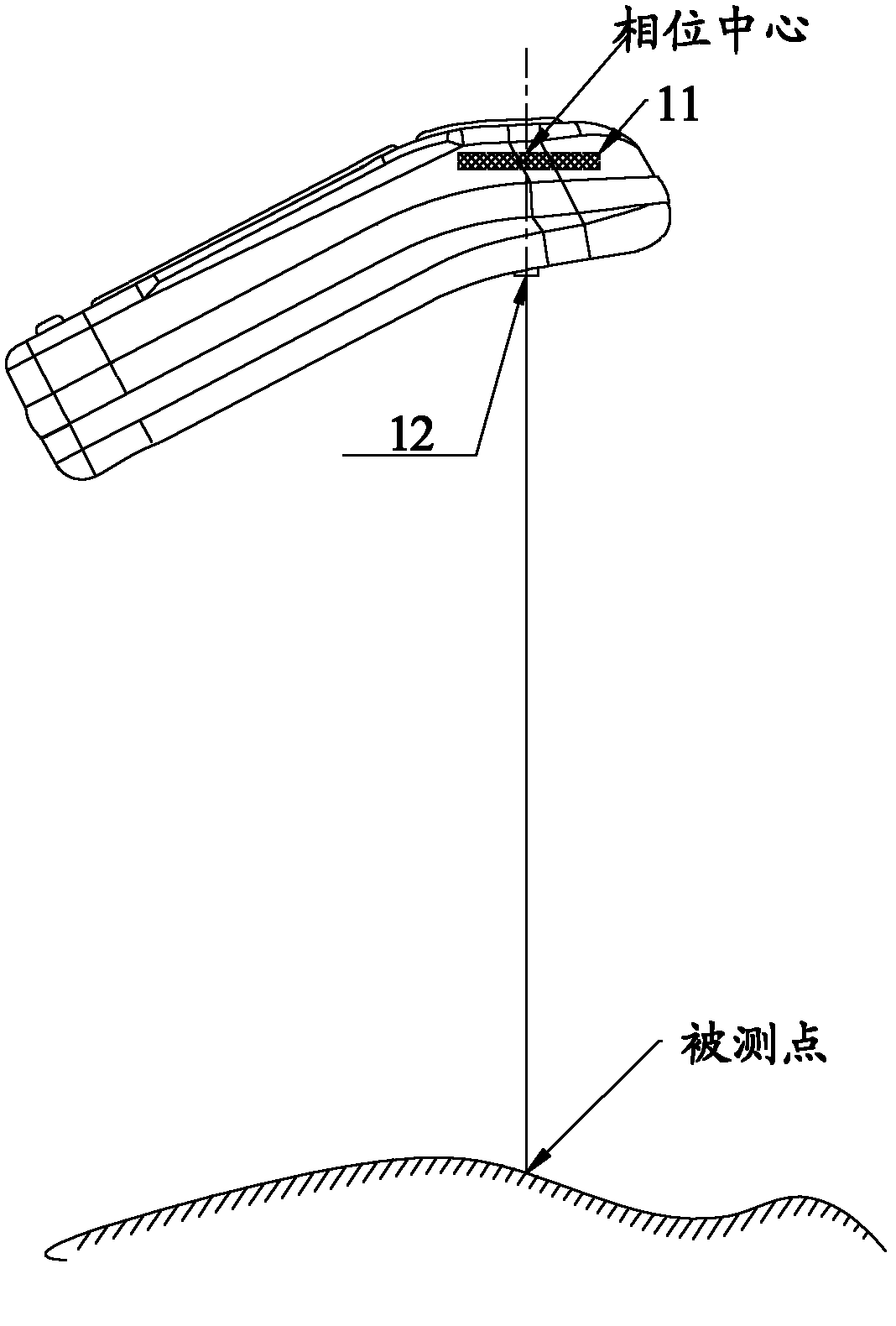
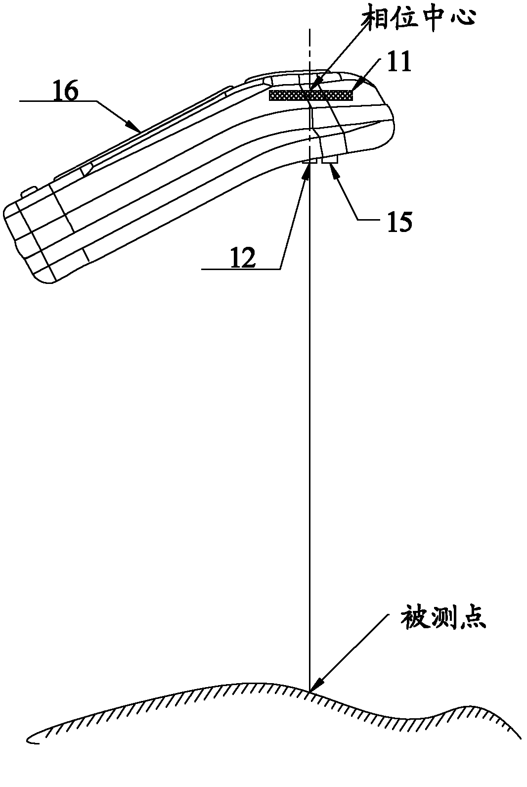
[0046] In the existing GNSS receiver, the centering pole needs to be perpendicular to the plane of the satellite receiving antenna, and its axis passes through the phase center of the satellite receiving antenna to ensure that the latitude and longitude coordinates of the satellite receiving antenna are the same as those of the measured point, so as to further Guaranteed measurement accuracy. However, in the process of actual coordinate measurement, the centering pole cannot be guaranteed to be perpendicular to the plane of the satellite receiving antenna, which makes the latitude and longitude coordinates of the satellite receiving antenna inconsistent with the latitude and longitude coordinates of the north point, reducing the measurement accuracy. Therefore, the present application discloses a new GNSS receiver, which changes the existing position measurement method and improves the measurement accuracy.

[0047] The following will clearly and completely describe the techni...


PUM


Abstract

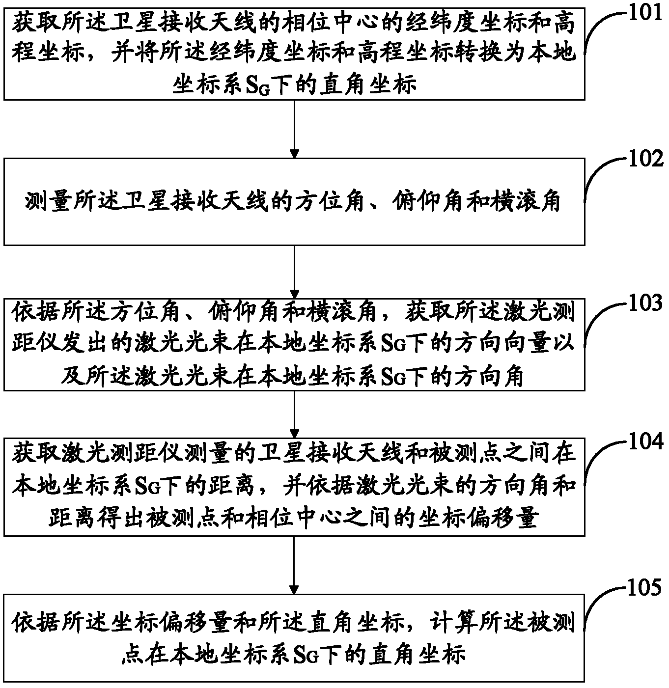
The invention discloses a global navigation satellite system (GNSS) receiver and a position measurement method. The GNSS receiver comprises a satellite receiving antenna, a laser ranging instrument, a posture sensor and a maser control board, wherein the posture sensor is used for receiving an azimuth angle, a pitch angle and a roll angle of the satellite receiving antenna. The maser control board is used for obtaining a longitude and latitude coordinate and an elevation coordinate of the phase center of the satellite receiving antenna, transforming the longitude and latitude coordinate and the elevation coordinate into a right-angle coordinate under a local coordinate system SG, obtaining coordinate offset of a measured point and the phase center according to the distance, the azimuth angle, the pitch angle and the roll angle between the satellite receiving antenna and the measured point, and calculating the right-angle coordinate of the measured point under local coordinate system SG. Compared with the prior art, the GNSS receiver improves accuracy of measurement, eliminates a centering rod simultaneously, and reduces the volume. In addition, during measurement, the longitude and latitude coordinate of the satellite receiving antenna has no need to be guaranteed to be identical with a longitude and latitude coordinate of the measured point, thereby reducing operation difficulties.

Description

technical field [0001] The present application relates to the technical field of geographic measurement, in particular to a global navigation satellite system receiver and a position measurement method. Background technique [0002] GNSS (Global Navigation Satellites System, Global Navigation Satellite System) receiver is used in geodetic applications to measure the coordinates of an object on the earth. Currently, GNSS receivers include non-handheld GNSS receivers and handheld GNSS receivers. Wherein the most commonly used is the hand-held GNSS receiver, and the hand-held GNSS receiver includes a centering rod, and a satellite receiving antenna and a positioning and settlement module arranged in the main control board. [0003] The measurement principle of the above-mentioned handheld GNSS receiver is: first, obtain the latitude and longitude coordinates of the phase center of the satellite receiving antenna, and use the latitude and longitude coordinates as the latitude a...

Claims


Application Information

Patent Timeline
Patent Type & Authority Applications(China)
IPC IPC(8): G01S19/13G01S19/45
Inventor 胡华俞江虹郁宏伟刘峻宁毕勤韩友东姚刚李文斌
Owner HERONAV BEIJING TECH DEV
Learn More