CD column diagram-based method for estimating spatial query selectivity
A spatial query and histogram technology, applied in computing, special data processing applications, instruments, etc., can solve the problem of uneven distribution of spatial data in large continuous geographical areas, achieve high accuracy, improve accuracy, and ensure the effect of estimation accuracy
- Summary
- Abstract
- Description
- Claims
- Application Information
AI Technical Summary
Problems solved by technology
Method used
Image
Examples
Embodiment Construction
[0050] The present invention will be described in detail below in conjunction with the accompanying drawings and specific embodiments.
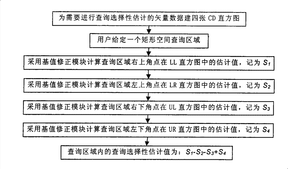
[0051] The CD histogram-based spatial query selectivity estimation method of the present invention realizes a flow chart such as figure 1 As shown, here image 3 The vector data of the continuous distribution of the shown geographical area is an example, and the specific implementation process of the present invention is described in detail, and its specific steps:
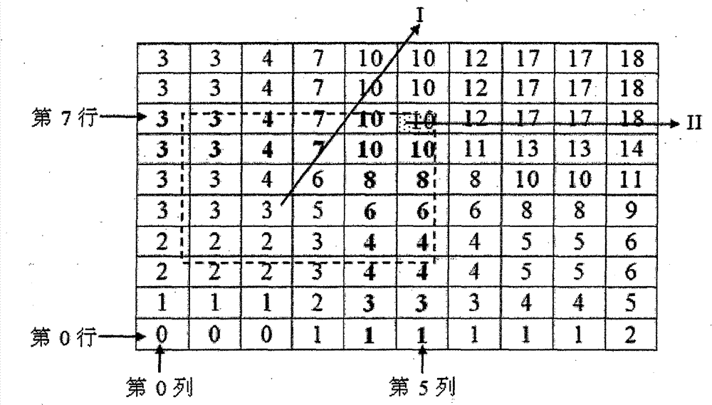
[0052] (1) with image 3 Take the vector data continuously distributed in the geographical area shown as an example, and generate four two-dimensional CD histograms, which are respectively recorded as LL, LR, UL, and UR histograms;
[0053] The minimum value (MapXMin) in the x direction of the geodetic coordinates of this area is 488242.754, the maximum value (MapXMax) is 530038.454, the minimum value (MapYMin) in the y direction is 252446.810, and the maximum value (MapYMax) ...
PUM
 Abstract
Description
Claims
Application Information
 - Generate Ideas
- Intellectual Property
- Life Sciences
- Materials
- Tech Scout
- Unparalleled Data Quality
- Higher Quality Content
- 60% Fewer Hallucinations
Browse by: Latest US Patents, China's latest patents, Technical Efficacy Thesaurus, Application Domain, Technology Topic, Popular Technical Reports.
© 2025 PatSnap. All rights reserved.Legal|Privacy policy|Modern Slavery Act Transparency Statement|Sitemap|About US| Contact US: help@patsnap.com


