
Positioning device, method of calculating search range, and recording medium

A technology of positioning device and search range, applied in the field of positioning device, can solve the problems of unable to receive satellite signals quickly, unable to precisely define search range, unable to effectively use search resources and the like

Inactive Publication Date: 2008-01-23
SEIKO EPSON CORP
View PDF1 Cites 1 Cited by
  • Summary
  • Abstract
  • Description
  • Claims
  • Application Information

AI Technical Summary

Problems solved by technology

[0006] However, when the Doppler shift error is large, the search range cannot be specified exactly, and satellite signals cannot be received quickly.
In addition, if the maximum error of the Doppler shift is taken into account to expand the search range and expand the search range, it is often impossible to effectively use the search resource (correlator) problem

Method used


Image

  • Positioning device, method of calculating search range, and recording medium
  • Positioning device, method of calculating search range, and recording medium
  • Positioning device, method of calculating search range, and recording medium

Examples


Embodiment Construction

[0034] Hereinafter, preferred embodiments of the present invention will be described in detail with reference to the drawings and the like.

[0035] In addition, the embodiments described below are preferred specific embodiments of the present invention. Therefore, various preferred limitations are imposed on the technology. The scope of the invention is not limited to these modes.

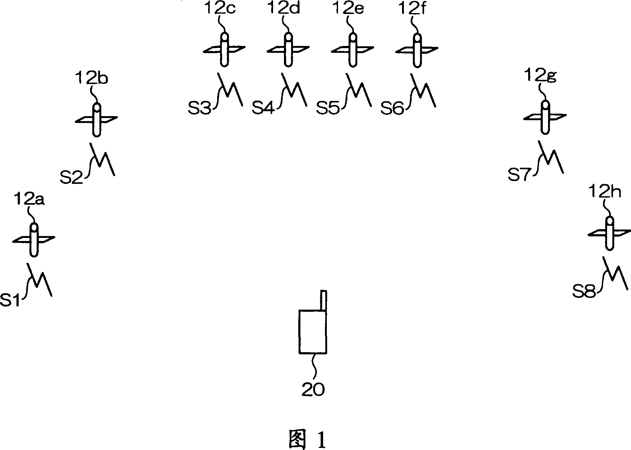
[0036] FIG. 1 is a schematic diagram showing a terminal 20 and the like according to an embodiment of the present invention.

[0037] As shown in FIG. 1, the terminal 20 is capable of receiving signals S1 to S8 from GPS satellites 12a to 12h.

[0038] Also, only GPS satellites are referred to as "satellites".

[0039]The GPS satellite 12a etc. are an example of an SPS satellite, and the signal S1 etc. are an example of a satellite signal. The signal S1 includes a C / A (Clear and Acquision, or Coarse / Access: Coarse Acquisition Code) code. The C / A code is one of pseudo-noise codes (hereinafter re...


PUM


Abstract

A positioning device which locates a position using satellite signals from a plurality of satellite positioning system (SPS) satellites includes a satellite position calculation section which calculates a satellite position of each SPS satellite in an orbit, a relative position calculation section which calculates a relative position between an initial position P 0 of the positioning device and a satellite position Pv of each SPS satellite, a Doppler shift error calculation section which calculates a Doppler shift error which is an error of a Doppler shift of a frequency of each satellite signal based on the relative position, and a frequency range calculation section which calculates a frequency range for receiving each satellite signal based on the Doppler shift error.

Description

technical field [0001] The present invention relates to a positioning device capable of positioning using SPS (Satellite Positioning System: Satellite Positioning System), a search range calculation method, a program, and a storage medium. Background technique [0002] Currently, a positioning system that uses SPS such as GPS (Global Positioning System: Global Positioning System) to locate the current position of a GPS receiver is widely used (for example, Japanese Patent Application Laid-Open No. 2000-131415 (FIG. 1, etc.)) . [0003] The GPS receiver receives signals such as from four GPS satellites located in the sky (hereinafter referred to as "satellite signals"), based on the difference between the time when the satellite signals are transmitted from each GPS satellite and the time when they arrive at the GPS receiver (hereinafter referred to as "satellite signals"). called "delay time") to obtain the distance between each GPS satellite and the GPS receiver (hereinaft...

Claims


Application Information

Patent Timeline
Patent Type & Authority Applications(China)
IPC IPC(8): G01S5/14G01S19/24
CPCG01S19/29G01S5/0284G01S19/27G01S19/30
Inventor 松本一实
Owner SEIKO EPSON CORP
Learn More