
Navigation System

Inactive Publication Date: 2017-05-18
INFORMATION EDGE
View PDF24 Cites 3 Cited by
  • Summary
  • Abstract
  • Description
  • Claims
  • Application Information

AI Technical Summary

Benefits of technology

The invention described in this patent allows for optimizing routes by using information about historical journeys. This helps drivers avoid areas of heavy traffic and complete their journeys more quickly. Additionally, the invention improves the accuracy of navigation devices by querying a database of historical journeys to identify the best route to a destination.

Problems solved by technology

Particularly when used to direct a driver in a vehicle along a journey, difficulties are presented when there is heavy traffic along that journey.
This causes delays to the user.
These delays are annoying for the user, but may also be cause other problems.
Both of these targets can prove difficult to achieve when a journey that has been planned by the navigation device passes through areas of heavy traffic or other reasons for delay along a road.
Furthermore, cars that spend more time driving (for example because they spend time moving slowly or stopped in traffic) will be use more fuel, and consequently be more damaging to the environment.
However, there may have been a different route that was longer in distance, but may in fact have resulted in a lower total journey time.
Traffic may sometimes slow or come to a standstill.
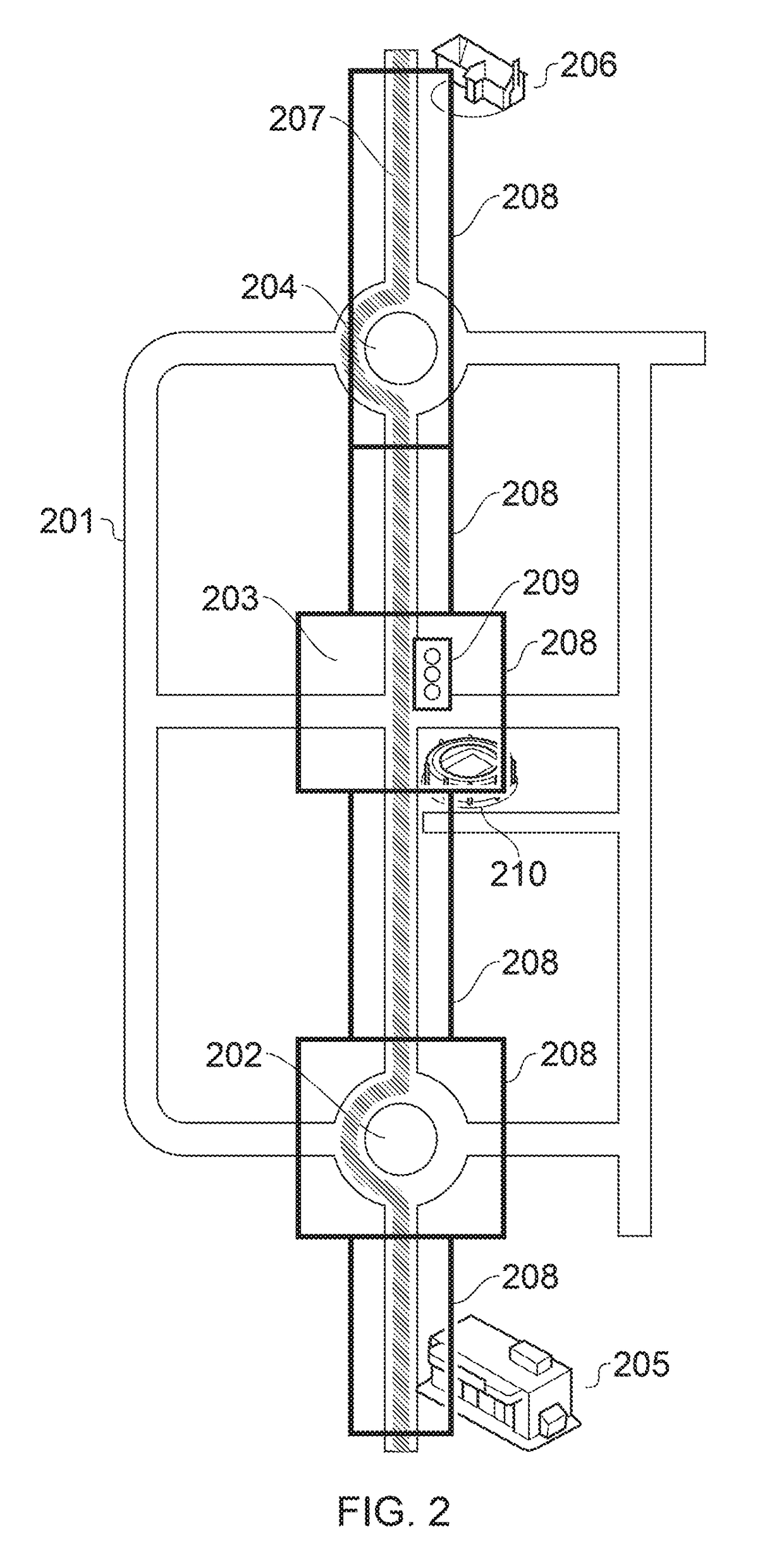
Junctions / roundabouts may also present areas of heavy traffic at some times, but not at other times. Navigation devices do not have any way of accounting for this temporal variation in traffic patterns, and as such, will sometimes direct a user along a road where traffic is heavy, delaying the user's progress to their destination.
If a device cannot determine its position accurately, then it can present difficulties in determining when a location has in fact been reached.
For example, if the device is inaccurate, it may not be able to direct a user exactly to their desired destination.
This accuracy problem is exacerbated by the use digital maps that do not know exactly where an address is located.
While this method may sometimes direct the user to close to the correct location, many times it will not.
This again constitutes a problem for navigation device users, who have to spend significant time locating the correct destination after the navigation device has taken them effectively as close as it can.
Even a top-ranked product would not be accurate in all situations and in different locations for example in rural locations and / or in urban locations.
Of course a navigation device can only present instructions to the user that they should follow to reach their destination.
A user who doesn't follow the directions presented to them by their navigation device may as a result take a non-optimal route.
Such a non-optimal route may take the user longer to complete than the route down which the navigation device intended to direct them.
In particular, the delivery of hot food from a production point to various destinations within a demarcated territory present issues for satellite navigation devices.
Multi drops are discouraged and only employed when the delivery resources i.e. the number of drivers are insufficient to the demand.

Method used


Image

  • Navigation System
  • Navigation System
  • Navigation System

Examples


Embodiment Construction

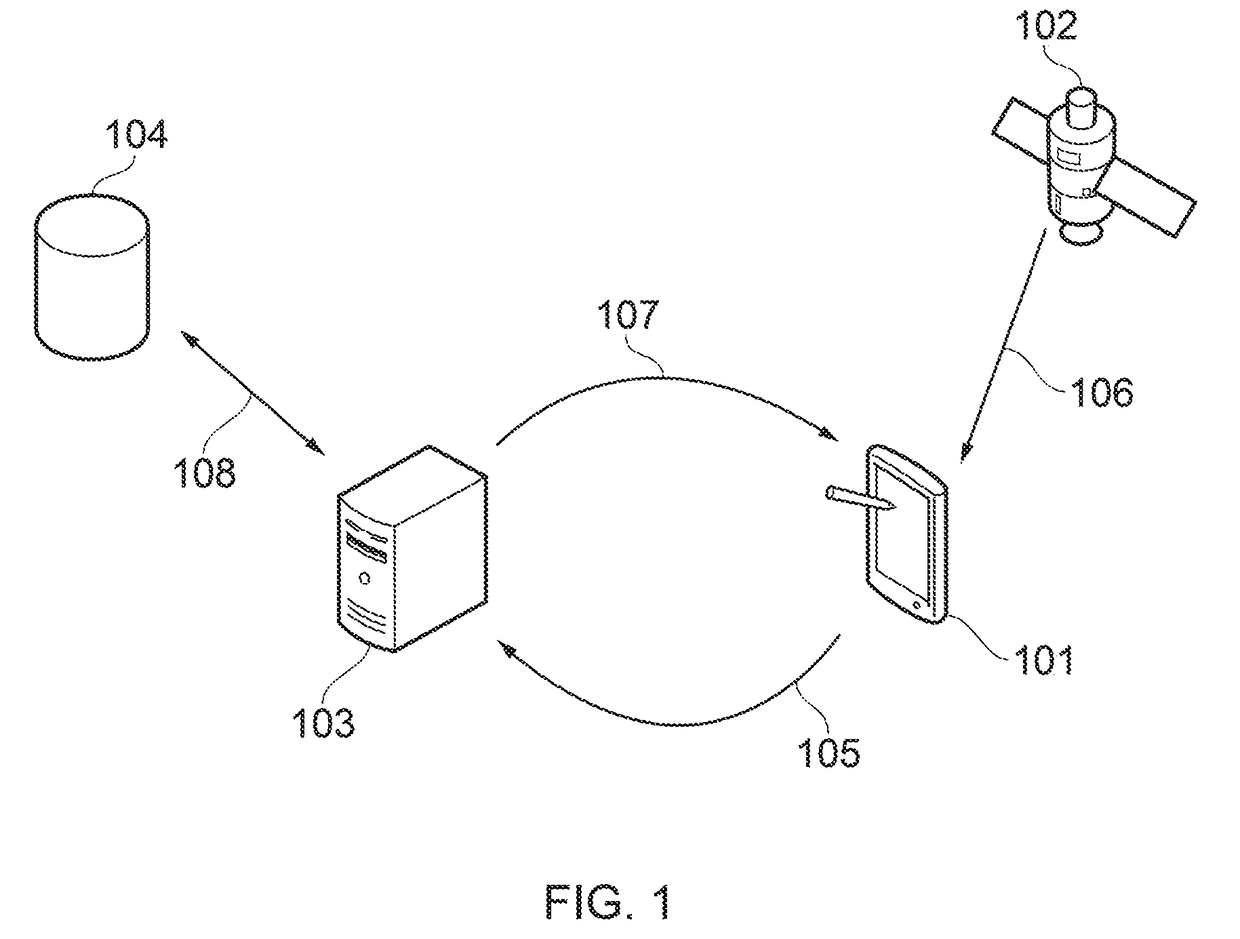
[0252]FIG. 1 shows a device 101. The device 101 is able to receive signals from the satellites 102 of a global positioning system. The device 101 is consequently able to determine its position on the earth. The device can do this essentially in real time, and so can determine tracking of its position through periodic measurements of its position.

[0253]The device may be a satellite navigation device (a “sat-nay”), a mobile phone with satellite navigation capability, or another suitably enabled device. The device 101 determines a first route between a start location and an end location using a standard route finding algorithm.

[0254]The first route may be determined by the device 101. The device 101 may run a software application that is able to determine the first route.

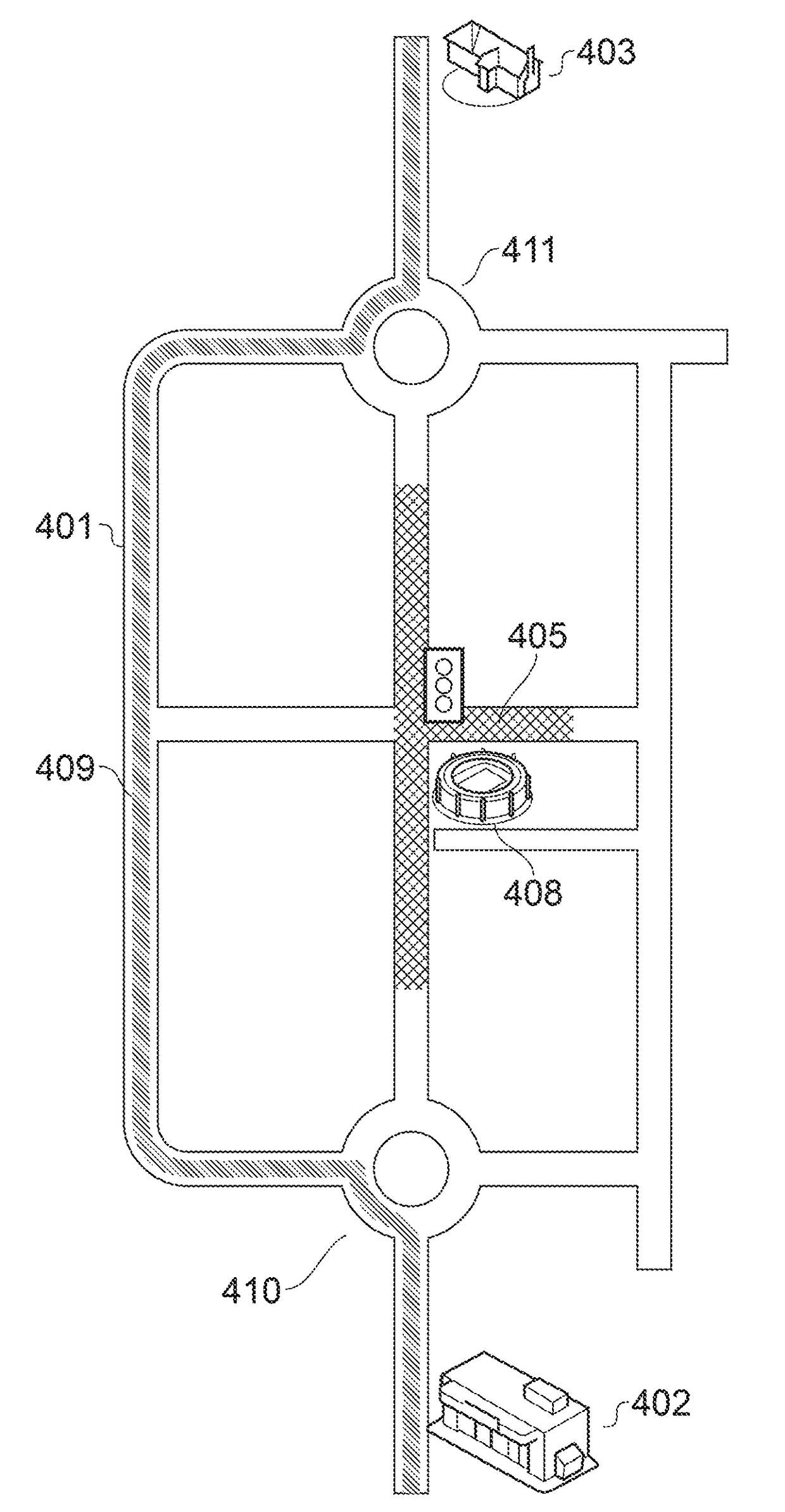
[0255]The server 103 determines a second route between the start and end locations which avoids choke points between the start and end locations. Choke points may be areas along the route where there has historically b...


PUM


Abstract

Some embodiments relate to methods and systems for supporting location detection and navigation technologies. Destination information defining a desired destination can be obtained. A primary database can be queried to identify a historical visit to the destination. The primary database can include historical data for a plurality of historical journeys. The historical visit can include measured location information for the destination.

Description

CROSS-REFERENCE TO RELATED APPLICATIONS[0001]This application claims the benefit of and priority to Great Britain Application Serial Number GB1517986.4, filed on Oct. 12, 2015, which is hereby incorporated by reference in its entirety for all purposes.FIELD[0002]The present invention relates to a navigation system, in particular a navigation system and device for optimising journey times.BACKGROUND[0003]To reach an unknown destination, people need to be provided with directions to reach the destination. Traditionally, this has been done by following a map, where the user determines their route to the destination by interpreting the roads and pathways on the map. The user would typically identify the route they intended to take on the map, and then travel along that route to their destination.[0004]More recently users have used electronic maps. These digital maps are typically displayed on a screen, for example on a computer screen, a mobile device, a tablet computer, or a dedicated ...

Claims


Application Information

Patent Timeline
IPC IPC(8): G01C21/34G01C21/36
CPCG01C21/3667G01C21/3415G01C21/3484G01C21/3617G01C21/3492
Inventor BRITO, VILOSHYAP, KENTTHORBURN, GREG
Owner INFORMATION EDGE
Learn More