
Road landscape map producing apparatus, method and program

Inactive Publication Date: 2009-01-29
PIONEER CORP
View PDF1 Cites 9 Cited by
  • Summary
  • Abstract
  • Description
  • Claims
  • Application Information

AI Technical Summary

Benefits of technology

[0006]The present invention has been achieved in order to solve the above problem. It is an object of this invention to provide a road landscape map producing method capable of efficiently producing a road landscape map including road landscape information by executing image processing of a photographed image of a movable body.Means for Solving the Problem
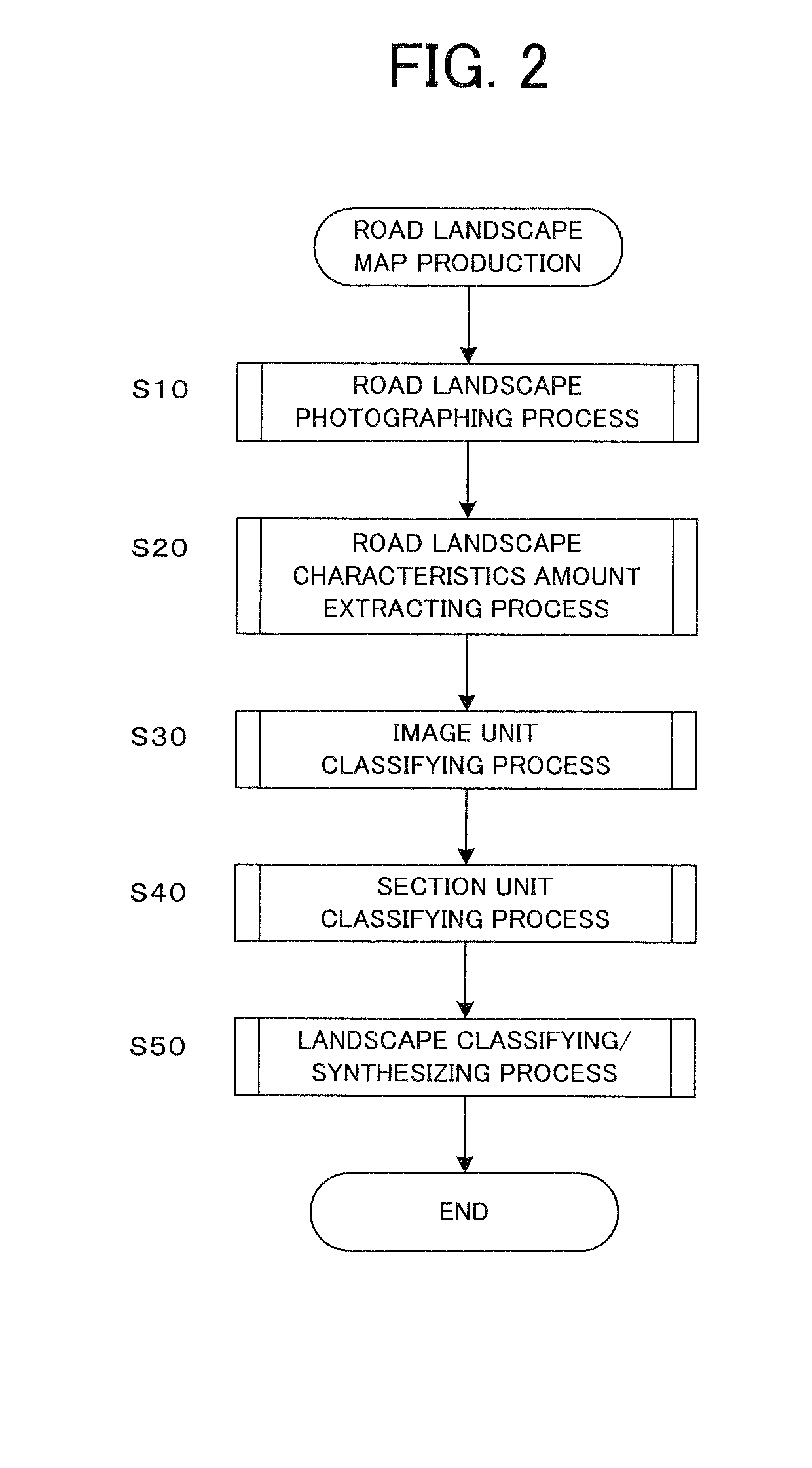
[0009]Specifically, the photographing device such as a camera photographs the surrounding image in accordance with the movement of the movable body. Preferably, a still picture is photographed as the surrounding image. The surrounding image is classified into the road landscape classification item by the image process. Based on the geographic position at which the surrounding image is photographed, the road landscape classification item is associated with the map information. Thereby, the road landscape map is produced. Since the road landscape map produced in this manner includes the information showing the landscape at each position, by displaying the information, a user can easily know the landscape at each position on the map.
[0011]In another manner of the above road landscape map producing apparatus, the characteristics amount extraction unit may extract plural characteristics amounts, and the image unit classification unit may determine one of the plural road landscape classification items as the road landscape classification item by the surrounding image unit, based on the plural characteristics amounts. In this manner, since the road landscape classification item is determined in consideration of the combination of the plural characteristics amounts, the possibility of erroneous determination can be reduced.
[0014]In still another manner, the road landscape map producing apparatus may include: a display device; and a display control unit which displays the road landscape map on the display device in a form capable of visually distinguishing the road landscape classification item by the section unit. In this manner, by displaying the road landscape map on the display device, it becomes easy for the user to visually know the road landscape for each section on the display device. In addition, since the road landscape classification item is determined for each section, even when only the part of the section is erroneously determined as the other road landscape classification item due to the noise in the surrounding image and other cause, the accurate road landscape classification can be executed in the entire section.
[0018]According to still another aspect of the present invention, there is provided a road landscape map producing system, including: a receiving unit which receives a surrounding image photographed in accordance with movement of a movable body via a communication network; an image processing unit which executes image processing of the surrounding image and classifies the surrounding image into a predetermined road landscape classification item; a producing unit which associates the road landscape classification item with map information, based on a geographic position at which the surrounding image is photographed, and produces a road landscape map; and a database which stores the road landscape map. By the road landscape map producing system, a server can produce the road landscape map based on the surrounding image photographed by the movable body, and the database can store the road landscape map. Particularly, by using the plural movable bodies, it becomes possible to efficiently produce the road landscape map in a wide range in a short time.
[0019]According to still another aspect of the present invention, there is provided a road landscape map producing system, including: a receiving unit which receives, via a communication network, a part of surrounding images photographed in accordance with movement of a movable body and classified into a predetermined road landscape classification item after image processing; a producing unit which associates, based on a geographic position at which the surrounding image is photographed, the road landscape classification item with map information and produces a road landscape map; and a database which stores the road landscape map. By the road landscape map producing system, only the part (e.g., the part having the large characteristics amount) of the surrounding image photographed by the movable body and classified after the image processing is transmitted and stored in the database. Therefore, since only the necessary surrounding image is transmitted via the network, the communication amount can be advantageously saved.

Problems solved by technology

However, it is not easy to obtain the appropriate landscape information from only the information on the map.
Therefore, it is troublesome and time-consuming to produce the map information including the landscape information.

Method used


Image

  • Road landscape map producing apparatus, method and program
  • Road landscape map producing apparatus, method and program
  • Road landscape map producing apparatus, method and program

Examples


first embodiment

(Configuration of Road Landscape Map Producing Apparatus)

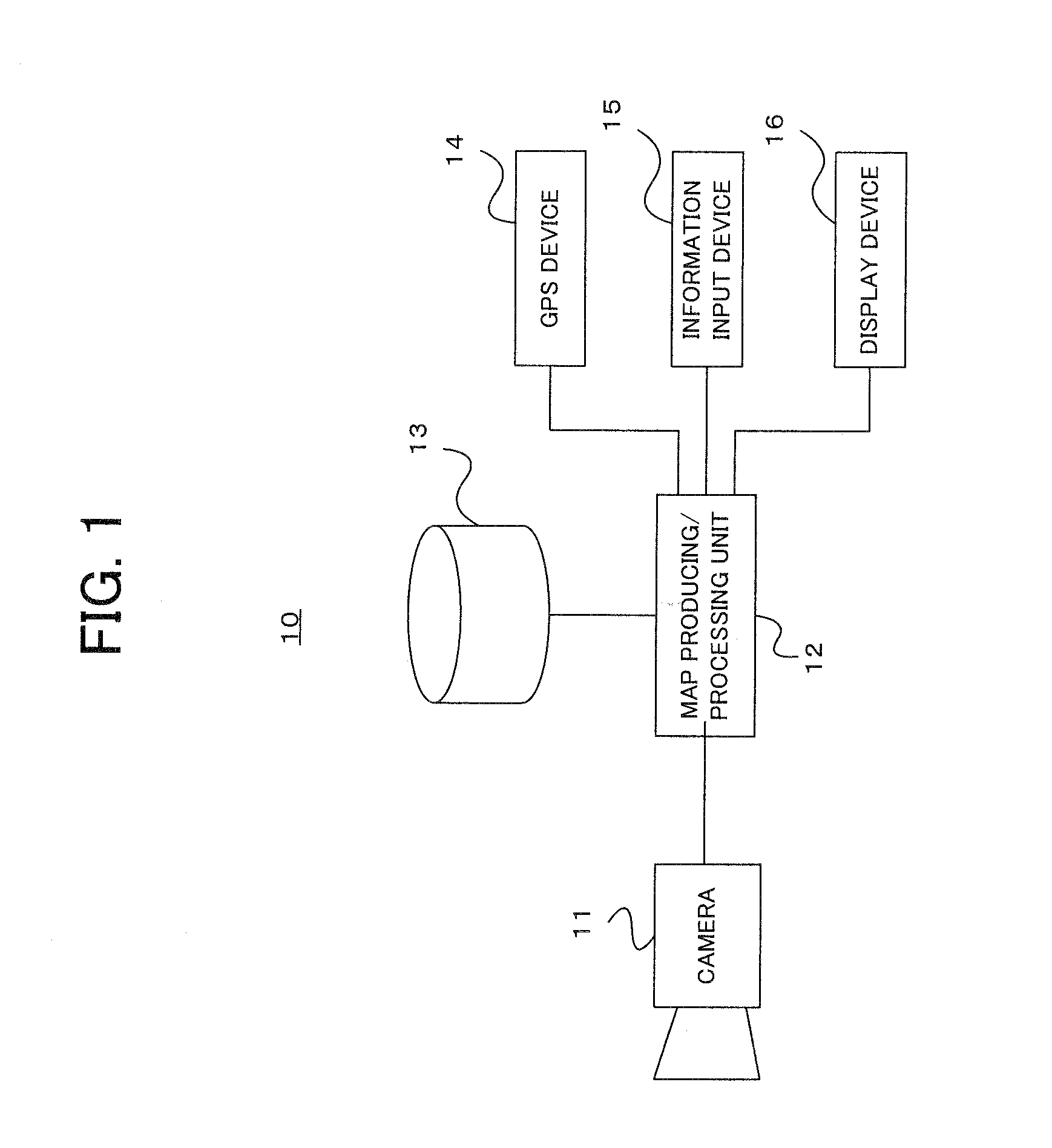
[0045]FIG. 1 shows a schematic configuration of a road landscape map producing apparatus according to a first embodiment of the present invention. A road landscape map producing apparatus 10 (hereinafter, simply referred to as “map producing apparatus”, too) shown in FIG. 1 is loaded on a movable body such as a vehicle, and automatically produces a road landscape map including a road landscape information based on a photographed image. As shown, the map producing apparatus 10 includes a camera 11, a map producing / processing unit 12, a storage device 13, a GPS device 14, an information input device 15 and a display device 16.

[0046]The camera 11, which is arranged on the front side of the vehicle, functions as a photographing device. The camera 11 constantly photographs a surrounding image (still picture) in accordance with the movement of the movable body on which the map producing apparatus 10 is loaded. The GPS device 14 incl...

second embodiment

[0079]Next, a description will be given of a second embodiment of the present invention. In the second embodiment, the road landscape map producing technique of the present invention is applied to a system including the network and the server.

(Example of First System)

[0080]FIG. 12 shows a schematic configuration of the road landscape map producing system according to the second embodiment. As shown, in a road landscape map producing system 100, the map producing device 10 is loaded on one or plural movable body (bodies). The map producing device 10 loaded on the movable body 2 can communicate with a server 112 via a network 110 by wireless communication. The map producing device 10 transmits the surrounding image photographed by the camera 11 to the server 112 via the network 110. Additionally, the map producing device 10 can take out the surrounding image, which is photographed with using the movable body 2, to a home 120 in a form such as a storage medium, and can transmit the sur...


PUM


Abstract

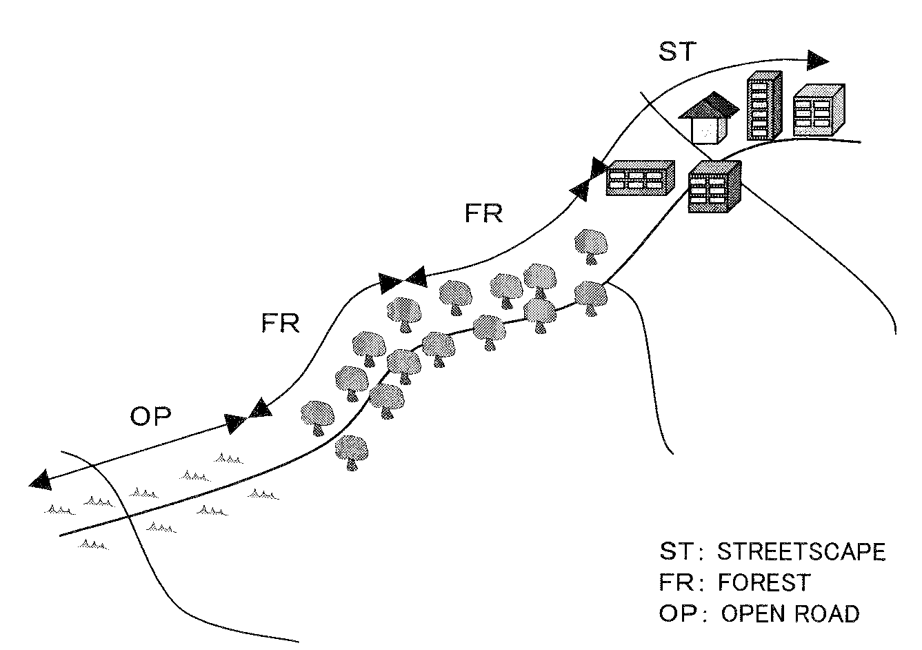
A road landscape map producing apparatus is loaded on a movable body, and produces a road landscape map. The road landscape map includes road landscape information showing a surrounding landscape in a road. The road landscape information includes road landscape classification items obtained by classifying the surrounding landscape into some items, e.g., “streetscape”, “forest” and “open road”. A photographing device such as a camera photographs surrounding images in accordance with movement of the movable body. A still picture is photographed as the surrounding image. The surrounding image is classified into the road landscape classification items by an image process. Based on a geographic position at which the surrounding image is photographed, the road landscape classification item is associated with the map information. Thereby, the road landscape map is produced. Since the produced road landscape map includes the road landscape information showing the road landscape at each point, by displaying the map, it becomes possible to easily know the landscape at each point on the map.

Description

TECHNICAL FIELD[0001]The present invention relates to a producing method of map information, particularly, a producing method of a road landscape map including road landscape information showing a surrounding landscape.BACKGROUND TECHNIQUE[0002]There is known a navigation apparatus which loads a GPS (Global Positioning System) and displays, on a map, a present position of a movable body such as a vehicle and a person. Generally speaking, the above navigation apparatus displays the present position of the movable body and the surrounding map on a display device. Recently, there is known a navigation apparatus which searches and guides a route to a destination by designating the destination and the route.[0003]Moreover, there is disclosed a navigation apparatus having a function to automatically search and supply a side-trip route for stopping by a good viewing point in such a case that there is the point in the vicinity of a guidance route to a destination in Patent Reference-1.[0004...

Claims


Application Information

Patent Timeline
IPC IPC(8): G01C21/30
CPCG01C21/30G01C21/32G09B29/106G09B29/102G08G1/0962G01C21/3826G01C21/3815
Inventor FUJITA, RYUJIROICHIHARA, NAOHIKOINOUE, HIROTO
Owner PIONEER CORP
Learn More