
Wireless location assisted zone guidance system compatible with large and small land zones

a technology of location assistance and guidance system, applied in the field of electric communication, can solve the problems of increasing the size of electronically accessible memory, increasing both cost and power consumption, and affecting so as to improve the behavior of pets, improve the efficiency and efficiency of training, and improve the effect of taming and training

Active Publication Date: 2021-06-01
GPSIP
View PDF120 Cites 0 Cited by
  • Summary
  • Abstract
  • Description
  • Claims
  • Application Information

AI Technical Summary

Benefits of technology

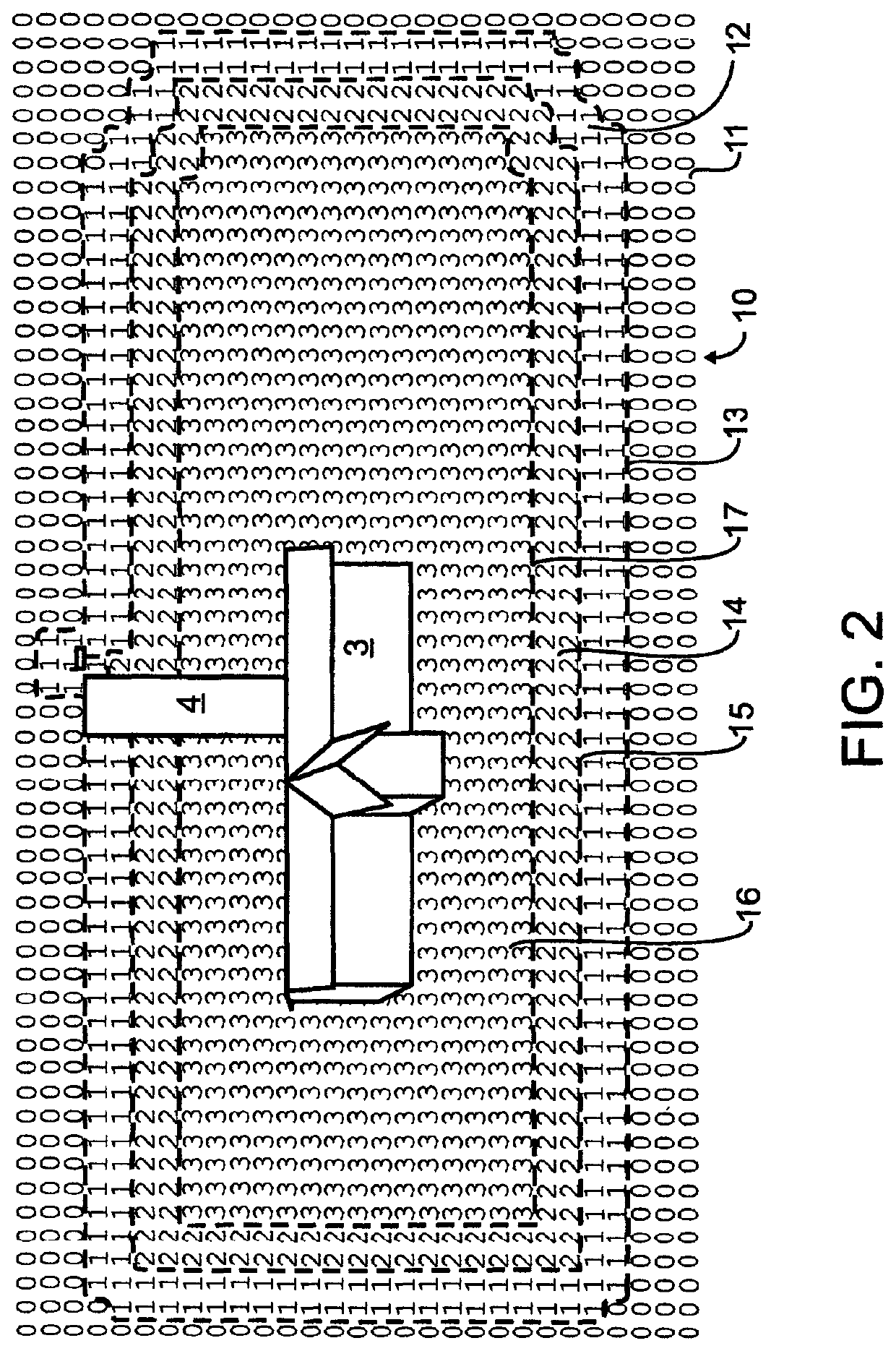
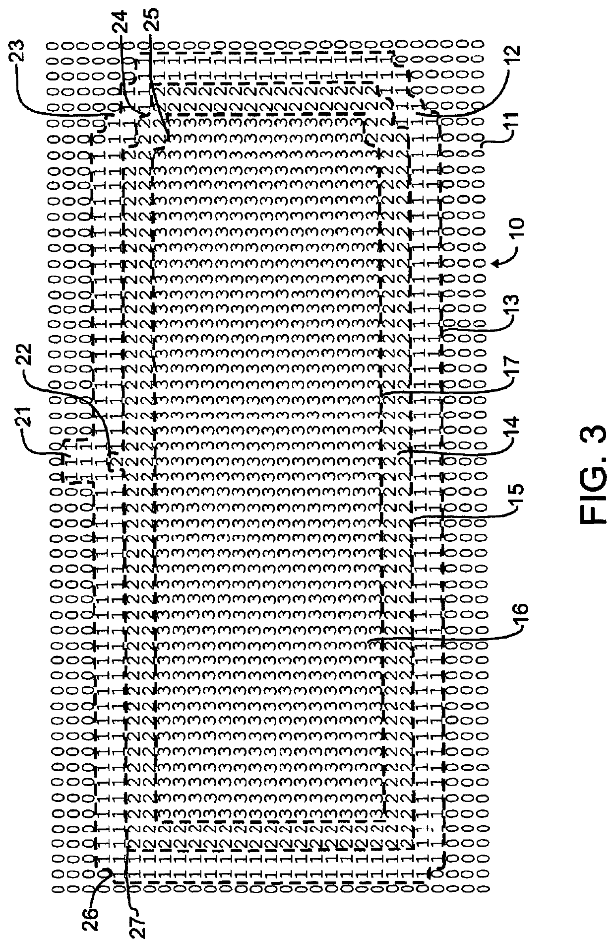
The present invention provides an apparatus for modifying the behavior of a pet or other living being. It uses a combination of actual data positions and universal location systems to determine location and provide stimuli based on that location for extended periods of operation. The apparatus is simple and efficient to set up and operate, and can efficiently and expeditously train a pet. It also allows a person to set an acceptable area or "safe zone" and adjust or redefine that area again. The apparatus automatically generates a number of zones that facilitate positive training and behavior modification, and automatically adjusts the correlation of the data table to accommodate both large and small land areas in the creation of an assisted guidance region.

Problems solved by technology

When a large land area is being defined as an assisted guidance region, the memory required for storing this directly mapped land area may be undesirably large.
The increased size of electronically accessible memory may increase both cost and power draw, neither which is desirable.

Method used


Image

  • Wireless location assisted zone guidance system compatible with large and small land zones
  • Wireless location assisted zone guidance system compatible with large and small land zones
  • Wireless location assisted zone guidance system compatible with large and small land zones

Examples


Embodiment Construction

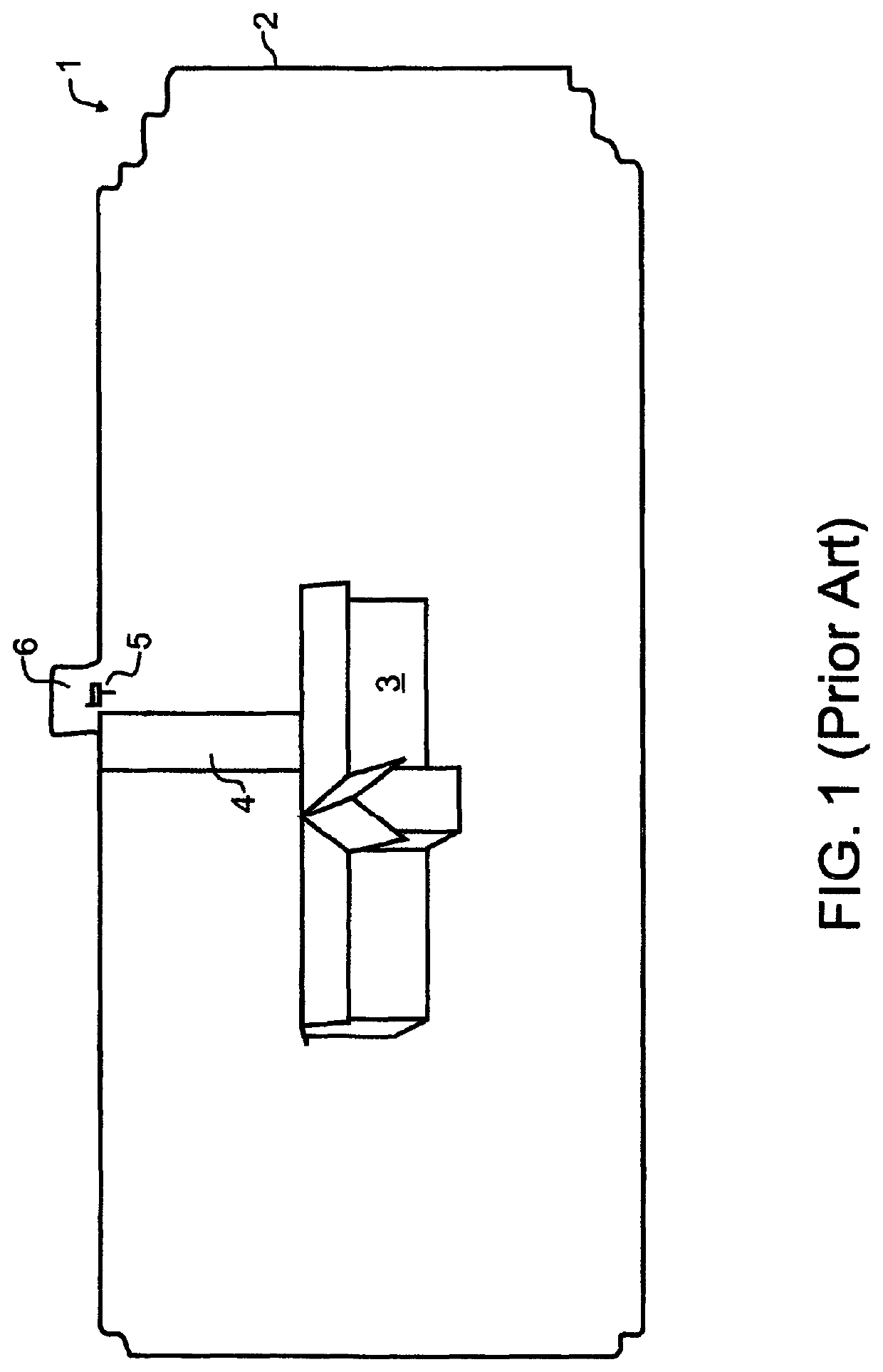
[0038]In a preferred embodiment designed in accord with the teachings of the present invention, a pet owner might want to train a pet to stay within an example property 1 such as that illustrated in prior art FIG. 1. An outer limit of the property 2 may encompass one or more buildings 3, a driveway 4, and a mailbox 5. If, for exemplary purposes, the pet is or will be trained to walk with the owner to the mailbox, or to retrieve the newspaper from adjacent to the mailbox, then the owner may wish to provide a small peninsula 6 which could extend beyond the bounds of the particular property location.

[0039]A self-contained collar apparatus, which might for exemplary purposes and not solely limiting thereto resemble that illustrated by Swanson et al in 2007 / 0204804 and incorporated by reference herein above, will preferably contain the necessary electronic components such as illustrated in the Swanson et al FIG. 5, including components to receive and decipher location determining signals...


PUM


Abstract

A look-up table is defined by at least one reference point, and rows and columns that are offset from the reference. The table rows and columns correspond to ordinate and abscissa data points representing geographic locations. Each data point offset in the table corresponds to a predefined geographic offset. The look-up table contains machine-stored values at each table location, with each value representing a particular one of several guidance zones. Each guidance zone is associated with behavioral guidance provided to an animal Real-time determination of a current guidance zone is made by first determining present location. The corresponding table location is identified by calculating latitudinal and longitudinal offsets from a reference point, and using these offsets as the two indices to access a double-indexed array. The offsets are selectively subjected to a scalar conversion to accommodate large land areas while limiting the amount of memory required to store the table.

Description

CROSS REFERENCE TO RELATED APPLICATIONS[0001]This application claims the benefit under 35 U.S.C. 119(e) of U.S. provisional 61 / 954,589, filed Mar. 17, 2014 and herewith, and is also a continuation-in-part of U.S. patent application Ser. No. 14 / 217,390, filed Mar. 17, 2014 and herewith, which in turn claims the benefit under 35 U.S.C. 119(e) of U.S. provisional 61 / 801,509, filed Mar. 15, 2013, the contents of each which are incorporated herein by reference in entirety.BACKGROUND OF THE INVENTION1. Field of the Invention[0002]This invention pertains generally to electrical communications, and more particularly to condition responsive indicating systems with a radio link and including personal portable device for tracking location. The condition responsive indicating systems of the present invention monitor the specific condition of humans or animals. In one preferred manifestation, a fully self-contained collar designed in accord with the teachings of the present invention monitors th...

Claims


Application Information

Patent Timeline
Patent Type & Authority Patents(United States)
IPC IPC(8): A01K15/04A01K29/00G08B21/00G01S5/00H04W4/02A01K27/00A01K15/02
CPCA01K29/005A01K15/023A01K27/009G01S5/00G08B21/00H04W4/02G08B21/0225G08B21/0261G08B21/0269H04W4/021G01S19/14G01S19/52H04L67/12G01S2205/01H04W4/029
Inventor LANDERS, RODNEY P.NIEUWSMA, KEVIN L.JAMES, CHAD R.KREKELBERG, PATRICK J.
Owner GPSIP
Learn More