
Method for simultaneously estimating surface moisture and roughness of bare soil based on radar and optical remote sensing data

A technology of optical remote sensing and remote sensing data, which is applied in material analysis by optical means, electrical/magnetic roughness/irregularity measurement, and the use of optical devices, etc. It can solve the problems that surface roughness affects SSM inversion accuracy, etc.

Pending Publication Date: 2021-12-31
NORTHEAST INST OF GEOGRAPHY & AGRIECOLOGY C A S
View PDF11 Cites 2 Cited by
  • Summary
  • Abstract
  • Description
  • Claims
  • Application Information

AI Technical Summary

Problems solved by technology

[0005] The purpose of the present invention is to solve the problem that surface roughness affects the accuracy of SSM inversion in the prior art, and to provide a method for simultaneously estimating the surface moisture and roughness of bare soil based on radar and optical remote sensing data

Method used


Image

  • Method for simultaneously estimating surface moisture and roughness of bare soil based on radar and optical remote sensing data
  • Method for simultaneously estimating surface moisture and roughness of bare soil based on radar and optical remote sensing data
  • Method for simultaneously estimating surface moisture and roughness of bare soil based on radar and optical remote sensing data

Examples


Embodiment 1

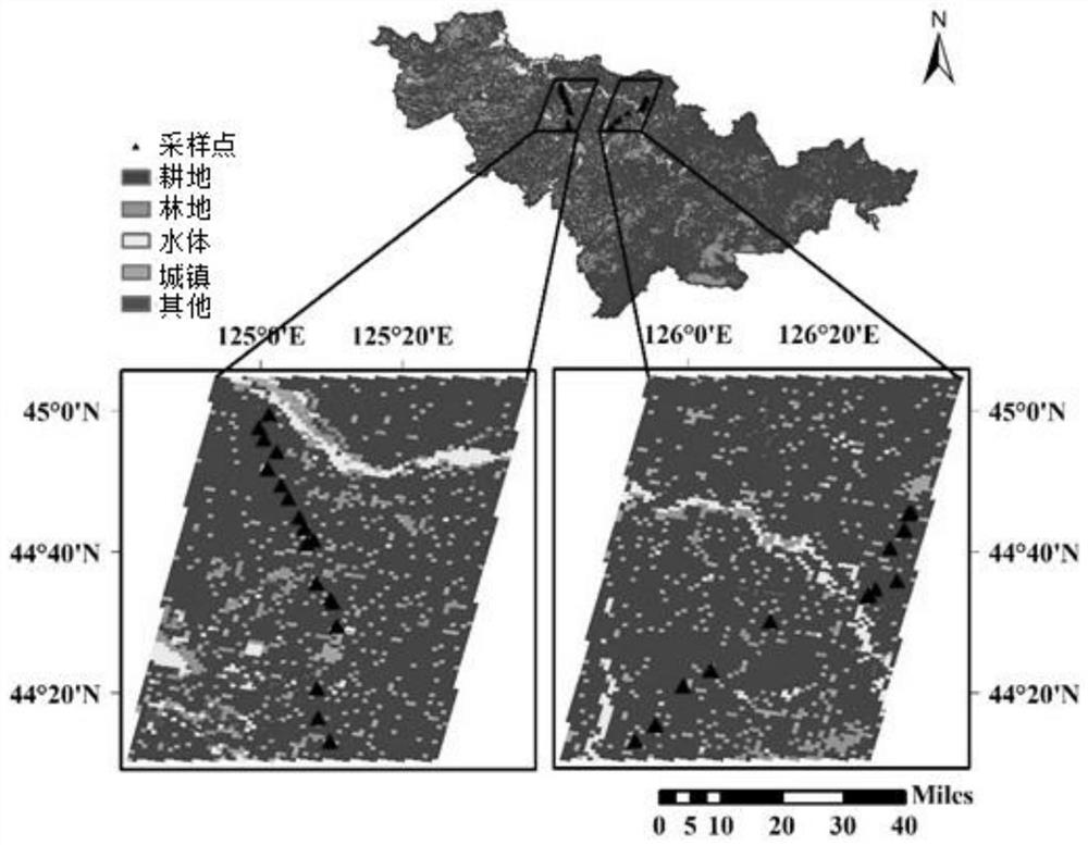
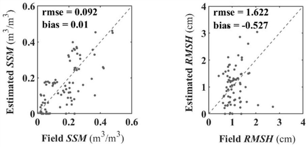
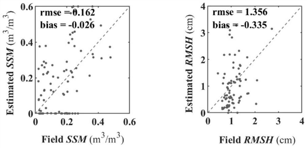
[0128] A method for simultaneously estimating the moisture and roughness of bare soil surfaces based on radar and optical remote sensing data, the steps are as follows:

[0129] Step 1. Obtain the soil parameters and latitude and longitude coordinates of 88 sample points in the study area;

[0130] Soil parameters include soil surface moisture (SSM) and root mean square height (RMSH);

[0131] Step 2, according to the longitude and latitude coordinates of 88 sampling points, extract the Sentinel-1 radar remote sensing data and Sentinel-2 optical remote sensing data of 88 sampling points from the Sentinel data distribution website; Sentinel-1 radar remote sensing data includes And Angle data, Sentinel-2 optical remote sensing data include spectral reflectance data in six bands of BLUE, GREEN, RED, NIR, SWIR1 and SWIR2;

[0132] Step 3. Use the bare soil reflectance model to model the spectral reflectance data of the six bands and the soil parameters respectively, so as to obt...


PUM


Abstract

The invention relates to a method for simultaneously estimating surface moisture and roughness of bare soil based on radar and optical data, which belongs to the technical field of remote sensing quantitative inversion of surface soil moisture and roughness. The problem that in the prior art, the soil surface moisture inversion precision is affected by the surface roughness is solved. The method comprises the following steps of firstly, acquiring soil data and latitude and longitude coordinates of N sample points in a research area, extracting radar data and optical data from a satellite data distribution website according to the latitude and longitude coordinates of the N sample points, obtaining an empirical coefficient and a root-mean-square error deltar(i) of the bare soil reflectivity model, and an empirical coefficient and a root-mean-square error, a root-mean-square error deltaSSM and a root-mean-square error deltaRMSH of the bare soil backscattering coefficient model, and finally, substituting the constructed empirical relation and related parameters into a collaborative inversion model based on radar and optical remote sensing data to realize inversion of surface soil moisture and root-mean-square height. According to the radar data, optical data and initial value collaborative inversion scheme, the obtained inversion precision is higher.

Description

technical field [0001] The invention belongs to the technical field of remote sensing quantitative inversion of soil surface moisture and roughness, in particular to a method for simultaneously estimating bare soil surface moisture and roughness based on radar and optical remote sensing data. Background technique [0002] Soil surface moisture (SSM) is an important part of the earth's water resources, a critical boundary between the earth's surface and the atmosphere, an important energy conversion factor, and a key factor affecting surface evapotranspiration. The timely acquisition of SSM is of great significance to surface water cycle, energy cycle, ecological environment and agricultural application. [0003] Remote sensing technology has the advantages of large-scale and quasi-real-time, and is widely used in SSM inversion. Radar remote sensing is one of the most potential methods for estimating SSM, which has the characteristics of all-time, all-weather, multi-polariza...

Claims


Application Information

Patent Timeline
Patent Type & Authority Applications(China)
IPC IPC(8): G01B11/30G01N21/17G01B7/34G01N27/00G01S13/88
CPCG01B11/30G01N21/17G01B7/34G01N27/00G01S13/88G01N2021/1793
Inventor 冯壮壮郑兴明陈思
Owner NORTHEAST INST OF GEOGRAPHY & AGRIECOLOGY C A S
Learn More