Geometric fine correction method suitable for high-resolution remote sensing image
A remote sensing image and high-resolution technology, applied in image enhancement, image analysis, image data processing, etc., can solve problems such as error matching, geometric fine correction failure, etc., and achieve the effect of improving operating speed and reducing redundant calculations
- Summary
- Abstract
- Description
- Claims
- Application Information
AI Technical Summary
Problems solved by technology
Method used
Image
Examples
Embodiment Construction
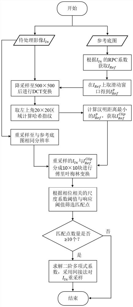
[0031] combine Figure 1 to Figure 8 Describe this embodiment, a geometric fine correction method suitable for high-resolution remote sensing images, the method is specifically implemented by the following steps:
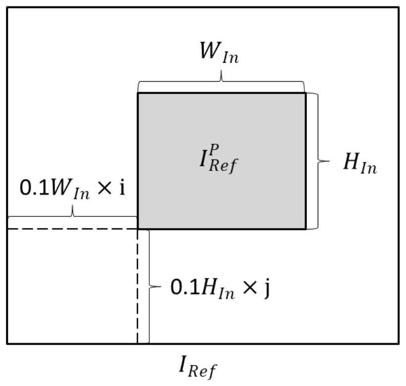
[0032] (1) Let the image to be processed be I In , according to I In RPC coefficient, calculate I In The maximum and minimum range of the coordinates, and according to the possible maximum positioning error, the I In The coordinate range of the extended range is expanded from the center to the outside, and the lengths of the expanded range in the east-west and north-south directions are respectively W Ref 、H Ref , the maximum value of the abscissa is The minimum value is The maximum value of the vertical axis is The minimum value is Get the underlay for this extent I Ref ;
[0033] (2) Suppose the image to be processed I In The lengths of the east-west and north-south directions are respectively W In 、H In . to meRef Take the sliding window, and th...
PUM
 Abstract
Description
Claims
Application Information
 - R&D
- Intellectual Property
- Life Sciences
- Materials
- Tech Scout
- Unparalleled Data Quality
- Higher Quality Content
- 60% Fewer Hallucinations
Browse by: Latest US Patents, China's latest patents, Technical Efficacy Thesaurus, Application Domain, Technology Topic, Popular Technical Reports.
© 2025 PatSnap. All rights reserved.Legal|Privacy policy|Modern Slavery Act Transparency Statement|Sitemap|About US| Contact US: help@patsnap.com


