
Water and soil loss dynamic monitoring field investigation information mobile acquisition system and method

A technology of dynamic monitoring and acquisition system, applied in signal transmission system, soil material test, closed-circuit television system, etc., can solve the problem of high cost of water and soil loss monitoring, inability to synchronously verify soil erosion intensity and vegetation coverage, and inability to support massive vector Problems such as rapid data display and editing

Active Publication Date: 2021-02-23
太湖流域管理局太湖流域水土保持监测中心站 +1
View PDF4 Cites 7 Cited by
  • Summary
  • Abstract
  • Description
  • Claims
  • Application Information

AI Technical Summary

Problems solved by technology

The dynamic monitoring of water and soil loss is based on satellite remote sensing and GIS technology. Due to the high precision requirements, in order to accurately grasp the information of water and soil loss, it is necessary to rely on the staff to collect a large amount of data and take images on the spot. At present, most of them use manual records to conduct on-site surveys. In the later stage, relevant data and on-site images need to be manually sorted and managed
The monitoring of water and soil loss in the existing technology is costly, cumbersome and time-consuming
In addition, in the dynamic monitoring of water and soil loss, each working unit is composed of tens of thousands of soil erosion plots with spatial information. After the soil erosion plot data is downloaded to the mobile terminal, each data call will The device generates a lot of stress and cannot display as quickly as needed
Existing auxiliary tools only support on-site positioning and navigation of a single pre-selected small number of maps, and cannot classify and review special tasks such as interpreting signs, water and soil conservation measures, and human-disturbed maps and record on-site information
Existing similar mobile terminals cannot support the rapid display and editing of massive vector data, nor can they perform simultaneous verification of on-site soil erosion intensity and vegetation coverage

Method used


Image

  • Water and soil loss dynamic monitoring field investigation information mobile acquisition system and method
  • Water and soil loss dynamic monitoring field investigation information mobile acquisition system and method
  • Water and soil loss dynamic monitoring field investigation information mobile acquisition system and method

Examples


Embodiment 1

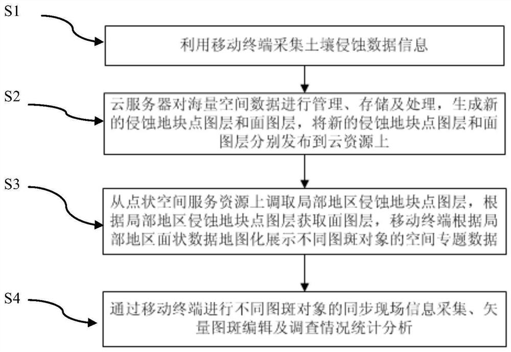
[0036] Embodiment 1, a mobile collection system of field investigation information for dynamic monitoring of water and soil loss, such as Figure 5 As shown, it includes a cloud server and a mobile terminal equipped with an information collection module. The mobile terminal equipped with an information collection module is wirelessly connected to the cloud server. The mobile terminal includes a wireless communication module, and the wireless communication module sends the collected information through a 4G / 5G base station. to the cloud server.

[0037] The cloud server includes a soil erosion data conversion unit and a data storage unit; the mobile terminal is provided with an information collection unit, an information display unit, and a wireless communication module.

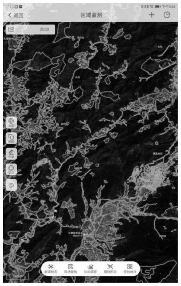
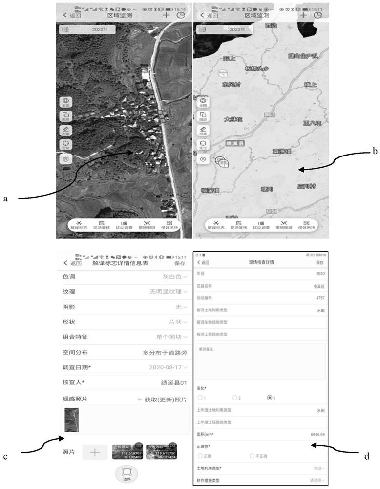
[0038] The cloud server can publish the massive soil erosion plots in the collected soil erosion data information as cloud planar space service resources and point space service resources respectively through...


PUM


Abstract

The invention relates to the field of water and soil loss dynamic monitoring, and discloses a water and soil loss dynamic monitoring field investigation information mobile acquisition system and method. The method comprises the steps of: carrying out water and soil loss dynamic monitoring field investigation and field information acquisition through a mobile terminal; and managing, storing and processing massive spatial data and recheck information through a cloud server, and enabling a mobile terminal to quickly call and display thematic data and monitor remote sensing images in the same period. According to the system and method, flexible calling and rapid display of tens of thousands of soil erosion land parcel data are realized through GIS algorithm optimization, the reasonability of the data can be rechecked and verified synchronously on site, and reference and basis are provided for soil erosion calculation and result analysis. According to the traditional technology, a paper mapand a paper table is printed to record different thematic investigation information, and as a result, accurate positioning and analysis cannot be achieved, and efficiency is low. With the system andmethod adopted, the above problems can be solved.

Description

technical field [0001] The invention relates to the field of dynamic monitoring of water and soil loss, in particular to a key technical method for the construction of a mobile collection system for field investigation information of dynamic monitoring of water and soil loss. Background technique [0002] Water and soil loss monitoring is one of the main contents of ecological environment monitoring. The dynamic monitoring of water and soil loss is based on remote sensing monitoring based on satellite remote sensing and GIS technology. Due to the high accuracy requirements, in order to accurately grasp the information of water and soil loss, it is necessary to rely on the staff to collect a large amount of data and take images on the spot. At present, most of them use manual records to conduct on-site surveys. In the later stage, relevant data and on-site images need to be manually sorted and managed. The monitoring of water and soil loss in the prior art is costly, cumbers...

Claims


Application Information

Patent Timeline
Patent Type & Authority Applications(China)
IPC IPC(8): G01N33/24H04N7/18G08C17/02
CPCG01N33/24H04N7/183G08C17/02
Inventor 杜婧张怡张玉刚杨勇耀刘宁张学沛周巧稚尤炎煌周婷昀马爱民杨均科袁柳朱熙华尹育知张瀚马超马贵福
Owner 太湖流域管理局太湖流域水土保持监测中心站
Learn More