
Method for delineating ocean seamount carbonate rock distribution range and processing terminal

A technique of distribution range, carbonate rock, applied in seismic signal processing, geophysical measurement, seismology, etc.

Active Publication Date: 2021-01-22
GUANGZHOU MARINE GEOLOGICAL SURVEY
View PDF7 Cites 0 Cited by
  • Summary
  • Abstract
  • Description
  • Claims
  • Application Information

AI Technical Summary

Problems solved by technology

[0004] In view of the deficiencies in the prior art, one of the purposes of the present invention provides a method for delineating the distribution range of oceanic seamount carbonate rocks, which can solve the problem of quickly determining the distribution range of seamount carbonate rocks;
[0005] The second object of the present invention is to provide a processing terminal, which can solve the problem of quickly determining the distribution range of seamount carbonate rocks

Method used


Image

  • Method for delineating ocean seamount carbonate rock distribution range and processing terminal
  • Method for delineating ocean seamount carbonate rock distribution range and processing terminal
  • Method for delineating ocean seamount carbonate rock distribution range and processing terminal

Examples


Embodiment Construction

[0041] Below, the present invention will be further described in conjunction with the accompanying drawings and specific embodiments.

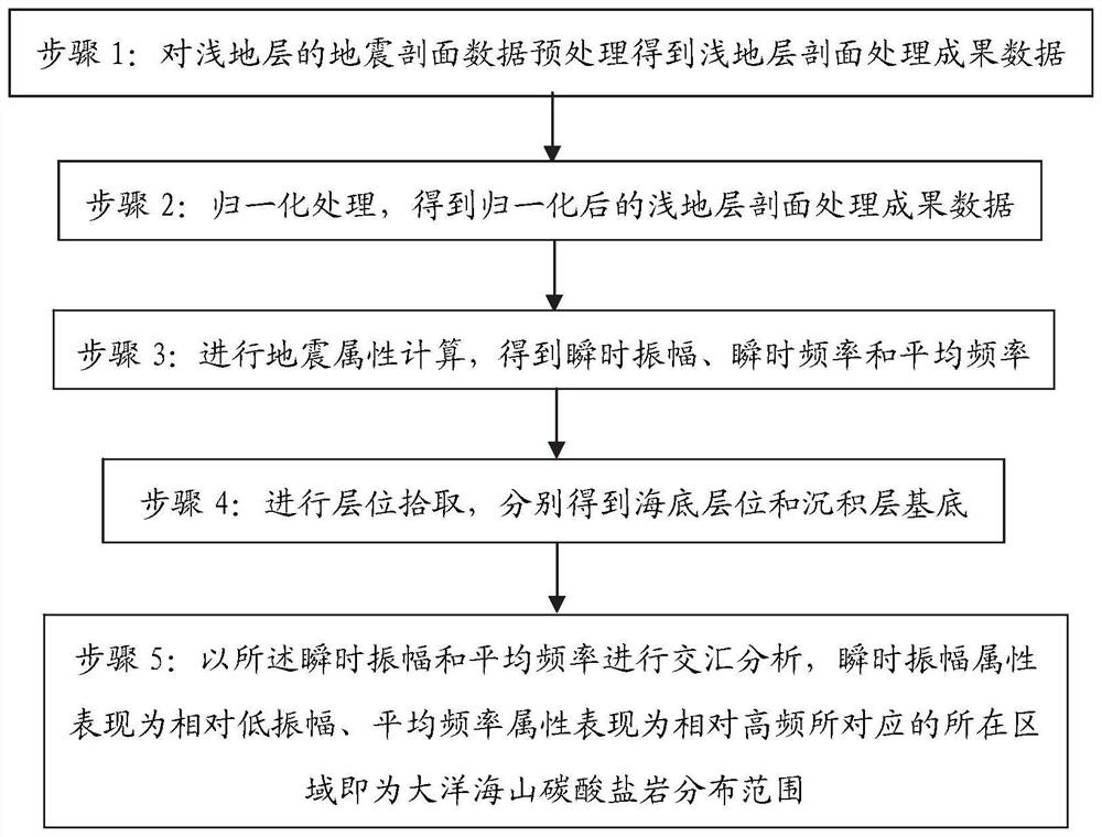
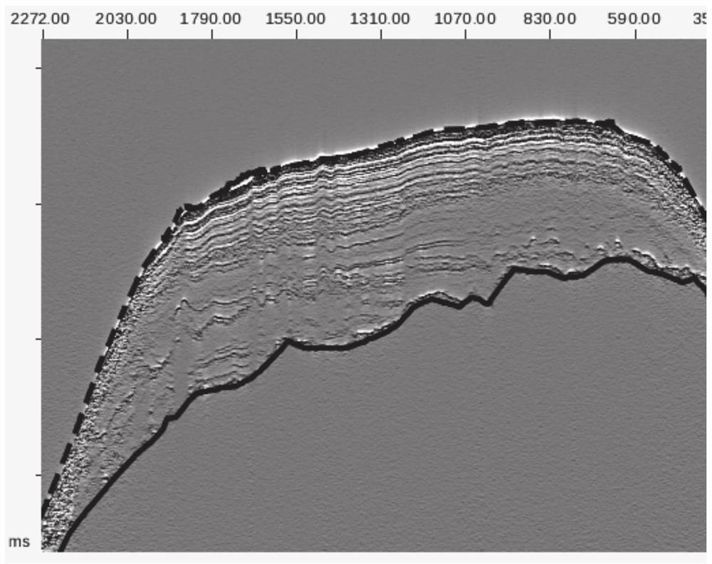
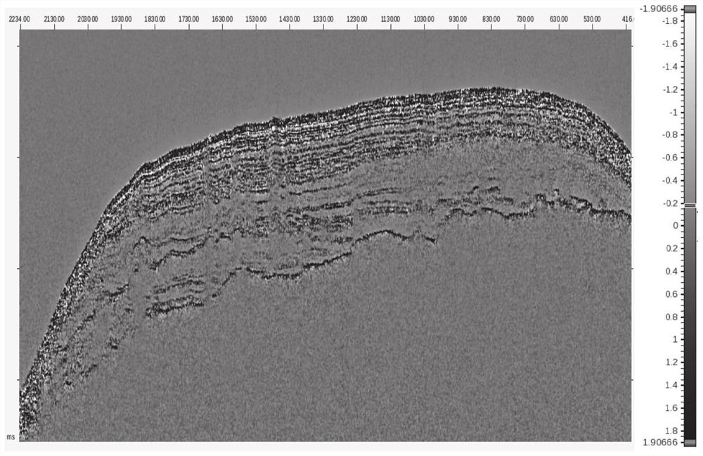
[0042] like Figure 1-Figure 6 As shown, a method to delineate the distribution range of oceanic seamount carbonate rocks includes the following steps:

[0043] Step 1: Obtain the seismic profile data of the shallow stratum and perform preprocessing to obtain the data of the shallow stratum profile processing results. Preprocessing mainly includes processing of abnormal noise suppression and surge correction on the seismic section data of shallow strata.

[0044] Step 2: Normalize the processing result data of the shallow stratum profile, and obtain the normalized shallow stratum profile processing result data x(t), so as to limit the amplitude range of the shallow stratum profile processing result data, for example, the amplitude The range is limited to the [-1,1] interval. Normalization processing can be carried out according to formula ①...


PUM


Abstract

The invention relates to a method for delineating an ocean seamount carbonate rock distribution range and a processing terminal. The method comprises the following steps of: 1, preprocessing seismic profile data of a shallow stratum to obtain shallow stratum profile processing result data; 2, performing normalization processing to obtain normalized shallow stratum profile processing result data; 3, carrying out seismic attribute calculation to obtain instantaneous amplitude, instantaneous frequency and average frequency; 4, carrying out horizon pickup to respectively obtain a seabed horizon and a deposition layer substrate; and 5, carrying out intersection analysis according to the instantaneous amplitude and the average frequency, and determining an area where the instantaneous amplitudeattribute is represented as relatively low amplitude and the average frequency attribute is represented as relatively high frequency as an ocean seamount carbonate rock distribution range. The methodcan quickly identify and delineate the carbonate rock distribution range of a ocean seamount, can be applied to three-dimensional space to display the carbonate rock distribution range, and can be better applied.

Description

technical field [0001] The invention relates to the technical field of submarine seamount carbonate exploration, in particular to a method for delineating the distribution range of oceanic seamount carbonate rocks and a processing terminal. Background technique [0002] Cobalt-rich crust is an oceanic seabed solid mineral resource rich in cobalt, nickel, copper, platinum group elements, iron-manganese elements and rare earth elements, with extremely high economic value. Oceanic seamounts are the main ore-forming potential areas of cobalt-rich crusts, and rocks such as carbonate rocks developed in oceanic seamounts are favorable substrates for the growth and development of cobalt-rich crusts. Rapid and accurate identification of the spatial distribution of seamount carbonate rocks can be used for The delineation of potential ore-forming areas of cobalt-rich crusts provides an important reference. At the same time, oceanic seamounts are one of the most understudied major geom...

Claims


Application Information

Patent Timeline
Patent Type & Authority Applications(China)
IPC IPC(8): G01V1/30G01V1/36
CPCG01V1/307G01V1/36G01V2210/63G01V2210/632
Inventor 杨振赵斌
Owner GUANGZHOU MARINE GEOLOGICAL SURVEY
Learn More