Method and device for constructing high-precision map
A construction method and map technology, applied in directions such as road network navigators, can solve the problems of inaccurate pavement elements and low accuracy of high-precision maps, and achieve the effect of improving accuracy and saving costs.
- Summary
- Abstract
- Description
- Claims
- Application Information
AI Technical Summary
Problems solved by technology
Method used
Image
Examples
Embodiment Construction
[0038] Hereinafter, exemplary embodiments according to the present application will be described in detail with reference to the accompanying drawings. Apparently, the described embodiments are only some of the embodiments of the present application, rather than all the embodiments of the present application. It should be understood that the present application is not limited by the exemplary embodiments described here.
[0039] Application overview
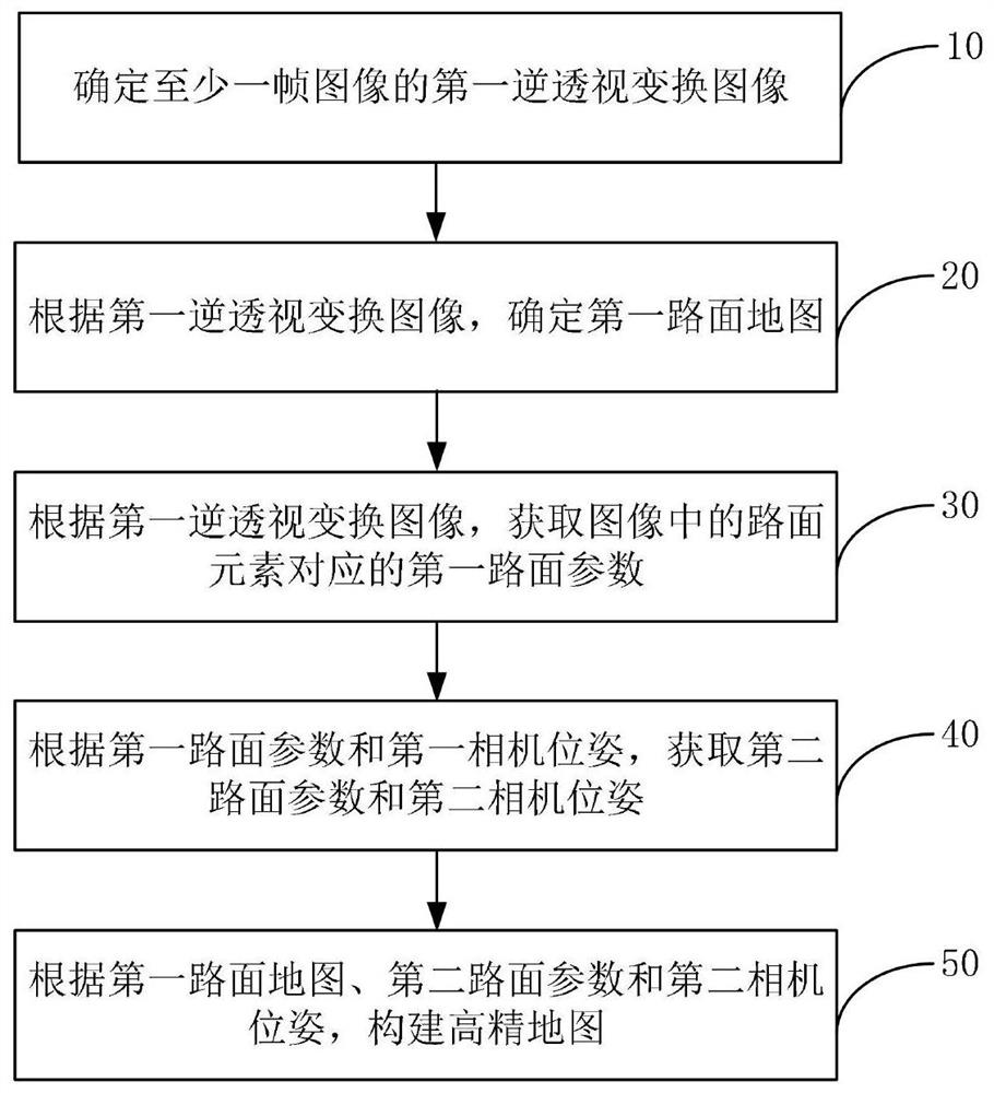
[0040] Accurate road surface element information in high-precision maps is the basic condition for realizing automatic driving. At present, lidar is often used to collect road surface elements, and high-precision maps are constructed based on the reflection value of road surface elements to laser light. When the elements are collected, there are reflective requirements for the road elements. When the reflection ability of the road elements is insufficient, the accuracy of the road elements collected by the lidar is not high, wh...
PUM
 Abstract
Description
Claims
Application Information
 - R&D Engineer
- R&D Manager
- IP Professional
- Industry Leading Data Capabilities
- Powerful AI technology
- Patent DNA Extraction
Browse by: Latest US Patents, China's latest patents, Technical Efficacy Thesaurus, Application Domain, Technology Topic, Popular Technical Reports.
© 2024 PatSnap. All rights reserved.Legal|Privacy policy|Modern Slavery Act Transparency Statement|Sitemap|About US| Contact US: help@patsnap.com


