Underwater multi-source acoustic image feature extraction method and system
A feature extraction and image technology, applied in the fields of instruments, character and pattern recognition, computer parts, etc., can solve the problems of limited information, few extraction methods, and inability to form complementarity of landform features, so as to improve classification accuracy and comprehensive feature extraction. Effect
- Summary
- Abstract
- Description
- Claims
- Application Information
AI Technical Summary
Problems solved by technology
Method used
Image
Examples
Embodiment 1
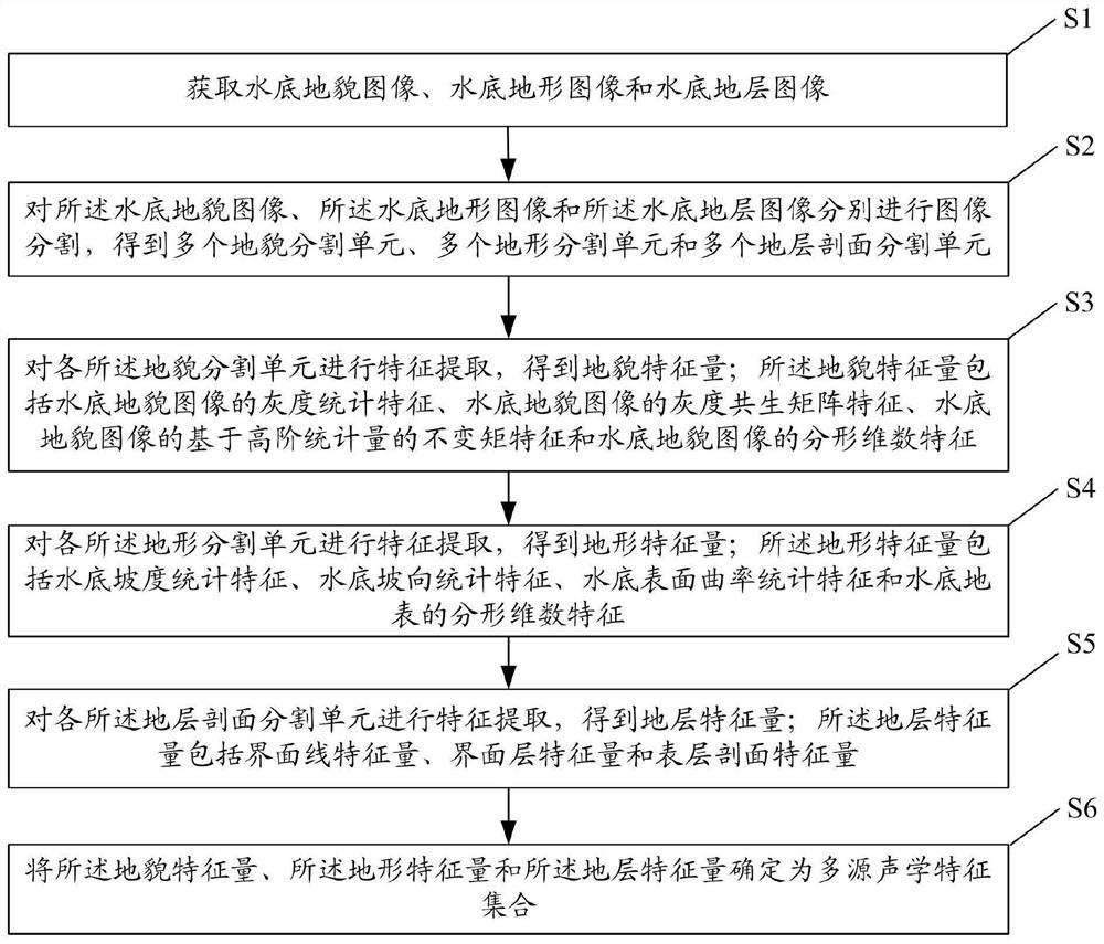
[0034] figure 1 It is a flow chart of the underwater multi-source acoustic feature extraction method in Embodiment 1 of the present invention. see figure 1 , the underwater multi-source acoustic feature extraction method of the present embodiment, comprising:
[0035] Step S1: Acquiring bottom topography images, bottom topography images and bottom formation images.
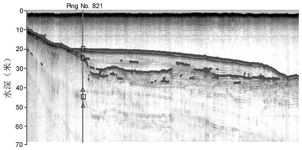
[0036] In this embodiment, the underwater stratum image is composed of multiple columns of sub-images; each column of the sub-images corresponds to a time series of sound reflection signals.
[0037] Step S2: Carry out image segmentation on the underwater landform image, the underwater terrain image and the underwater stratum image respectively to obtain a plurality of geomorphic segmentation units, a plurality of terrain segmentation units and a plurality of stratum section segmentation units. The landform segmentation unit and terrain segmentation unit correspond to local image blocks that are spatially conti...
Embodiment 2
[0123] figure 2 It is a flow chart of the underwater multi-source acoustic feature extraction method in Embodiment 2 of the present invention. see figure 2 , the underwater multi-source acoustic feature extraction method of this embodiment, the object of its processing is the underwater multi-source acoustic image acquired by three types of acoustic sensors, including: side-scan sonar, multi-beam sonar system, shallow formation profiler and other equipment respectively acquired Underwater landform images, underwater topographic images and underwater stratigraphic profile images. The idea of this embodiment is: the first step is to extract the features of the multi-source acoustic image; the second step is to perform feature screening on the extracted multi-source acoustic image features; the third step is to perform feature selection based on the filtered acoustic image features to get the optimal feature subset.
[0124] Step 1: Feature extraction of multi-source acous...
Embodiment 3
[0211] This embodiment provides an underwater multi-source acoustic feature extraction system, Figure 7 It is a schematic structural diagram of an underwater multi-source acoustic feature extraction system according to Embodiment 3 of the present invention. see Figure 7 , the underwater multi-source acoustic feature extraction system includes:
[0212] The image acquiring module 701 is used for acquiring underwater landform images, underwater terrain images and underwater stratum section images.
[0213] The image segmentation module 702 is configured to perform image segmentation on the underwater landform image, the underwater topographic image and the underwater stratum image respectively to obtain a plurality of geomorphic segmentation units, a plurality of terrain segmentation units and a plurality of stratum section segmentation units.
[0214] The geomorphic feature quantity module 703 is used to perform feature extraction on each of the geomorphic segmentation unit...
PUM
 Abstract
Description
Claims
Application Information
 - R&D
- Intellectual Property
- Life Sciences
- Materials
- Tech Scout
- Unparalleled Data Quality
- Higher Quality Content
- 60% Fewer Hallucinations
Browse by: Latest US Patents, China's latest patents, Technical Efficacy Thesaurus, Application Domain, Technology Topic, Popular Technical Reports.
© 2025 PatSnap. All rights reserved.Legal|Privacy policy|Modern Slavery Act Transparency Statement|Sitemap|About US| Contact US: help@patsnap.com


