Foundation and foundation subdivision engineering analysis and model selection method based on BIM + GIS
A branch engineering and foundation technology, applied in the field of BIM+GIS foundation and foundation branch project analysis and selection, can solve problems such as useless foundation and foundation branch projects, achieve low cost and improve production efficiency
- Summary
- Abstract
- Description
- Claims
- Application Information
AI Technical Summary
Problems solved by technology
Method used
Image
Examples
specific Embodiment approach
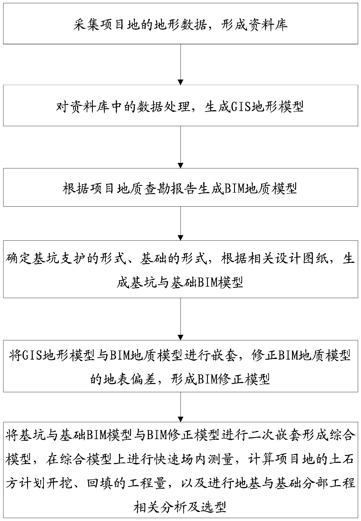
[0029]The purpose of the present invention is to overcome the deficiencies of the prior art, reduce the disputes over the amount of earthwork and rockwork, and adopt BIM+GIS to simulate the calculation technology of earthwork balance. In the early stage of the project, UAV forward and oblique photography technology is used to collect the original terrain data of the project site, and the original data database is formed accurately, low-cost and efficiently, and the data is processed based on the original data database to generate high-precision GIS "topography" In the model, the excavation and backfilling of the earth and stone on site are measured and calculated. At the same time, in order to reduce errors, according to the project geological survey report, Civil 3D is used to establish the "geological model", and according to the project foundation pit support construction drawing and project foundation construction The figure establishes the BIM "pit and foundation" model, a...
PUM
 Abstract
Description
Claims
Application Information
 - R&D
- Intellectual Property
- Life Sciences
- Materials
- Tech Scout
- Unparalleled Data Quality
- Higher Quality Content
- 60% Fewer Hallucinations
Browse by: Latest US Patents, China's latest patents, Technical Efficacy Thesaurus, Application Domain, Technology Topic, Popular Technical Reports.
© 2025 PatSnap. All rights reserved.Legal|Privacy policy|Modern Slavery Act Transparency Statement|Sitemap|About US| Contact US: help@patsnap.com


