Soil erosion surface form DEM construction and observation method and device in rainfall process
A soil erosion and surface morphology technology, applied in the field of soil erosion surface morphology DEM construction and observation, can solve problems such as inability to model three-dimensional cushion surface, difficult to deal with rain and fog, etc., to achieve real-time observation, improve accuracy and efficiency.
- Summary
- Abstract
- Description
- Claims
- Application Information
AI Technical Summary
Problems solved by technology
Method used
Image

Examples
Embodiment 1
[0058] This embodiment discloses a method for constructing a DEM of soil erosion surface morphology during rainfall, which is used to obtain a DEM of the soil erosion underlying surface in a rainfall environment.
[0059] Follow the steps below:
[0060] Step 1. Set N cameras directly above the soil erosion underlying surface to be modeled, where N is an integer greater than 1, and use each camera to simultaneously collect multiple images of the soil erosion underlying surface to be modeled. image, obtain N initial image groups, and each initial image in the initial image group has the same size;
[0061] In this embodiment, several groups of digital image collectors are networked based on wireless network technology, and each group of digital image collectors includes a digital camera and an industrial control level computer. The number of digital image collectors depends on the size and shape of the underlying surface area and the erection height of the digital image collec...
Embodiment 2
[0085] A method for observing surface morphology of soil erosion during rainfall, which is used to obtain the amount of soil erosion between adjacent observation moments during rainfall, is performed according to the following steps:
[0086] Step A, collect the DEM of the underlying surface of soil erosion to be observed before the rainfall, and use the model as a benchmark for calculating the amount of erosion;
[0087] In this step, the construction of the datum reference plane is completed, the 3D point cloud data and digital elevation model without erosion are obtained, and the 3D point cloud data and digital elevation model are used as the datum reference plane for the shape change of the underlying surface after erosion occurs.
[0088] Step B, using the DEM construction method of soil erosion surface form in the rainfall process described in any one of claims 1-2 to obtain the DEM of the soil erosion underlying surface at multiple observation moments in the rainfall pro...
Embodiment 3
[0094] In this example, an experiment was conducted on the effectiveness of the model construction and erosion observation method provided by the present invention. The experiment was carried out on October 4, 2018 in the artificially simulated rainfall hall of the State Key Laboratory of Soil Erosion and Dryland Agriculture on the Loess Plateau.
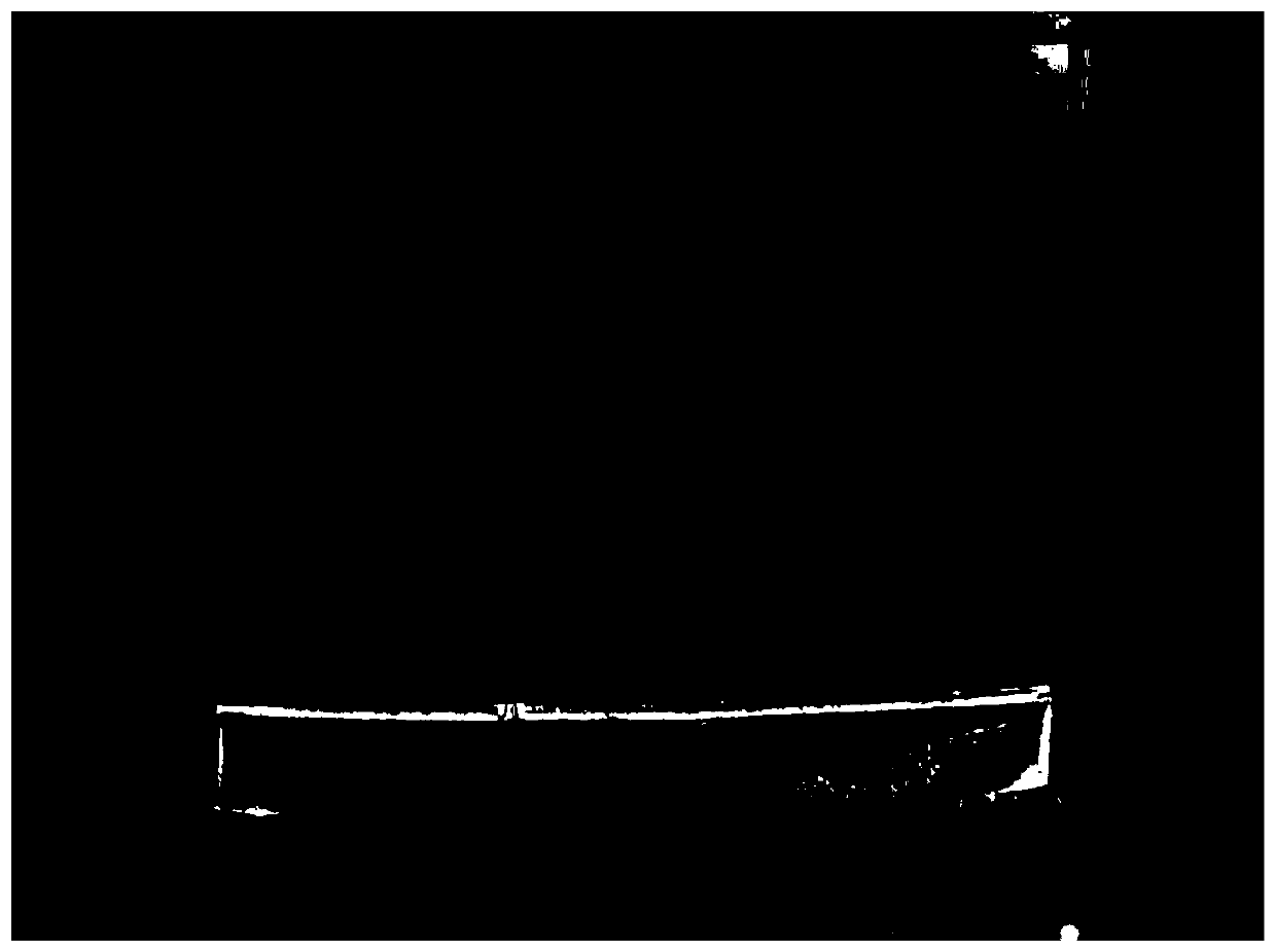
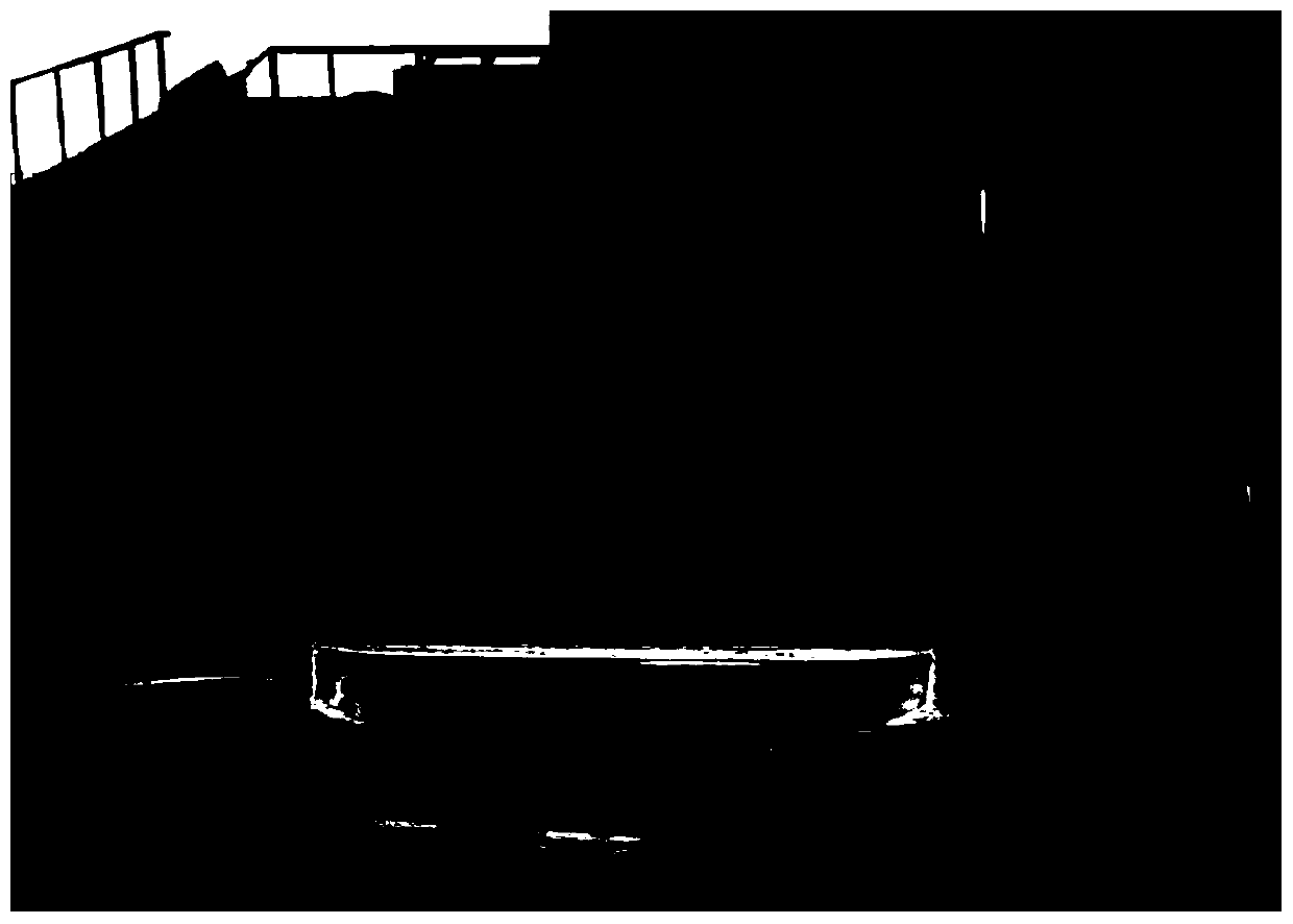
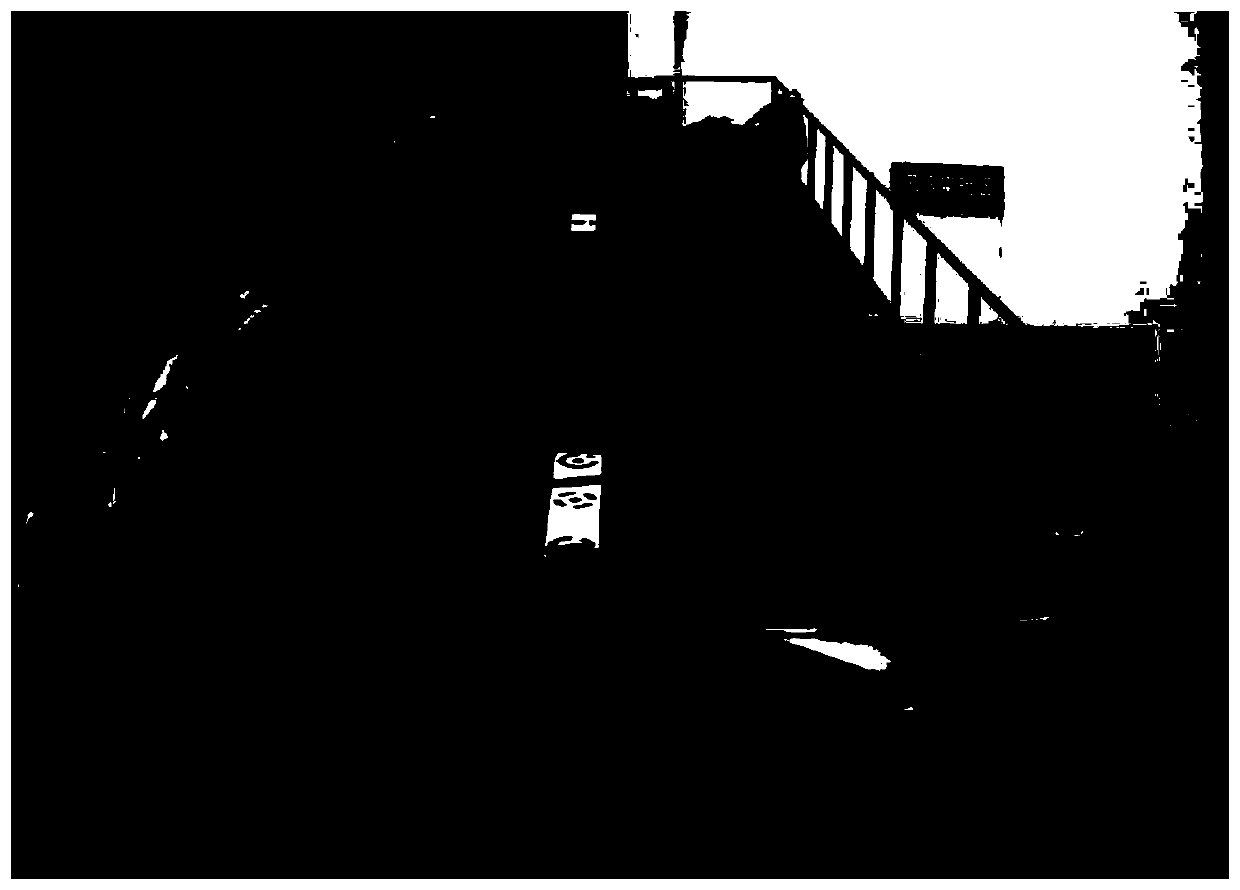
[0095] The experiment was set up with two left and right parallel steel channels and was carried out on the morning and afternoon of October 4, 2018 respectively. In the experiment, the intensity of artificially simulated rainfall is 90mm / h and 120mm / h respectively, and the constructed underlying surface is as follows: figure 1 , 2 , as shown in 3, where figure 1 with figure 2 The pictures of the underlying surfaces of the left and right soil grooves without erosion (taken before the rainfall), respectively, image 3 These are pictures of the underlying surfaces of the left and right soil tanks where erosion occurred (taken afte...
PUM
 Abstract
Description
Claims
Application Information
 - R&D
- Intellectual Property
- Life Sciences
- Materials
- Tech Scout
- Unparalleled Data Quality
- Higher Quality Content
- 60% Fewer Hallucinations
Browse by: Latest US Patents, China's latest patents, Technical Efficacy Thesaurus, Application Domain, Technology Topic, Popular Technical Reports.
© 2025 PatSnap. All rights reserved.Legal|Privacy policy|Modern Slavery Act Transparency Statement|Sitemap|About US| Contact US: help@patsnap.com