
A geosynchronous orbit sar squint imaging processing device for on-satellite walk and two-dimensional space variation correction

A technology of geosynchronous orbit and imaging processing, applied in the direction of measuring devices, radio wave reflection/re-radiation, instruments, etc., can solve the problems of serious two-dimensional space variability, low SAR repetition frequency, and large distance travel, etc., to reduce the Dealing with stress, improving ability and precision, and good focus

Active Publication Date: 2020-09-04
BEIHANG UNIV
View PDF5 Cites 0 Cited by
  • Summary
  • Abstract
  • Description
  • Claims
  • Application Information

AI Technical Summary

Problems solved by technology

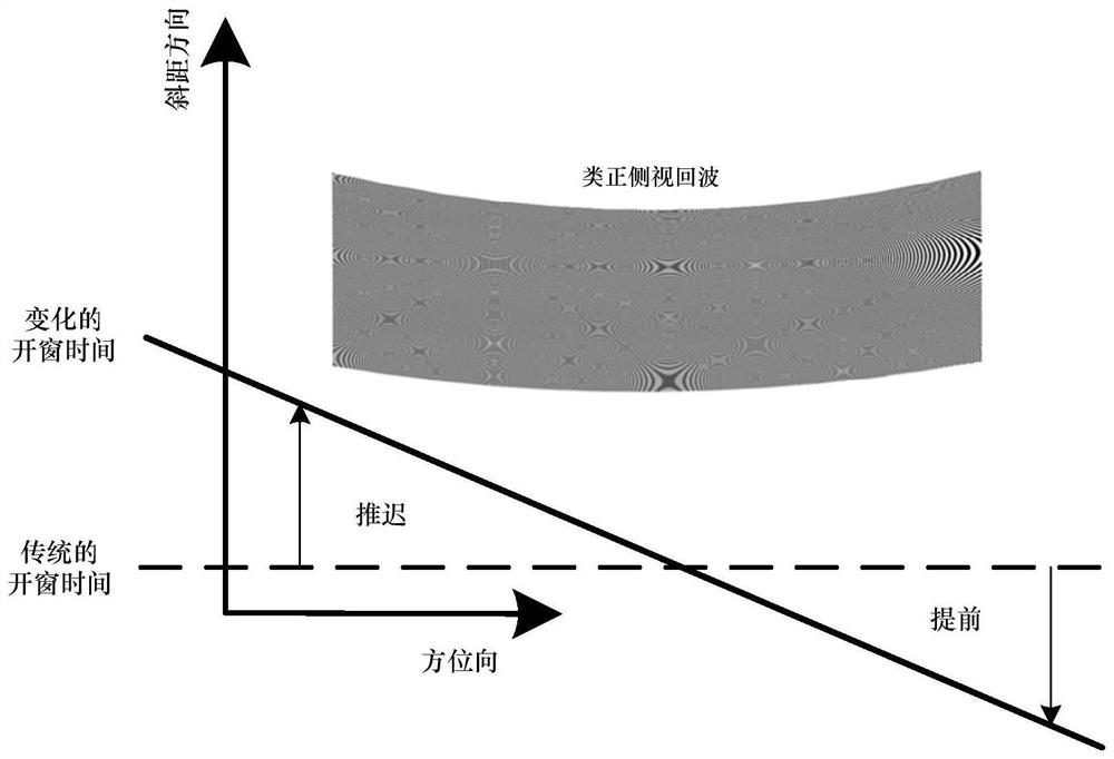
[0006] Aiming at the problems of large distance movement and serious two-dimensional space variation under the condition of GEO SAR squint observation, the present invention utilizes the characteristics of extremely low repetition frequency of synchronous orbit SAR, and proposes an echo signal star-walking reception strategy

Method used


Image

  • A geosynchronous orbit sar squint imaging processing device for on-satellite walk and two-dimensional space variation correction
  • A geosynchronous orbit sar squint imaging processing device for on-satellite walk and two-dimensional space variation correction
  • A geosynchronous orbit sar squint imaging processing device for on-satellite walk and two-dimensional space variation correction

Examples


Embodiment 1

[0181] The simulation implementation parameters are shown in Table 1. The scene center is set at 103.4° east longitude and 31° north latitude, which is the location of Wenchuan in my country. This method is used for synchronous orbit squint observation, the main purpose is to monitor the target of interest for a long time, such as geological disasters, so the requirement for the scene size is not large, so the simulation scene is set to 30km (azimuth) × 30km (distance Towards). In addition, it should be noted that since the RCM changes with the position, the width that can be realized by this method also changes with the observation position. For example, when the oblique viewing angle is small, the center of the scene is set at the equator, and the observation width can reach 150km (azimuth direction)×150km (distance direction).

[0182] Table 1 Radar parameters

[0183] parameter value Orbit inclination (degrees) 60 orbital eccentricity 0 Orbit...


PUM


Abstract

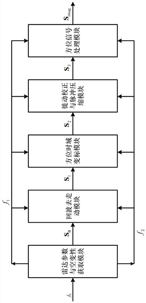
The invention discloses a geosynchronous orbit SAR squint imaging processing device for on-satellite walking removal and 2D spatial-variant correction. According to the device, sequentially, on a satellite, a receiving window is adjusted to remove signal walking through the satellite, a walking-removal echo link is downloaded, a spatial-variant model is constructed according to a satellite-groundgeometric relation, and a range direction residual walking correction, range migration correction and compression, azimuth direction partial dechirp for reducing a time span, azimuth direction residual walking removal, azimuth direction nonlinear conversion and compression and final geometric correction and imaging result outputting are conducted. Compared with the prior art, the feature of quitelow repetition frequency under GEO SAR is used, and while range direction and azimuth direction coupling is reduced through on-satellite walking removal, the effectiveness of data storage on the satellite is improved; for received echoes, partial fined correction is conducted in the azimuth direction and range direction, so that the focusing precision of an algorithm is improved.

Description

technical field [0001] The invention relates to squint imaging of GEO SAR. Specifically, it uses the characteristics of extremely low repetition frequency of GEO SAR to walk on the star, and uses the two-dimensional space variation model after the walk to perform two-dimensional space variation correction, so as to realize the method of GEO SAR squint processing, which belongs to remote sensing imaging processing field. Background technique [0002] Synthetic Aperture Radar (SAR) is an all-weather and all-weather active information acquisition system. The full link system of SAR can be divided into three parts, namely, the echo data acquisition on the radar carrier platform part, space segment data transmission part and ground segment data processing part. The synthetic aperture radar system obtains the original echo data of the synthetic aperture radar by transmitting and receiving pulse signals. [0003] Geosynchronous orbit Synthetic Aperture Radar (GEO SAR, Geosynchro...

Claims


Application Information

Patent Timeline
Patent Type & Authority Patents(China)
IPC IPC(8): G01S13/90G01S7/292
CPCG01S7/2923
Inventor 于泽耿纪文李春升
Owner BEIHANG UNIV
Learn More