Multi-beam sonar submarine topography measurement quality real-time evaluation method based on phase method
A topographic measurement and multi-beam technology, applied to radio wave measurement systems, measurement devices, sound wave reradiation, etc., can solve problems such as difficult estimation, and achieve the effect of simple and clear judgment criteria and accurate depth estimation
- Summary
- Abstract
- Description
- Claims
- Application Information
AI Technical Summary
Problems solved by technology
Method used
Image
Examples
Embodiment Construction
[0022] The present invention will be further described in detail below in conjunction with the accompanying drawings and specific embodiments.
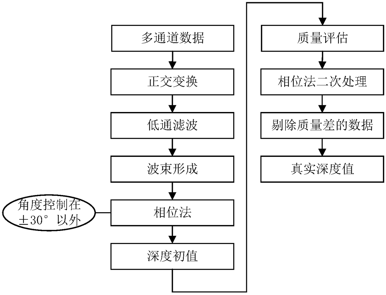
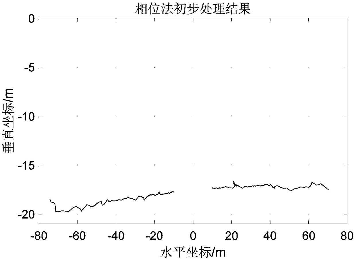
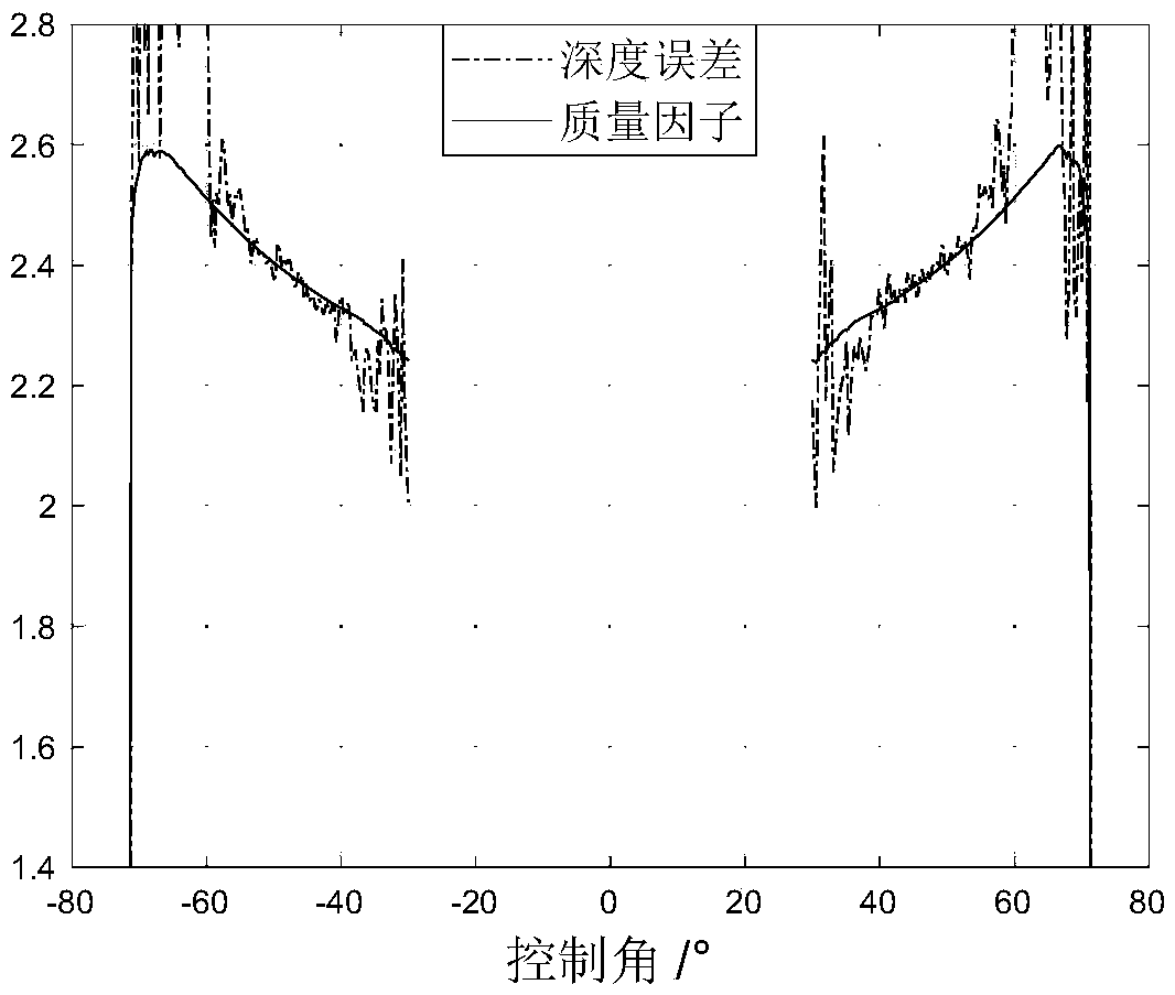
[0023] The purpose of the present invention is to solve the shortcomings and deficiencies of the above-mentioned prior art, and provide a kind of multi-beam sonar sea bottom terrain measurement quality real-time evaluation method based on the phase method, utilize the multi-beam sonar phase method to detect the result, real-time to the sea bottom topography quality evaluation, thereby preserving high-quality depth measurements and improving the quality of multibeam seafloor topography measurements.
[0024] Using the coherence effect of the receiving array, the phase difference sequence of the seabed scattering echo can be approximated as a linear function of time:
[0025] Δφ(t)=kt+b (1)
[0026] The least squares method does linear regression to estimate slope k and intercept b, which uses Euclidean distance as the error measure, a...
PUM
 Abstract
Description
Claims
Application Information
 - Generate Ideas
- Intellectual Property
- Life Sciences
- Materials
- Tech Scout
- Unparalleled Data Quality
- Higher Quality Content
- 60% Fewer Hallucinations
Browse by: Latest US Patents, China's latest patents, Technical Efficacy Thesaurus, Application Domain, Technology Topic, Popular Technical Reports.
© 2025 PatSnap. All rights reserved.Legal|Privacy policy|Modern Slavery Act Transparency Statement|Sitemap|About US| Contact US: help@patsnap.com


