A Method of Obtaining Three-Dimensional Movement of Earth's Surface from SAR Data of Two Parallel Tracks
A technology of surface movement and movement, which is applied in the field of seismic synchronous mobile monitoring and mine surface settlement monitoring, which can solve the problems of low practical application value, unrealistic, and large accuracy gap.
- Summary
- Abstract
- Description
- Claims
- Application Information
AI Technical Summary
Problems solved by technology
Method used
Image
Examples
Embodiment Construction
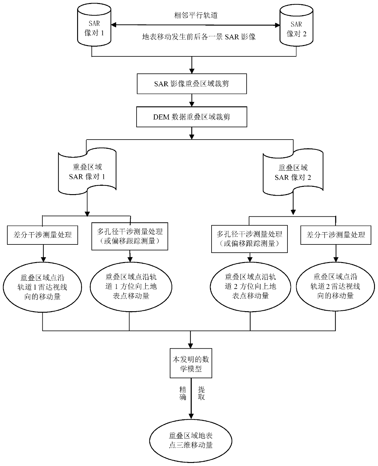
[0056] like figure 1 As shown, the present invention is a flow chart of the method for obtaining the three-dimensional movement amount of the ground surface from two adjacent parallel orbit SAR image pairs, and the specific implementation steps are as follows:
[0057] Step 1: Data collection and selection: collect single-view complex SAR data from two adjacent parallel orbits, one scene before and after ground movement, respectively. Selection principle: The time between the two SAR images and the surface movement is as short as possible, and the spatial vertical baseline of the two is as short as possible. In addition, collect digital elevation data (Digital Elevation Model, DEM) with the same coverage area as the SAR image;
[0058] Step 2: Data preprocessing: Cut the SAR images of the two differential image pairs to obtain the image data of the two SAR differential image pairs covering the overlapping area respectively. At the same time, the DEM data is trimmed according...
PUM
 Abstract
Description
Claims
Application Information
 - R&D
- Intellectual Property
- Life Sciences
- Materials
- Tech Scout
- Unparalleled Data Quality
- Higher Quality Content
- 60% Fewer Hallucinations
Browse by: Latest US Patents, China's latest patents, Technical Efficacy Thesaurus, Application Domain, Technology Topic, Popular Technical Reports.
© 2025 PatSnap. All rights reserved.Legal|Privacy policy|Modern Slavery Act Transparency Statement|Sitemap|About US| Contact US: help@patsnap.com


