
A shoreline extraction method of a remote sensing image based on an object-oriented method and a membership rule thereof

An object-oriented technology for remote sensing images, applied in image enhancement, image analysis, image data processing, etc., can solve problems such as errors and lack of quantitative indicators, and achieve good fitting and high-precision extraction effects

Inactive Publication Date: 2019-03-08
三亚中科遥感研究所 +1
View PDF1 Cites 24 Cited by
  • Summary
  • Abstract
  • Description
  • Claims
  • Application Information

AI Technical Summary

Problems solved by technology

Wu Xiaojuan et al. (Wu Xiaojuan et al., 2015), Jia Mingming et al. (Jia Mingming et al., 2013) adopted the principle of "highest segmentation efficiency" and only used the near-infrared band of satellite images to select an appropriate threshold to separate water bodies and non-water bodies after memory segmentation; Gao Yan (Gao Yan et al., 2014) adopted the “trial and error method” to classify and extract features only for artificial coastlines; Zhao Zhiling et al. (Zhao Zhiling et al., 2017) and Ju Chao et al. After segmentation, only the absolute threshold value of a single feature of NDWI is used to identify water body information. In the above methods, empirical models are mostly used to determine the segmentation scale, and there is a lack of a quantitative index to guide the determination of the optimal segmentation scale. At the same time, a single However, when the background of the underlying surface is complex, there are often errors, especially in the extraction of coastline information that requires a high position accuracy.

Method used


Image

  • A shoreline extraction method of a remote sensing image based on an object-oriented method and a membership rule thereof
  • A shoreline extraction method of a remote sensing image based on an object-oriented method and a membership rule thereof
  • A shoreline extraction method of a remote sensing image based on an object-oriented method and a membership rule thereof

Examples


Embodiment Construction

[0041] In order to make the purpose, technical solutions and advantages of the embodiments of the present invention clearer, the technical solutions of the present invention will be clearly and completely described below in conjunction with the accompanying drawings. Obviously, the described embodiments are part of the embodiments of the present invention, not all of them. the embodiment. Based on the embodiments of the present invention, all other embodiments obtained by persons of ordinary skill in the art without making creative efforts belong to the protection scope of the present invention.

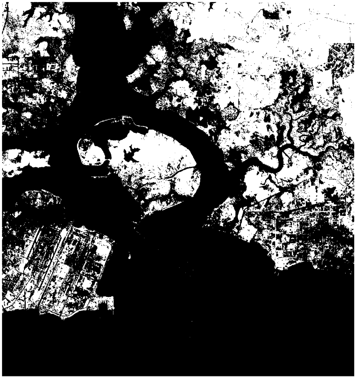
[0042] Artificial coastline construction areas such as ports and wharfs are places where the length and type of coastlines vary significantly, and are also one of the key areas for time-series spatial analysis of coastlines. The port of Singapore and its surrounding areas are one of the ten busiest port areas in the world, guarding the shipping arteries between the Pacific Ocean and ...


PUM


Abstract

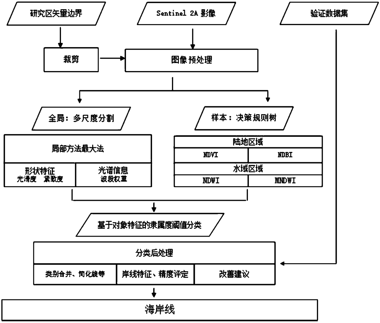
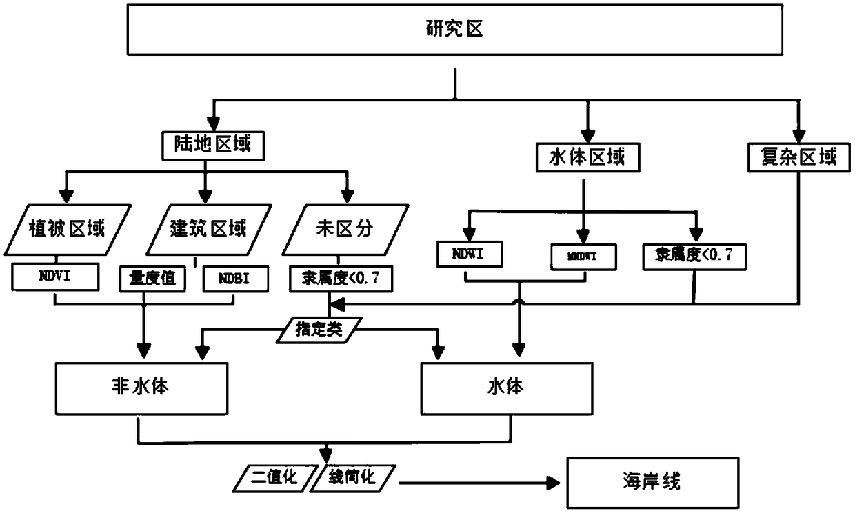
The invention provides a shoreline extraction method of a remote sensing image based on an object-oriented method and a membership rule thereof. The method obtains an optimal segmentation scale by evaluating multi-scale segmentation and segments an image based on homogeneity principle. Then, the feature samples are constructed to obtain the features of the underlying surface. Secondly, attributesare assigned to the image object unit based on membership rules. Finally, the land information is divided into water and non-water binary information images, and the coastline information is obtainedby line reduction algorithm after grating loss conversion. The method of the invention realizes the high-precision extraction of the coastline, has good fitting degree in most areas, and can be betterapplied to the extraction of the coastline in a large range.

Description

technical field [0001] The invention relates to a remote sensing image coastline extraction method, in particular to a remote sensing image coastline extraction method based on object-oriented and membership rules. Background technique [0002] The coastal zone is in the interaction zone between the ocean and the land. It is not only affected by global ecological environmental problems such as climate change, sea level transition, and marine and terrestrial habitats, but also affected by reclamation, artificial island projects, offshore ponds and nearshore ponds. Affected by human factors such as breeding, port construction, sand mining and dam building, how to quickly and accurately extract the coastline is one of the hot issues in coastal zone research. [0003] Researchers at home and abroad have proposed many methods, such as visual interpretation, threshold segmentation, edge detection, neural network classification, fuzzy classification, improved maximum likelihood cla...

Claims


Application Information

Patent Timeline
IPC IPC(8): G06T7/181
CPCG06T2207/10032G06T7/181
Inventor 张丽毕京鹏李通
Owner 三亚中科遥感研究所
Learn More