Urban-tree carbon content estimation method based on multi-echo airborne-laser-scanning data
An airborne laser scanning, multi-echo technology, applied in image data processing, re-radiation of electromagnetic waves, radio wave measurement systems, etc., can solve problems such as huge labor and time
- Summary
- Abstract
- Description
- Claims
- Application Information
AI Technical Summary
Problems solved by technology
Method used
Image
Examples
Embodiment
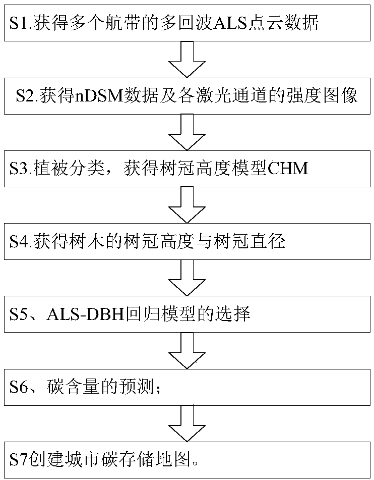
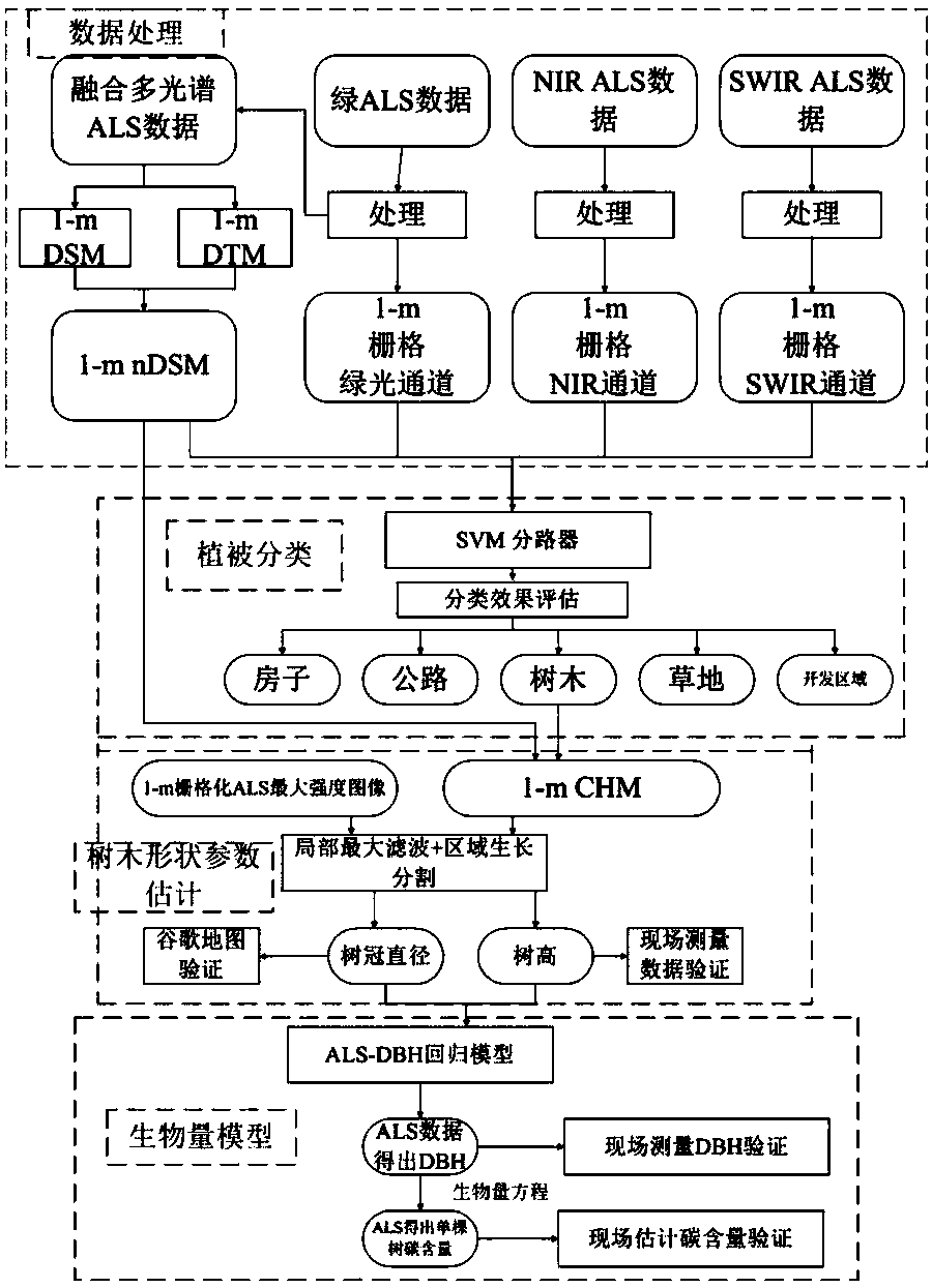
[0079] like figure 1 and figure 2 As shown, the carbon content estimation method of urban trees based on multi-echo airborne laser scanning data includes the following steps:
[0080] S1. Obtain multi-echo ALS point cloud data of multiple airways;
[0081] S2. Obtain nDSM data and intensity images of each laser channel;
[0082] S3, vegetation classification, obtain the canopy height model CHM;
[0083] S4, obtain crown height and crown diameter of trees;
[0084] S5, selection of ALS-DBH regression model;
[0085] S6. Prediction of carbon content;
[0086] S7 creates maps of urban carbon storage.
[0087] The wavelengths of the green laser, the near-infrared laser and the short-wave infrared laser in step S1 are 532 nm, 1064 nm and 1550 nm, respectively.
[0088] Step S2 specifically includes:
[0089] S21. Denoising the multi-echo ALS point cloud data of each airway respectively:
[0090] First, use an intensity filter to remove points with intensities outside 3σ t...
PUM
 Abstract
Description
Claims
Application Information
 - R&D
- Intellectual Property
- Life Sciences
- Materials
- Tech Scout
- Unparalleled Data Quality
- Higher Quality Content
- 60% Fewer Hallucinations
Browse by: Latest US Patents, China's latest patents, Technical Efficacy Thesaurus, Application Domain, Technology Topic, Popular Technical Reports.
© 2025 PatSnap. All rights reserved.Legal|Privacy policy|Modern Slavery Act Transparency Statement|Sitemap|About US| Contact US: help@patsnap.com


