A global one-map data storage organization method and call method
A technology for storing organizational and graph data, applied in special data processing applications, geographic information databases, structured data retrieval, etc., and can solve the problems of low file access efficiency and low system performance.
- Summary
- Abstract
- Description
- Claims
- Application Information
AI Technical Summary
Problems solved by technology
Method used
Image
Examples
Embodiment 1
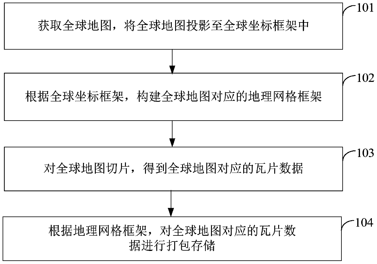
[0061] see figure 1 , the embodiment of the present invention provides a global map data storage organization method, the method specifically includes the following steps:
[0062] Step 101: Obtain a global map, and project the global map into a global coordinate frame.
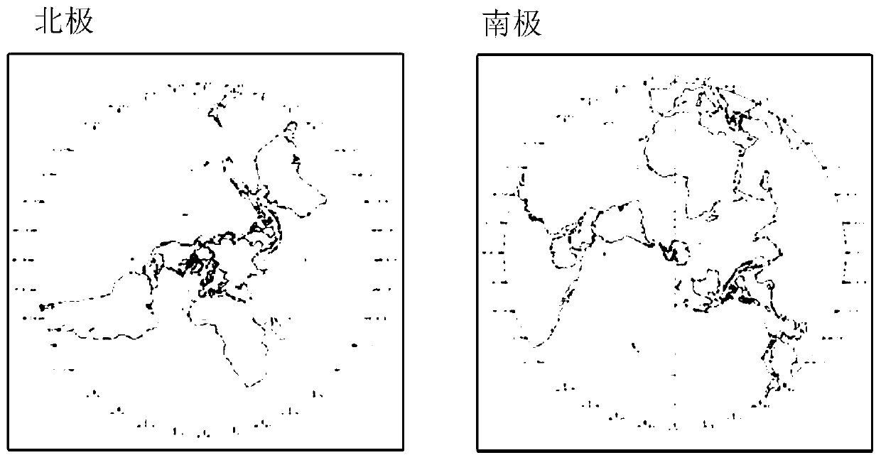
[0063] After obtaining the global map, use the Mercator (Web Mercator) projection method to project the global map, and cut out the first latitude map of the first preset latitude range from the Mercator projected global map; use the positive axis isometric The azimuth projection projects the global map, and cuts out the second latitude map of the second preset latitude range from the global map after the orthographic isometric projection.
[0064] The above-mentioned first preset latitude range is the middle and low latitude range, and the second preset latitude range is the high latitude range of the north and south regions. In the embodiment of the present invention, the first preset latitude range is (-...
Embodiment 2
[0101] see Figure 9 , the embodiment of the present invention provides a global map data call method, the method is used to call the tile data packaged and stored in the above-mentioned embodiment 1, specifically including the following steps:
[0102] Step 201: Receive a map display request from a user, and the map display request carries latitude and longitude coordinates to be displayed and a display level.
[0103] When the user browses the global map through an application related to the electronic map, the user drags the global map to make the terminal display the region he wants to view, and zooms in or out to view specific features in the region. The user submits a browsing request to the terminal through operations such as dragging, zooming in, or zooming out. When the terminal receives the browsing request, the terminal obtains the latitude and longitude coordinates of the location clicked by the user when the operation of dragging, zooming in, or zooming out is com...
Embodiment 3
[0132] see Figure 10 , an embodiment of the present invention provides a global one-map data storage organization device, the device is used to implement the global one-map data storage organization method described in Embodiment 1 above, the device includes:
[0133] The projection module 30 is used to obtain the global map, and project the global map into the global coordinate frame;
[0134] The construction module 31 is used to construct a geographic grid frame corresponding to the global map according to the global coordinate frame;
[0135] The slicing module 32 is used for slicing the global map to obtain tile data corresponding to the global map;
[0136] The package storage module 33 is configured to package and store the tile data corresponding to the global map according to the geographic grid framework.
[0137] The above-mentioned projection module 30 is used to project the global map using the Mercator projection method, and cut out the first latitude map of t...
PUM
 Abstract
Description
Claims
Application Information
 - R&D
- Intellectual Property
- Life Sciences
- Materials
- Tech Scout
- Unparalleled Data Quality
- Higher Quality Content
- 60% Fewer Hallucinations
Browse by: Latest US Patents, China's latest patents, Technical Efficacy Thesaurus, Application Domain, Technology Topic, Popular Technical Reports.
© 2025 PatSnap. All rights reserved.Legal|Privacy policy|Modern Slavery Act Transparency Statement|Sitemap|About US| Contact US: help@patsnap.com


