Eureka AIR delivers breakthrough ideas for toughest innovation challenges, trusted by R&D personnel around the world.

Remote sensing image automatic processing method based on parallel calculation and distributed storage

A technology of distributed storage and processing method, applied in the field of remote sensing image automation processing, which can solve the problems of troublesome data retrieval, low degree of automation, and limited capacity of single-point machines.

Inactive Publication Date: 2017-07-21
梅非
View PDF0 Cites 3 Cited by
  • Summary
  • Abstract
  • Description
  • Claims
  • Application Information

AI Technical Summary

Problems solved by technology

[0004] The present invention provides an automatic remote sensing image processing method based on parallel computing and distributed storage to solve the problems of low automation, low efficiency, limited capacity brought by single-point machines, data security, and troublesome data retrieval in the above-mentioned background technology

Method used


Image

  • Remote sensing image automatic processing method based on parallel calculation and distributed storage
  • Remote sensing image automatic processing method based on parallel calculation and distributed storage

Examples


Embodiment

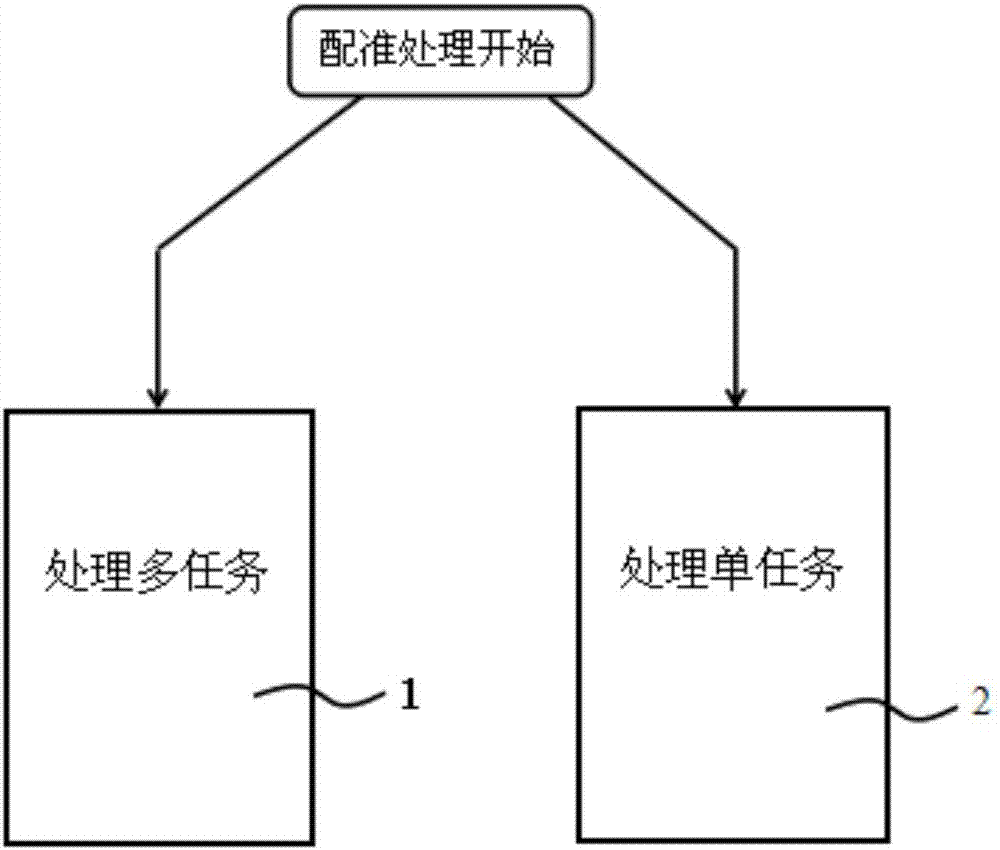
[0029] This embodiment includes: an automatic processing method for remote sensing images based on parallel computing and distributed storage, and the automatic processing method includes:

[0030] When the system detects new image data, the system automatically performs image registration processing according to a unified standard. The execution methods of tasks in the image registration processing include:

[0031] When processing multiple tasks, execute them in parallel with multiple tasks;

[0032] When processing a single task, it is executed according to the parallel processing mode in single task processing.

[0033] Since the parallel computing framework is used to realize the multi-task parallel processing of image processing and the parallel processing in single-task processing, the efficiency of automatic image processing can be improved under the premise of ensuring the processing effect.

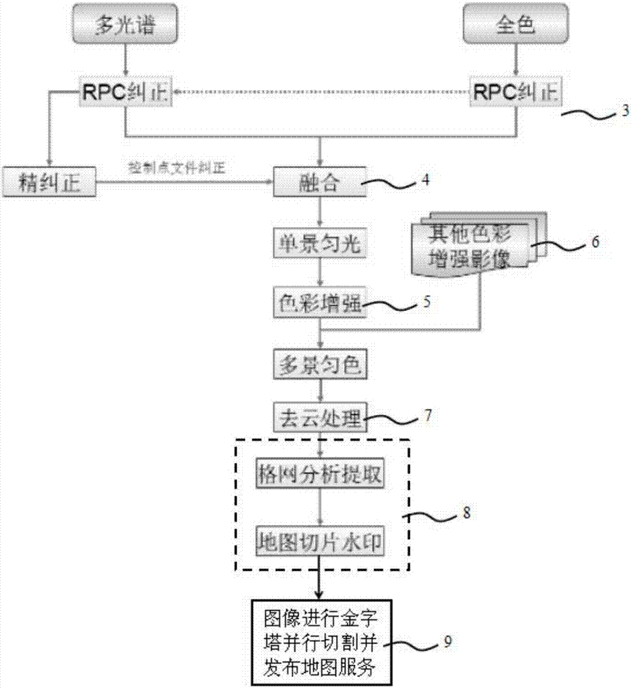
[0034] The image registration process includes:

[0035] a. RPC correctio...


PUM


Abstract

The invention belongs to the technical field of satellite image processing, and particularly relates to a remote sensing image automatic processing method based on parallel calculation and distributed storage. The method comprises a multi-task processing step and a single-task processing step. Thus, the beneficial effects of the method are that problems of low automation degree, low efficiency, limited capacity caused by single-point machines, low data safety and troublous data retrieval are solved; storage of big files is supported; small files can be highly efficiently stored; it is convenient for users to quickly and seamlessly browse images; and under the premise of ensuring processing effects, efficiency of automation processing of images is improved.

Description

technical field [0001] The invention belongs to the technical field of satellite image processing, in particular to an automatic remote sensing image processing method based on parallel computing and distributed storage. Background technique [0002] Since the United States implemented the Earth Resources Satellite Program in 1972, satellite remote sensing technology has developed rapidly around the world, new remote sensing platforms have been launched one after another, remote sensing instruments have been continuously updated, and remote sensing satellite image data are widely used in various industries, such as environmental monitoring , urban remote sensing, water and land resources monitoring, forest fires, pest monitoring and disaster assessment, etc. These applications require a large amount of image data as support. At the same time, manual processing is inseparable from traditional methods. After all, remote sensing images are only image data containing electromagn...

Claims


Application Information

Patent Timeline
IPC IPC(8): G06T1/20G06T1/60G06T1/00G06T7/30
CPCG06T1/0007G06T1/20G06T1/60G06T2207/20221G06T2207/10036G06T2207/10041G06T5/50G06T5/80G06T5/73G06T5/90
Inventor 梅非
Owner 梅非
Why Eureka
Eureka Blog
Learn More