
Method, device and system for navigating unmanned aerial vehicle

A technology of unmanned aerial vehicle and image acquisition device, applied in the field of unmanned aerial vehicle navigation, can solve the problem of low navigation stability, achieve the effect of high anti-interference and improve stability

Inactive Publication Date: 2017-06-20
GUANGDONG UNIV OF TECH
View PDF5 Cites 15 Cited by
  • Summary
  • Abstract
  • Description
  • Claims
  • Application Information

AI Technical Summary

Problems solved by technology

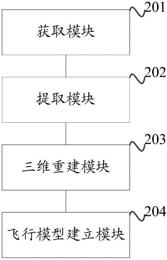
[0005] The purpose of the present invention is to provide a method, device and system for unmanned aerial vehicle navigation, the purpose is to solve the problem of low stability of navigation in the prior art that unmanned aerial vehicles use GPS navigation

Method used


Image

  • Method, device and system for navigating unmanned aerial vehicle
  • Method, device and system for navigating unmanned aerial vehicle
  • Method, device and system for navigating unmanned aerial vehicle

Examples


Embodiment Construction

[0048] In order to enable those skilled in the art to better understand the solution of the present invention, the present invention will be further described in detail below in conjunction with the accompanying drawings and specific embodiments. Apparently, the described embodiments are only some of the embodiments of the present invention, but not all of them. Based on the embodiments of the present invention, all other embodiments obtained by persons of ordinary skill in the art without making creative efforts belong to the protection scope of the present invention.

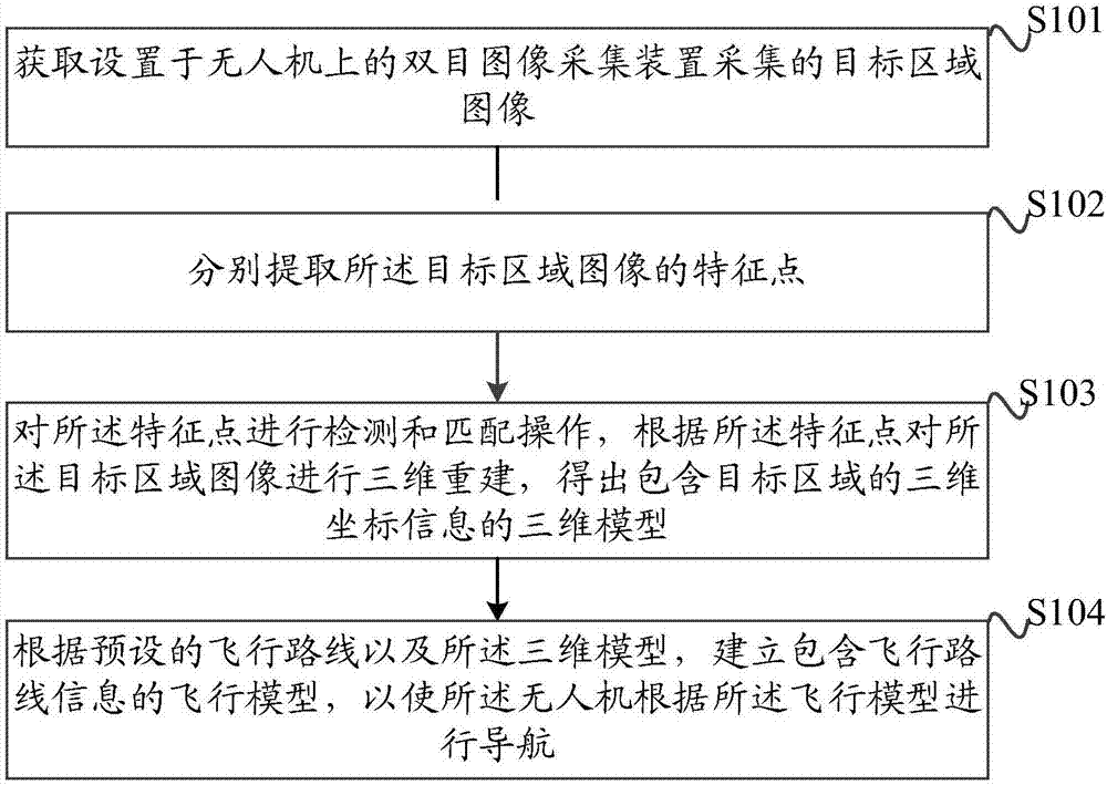
[0049] See figure 1 , figure 1 A schematic flow chart of a specific implementation of the drone navigation method provided by the embodiment of the present invention, the method includes the following steps:

[0050] Step 101: Obtain the image of the target area collected by the binocular image acquisition device arranged on the drone;

[0051] It should be noted that the aforementioned binocular image acqu...


PUM


Abstract

The invention discloses a method, a device and a system for navigating an unmanned aerial vehicle. The method comprises the following steps of obtaining a target area image collected by a binocular image collecting device which is arranged on the unmanned aerial vehicle; respectively extracting characteristic points of the target area image; detecting and matching the characteristic points, and performing three-dimensional reconstruction on the target area image according to the characteristic points, so as to obtain a three-dimensional model containing three-dimensional coordinate information of a target area; according to a preset flight route and the three-dimensional model, establishing a flight model containing the flight route information, so as to navigate the unmanned aerial vehicle according to the flight model. The method has the advantages that on the basis of the obtained target area image, the flight route of the unmanned aerial vehicle in the target area is determined by an image processing technique, the interference by instable factors is avoided, and the anti-interference property is higher; the stability in the navigation of the unmanned aerial vehicle is favorably improved.

Description

technical field [0001] The present invention relates to the technical field of unmanned aerial vehicles, in particular to a method, device and system for unmanned aerial vehicle navigation. Background technique [0002] With the development and progress of drone technology, plant protection drones have also developed rapidly. [0003] The plant protection UAV has many advantages such as small size, short flight adjustment, high flight efficiency and low operating cost. Compared with traditional manual spraying of pesticides, plant protection drones can easily spray pesticides on taller crops; and compared with manned aircraft pesticide spraying operations, plant protection drones have the characteristics of being able to adapt to small farmlands. [0004] The existing UAV navigation technology is mainly GPS navigation, that is, to use the real-time geographic location information of the UAV to conduct real-time navigation according to the geographic location information. T...

Claims


Application Information

Patent Timeline
IPC IPC(8): G01C21/20
CPCG01C21/20
Inventor 游天乐孙实超黎丹张涵汤云骏
Owner GUANGDONG UNIV OF TECH
Learn More