A correction method for echo intensity value of airborne lidar data in non-vegetated area
A technology of echo intensity and correction method, which is applied in the field of remote sensing mapping and can solve the problems of limited echo intensity value, difficulty in obtaining accurate atmospheric parameters, and difficulty in applying radar equations.
- Summary
- Abstract
- Description
- Claims
- Application Information
AI Technical Summary
Problems solved by technology
Method used
Image
Examples
Embodiment Construction
[0101] A method for correcting echo intensity values of airborne LiDAR data in non-vegetated coverage areas of the present invention will be described in detail below in conjunction with the accompanying drawings and embodiments.
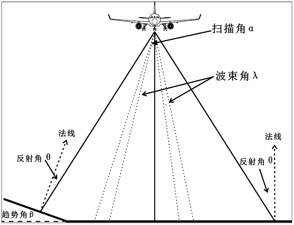
[0102] The scanning operation process of airborne lidar is as follows: figure 1 shown. The airborne LiDAR operates in a sweeping mode. When the ground objects scanned by the laser spot are horizontal, such as figure 1 As shown on the right, the reflection angle θ is equal to the scanning angle α; but the local object has a certain trend angle β in the scanning direction, such as figure 1 On the left, the reflection angle θ is equal to the scan angle α minus the trend angle β. As mentioned in the background technology, the traditional normalization correction method all assumes that the ground is a Lambertian body, and the laser reflection angle is equal to the incident angle (ie, the scanning angle), ignoring the influence of the inclination ang...
PUM
 Abstract
Description
Claims
Application Information
 - R&D
- Intellectual Property
- Life Sciences
- Materials
- Tech Scout
- Unparalleled Data Quality
- Higher Quality Content
- 60% Fewer Hallucinations
Browse by: Latest US Patents, China's latest patents, Technical Efficacy Thesaurus, Application Domain, Technology Topic, Popular Technical Reports.
© 2025 PatSnap. All rights reserved.Legal|Privacy policy|Modern Slavery Act Transparency Statement|Sitemap|About US| Contact US: help@patsnap.com


