Automated identification and extraction method of vertical stratum
A rock formation, straight technology, applied in the application field of geographic information technology, can solve problems such as low efficiency, accuracy varies from person to person, and quality is difficult to guarantee
- Summary
- Abstract
- Description
- Claims
- Application Information
AI Technical Summary
Problems solved by technology
Method used
Image


Examples
Embodiment Construction
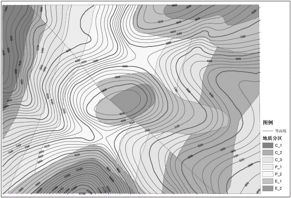
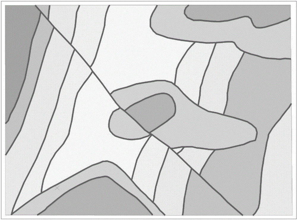
[0050] The effects of the present invention will be further described below in conjunction with the accompanying drawings and by describing an example of automatically identifying and marking vertical rock formations. This embodiment selects the topographic and geological map of a certain place as example data (mainly including contour layers and geological division layers), such as figure 2 shown.
[0051] (1) Rock boundary reading and preprocessing
[0052] Step 1.1 Load the geological decent layer data "geological division" in shp format, read the rock layer elements into the set Stratums={sta i |i=1, 2, 3, . . . , 25}, this embodiment contains a total of 25 rock layer elements.
[0053] The basic parameters of the topographic and geological map layer loaded in step 1.2 are: width 2316.33m, height 1705.86m, boundary point set BoundaryP={(461.44,-1999.47),(507.27,-1999.54),(716.37,-1999.88), (1,646.99,-2001.37),(1749.90,-2001.53),(1,891.30,-2001.76),(2378.58,-2,002.53),(...
PUM
 Abstract
Description
Claims
Application Information
 - R&D
- Intellectual Property
- Life Sciences
- Materials
- Tech Scout
- Unparalleled Data Quality
- Higher Quality Content
- 60% Fewer Hallucinations
Browse by: Latest US Patents, China's latest patents, Technical Efficacy Thesaurus, Application Domain, Technology Topic, Popular Technical Reports.
© 2025 PatSnap. All rights reserved.Legal|Privacy policy|Modern Slavery Act Transparency Statement|Sitemap|About US| Contact US: help@patsnap.com