
Traffic management system based on internet of things or dynamic three dimensional (3D) geographic information system (GIS) and method thereof

A technology of traffic management and Internet of Things, which is applied in the field of traffic management system based on Internet of Things and dynamic 3D GIS, can solve the problem of inability to collect 3D information for 3D management, driving vehicles cannot realize early warning and emergency avoidance, and it is difficult to realize effective traffic management and other issues, to achieve the effect of intelligent management

Inactive Publication Date: 2013-04-24
CHINA MERCHANTS CHONGQING COMM RES & DESIGN INST
View PDF6 Cites 45 Cited by
  • Summary
  • Abstract
  • Description
  • Claims
  • Application Information

AI Technical Summary

Problems solved by technology

[0004] 1. It is impossible to collect the overall three-dimensional information of the road conditions to realize the three-dimensional management of the road conditions, especially in the case of more and more overpasses in modern cities, especially multi-layer overpass ramps, viaducts, streets with high-rise buildings, deep mountain ditch roads, and tunnels , underground garages, etc., without GPS or poor signal, if it cannot provide three-dimensional road condition information, it will be difficult to achieve effective traffic management
[0005] 2. The above-mentioned road surface management system cannot realize early warning and emergency avoidance for driving vehicles with potential accident risks, and cannot effectively reduce the probability of vehicle accidents

Method used

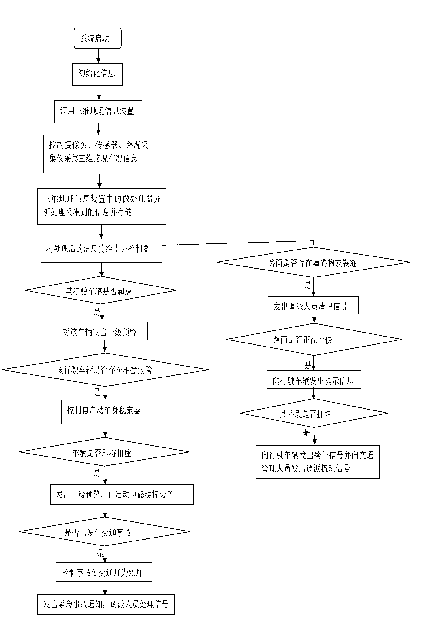

Image

  • Traffic management system based on internet of things or dynamic three dimensional (3D) geographic information system (GIS) and method thereof
  • Traffic management system based on internet of things or dynamic three dimensional (3D) geographic information system (GIS) and method thereof
  • Traffic management system based on internet of things or dynamic three dimensional (3D) geographic information system (GIS) and method thereof

Examples


Embodiment Construction

[0025] Below in conjunction with accompanying drawing and specific embodiment the present invention will be described in further detail:

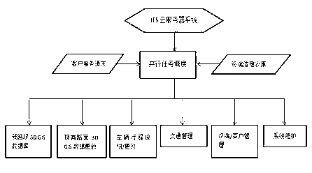
[0026] Such as figure 1 As shown, an embodiment of the present invention, a traffic management system based on the Internet of Things and dynamic 3D GIS, includes a system server, a road monitoring device and a vehicle-mounted device, and the road monitoring device and the vehicle-mounted device are respectively connected to the system server by communication, and the road monitoring The device and the vehicle-mounted device communicate with each other, and the communication can be a wired network or a wireless network. In this embodiment, wireless network communication is selected, and the vehicle-mounted device uses wireless network communication.

[0027] The system server described in this embodiment is an ITS (intelligent transportation) cloud server system, including a central controller, a communication port electrically connected to...


PUM


Abstract

The invention relates to a traffic management system based on an internet of things or a dynamic three dimensional (3D) geographic information system (GIS). The traffic management system comprises a road monitoring device and a system server. The road monitoring device comprises a monitor, an output end and a communication device. The monitor and the output end are respectively and electrically connected with the communication device. The system server comprises a central controller, a storage device, a displaying manipulator and a main communication device. The system server further comprises a dynamic three dimensional geographic information device. The dynamic three dimensional geographic information device, the storage device, the displaying manipulator and the main communication device are respectively and electrically connected with the processor. The road monitoring device is in communication connection with the system server through a wired network or a wireless network. According to the traffic management system, the purposes of monitoring traffic road conditions and vehicle conditions and three dimensional managements in real time can be achieved. The invention further relates to an implement method of the traffic management system based on the internet of things and the dynamic 3D GIS.

Description

technical field [0001] The invention relates to a management system, in particular to a traffic management system and method based on the Internet of Things and dynamic 3D GIS. Background technique [0002] The development of information technology has made the Internet of Things technology more and more widely used. The Internet of Things uses information sensing equipment such as radio frequency identification, infrared sensing, positioning systems, and laser scanning to connect items or equipment to the Internet according to agreed agreements. Connected for information communication to realize intelligent identification, tracking, positioning, monitoring and management of the network system. Three-dimensional geographic information system is a specific spatial information system, which collects, stores, manages, calculates, analyzes, displays and describes the relevant geographical distribution data in the whole or part of the space with the support of computer hardw...

Claims


Application Information

Patent Timeline
Patent Type & Authority Applications(China)
IPC IPC(8): G08G1/00G08G1/01G08G1/0962H04L29/08
Inventor 方波平李吉雄韩直喻洪李关寿张益
Owner CHINA MERCHANTS CHONGQING COMM RES & DESIGN INST
Learn More