
Mass raster tile map release method

A vector map and raster technology, which is applied in the field of massive raster tile map publishing, can solve the problems of increasing disk space occupation, long time consumption, and low search efficiency, so as to reduce the number of visits and occupation The effect of improving the quantity and improving access efficiency

Active Publication Date: 2015-04-29
CHONGQING SURVEY INST +1
View PDF3 Cites 0 Cited by
  • Summary
  • Abstract
  • Description
  • Claims
  • Application Information

AI Technical Summary

Problems solved by technology

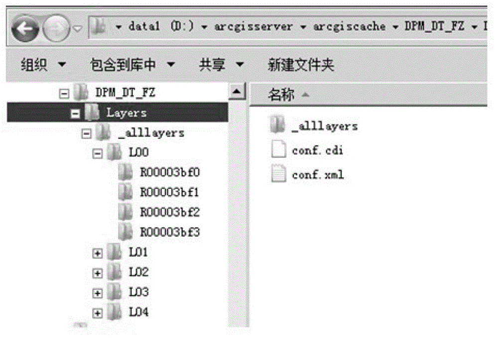
[0004] Currently, grid tile land Figure 1 Generally, it is released through IIS software. The IIS software publishing method has the following disadvantages: the vector map is cut into a large number of small raster pictures, which increases the disk space occupation. In addition, when the small raster pictures are stored in the root of the map directory, For a large number of identical pictures (such as blank pictures), they are stored repeatedly in rows and columns, which further increases the disk space occupation;
[0005] Copy the small raster image to the Web publishing server and publish it. Due to the large number of small raster images, it takes a long time to copy the data;
[0006] When searching for the location of the corresponding small raster image according to the URL path, the IIS software can only rely on the file system, and almost every access needs to perform disk IO, and the search efficiency is low

Method used


Image

  • Mass raster tile map release method
  • Mass raster tile map release method
  • Mass raster tile map release method

Examples


Embodiment Construction

[0055] Embodiments of the present invention are described in detail below, examples of which are shown in the drawings, wherein the same or similar reference numerals designate the same or similar elements or elements having the same or similar functions throughout. The embodiments described below by referring to the figures are exemplary only for explaining the present invention and should not be construed as limiting the present invention.

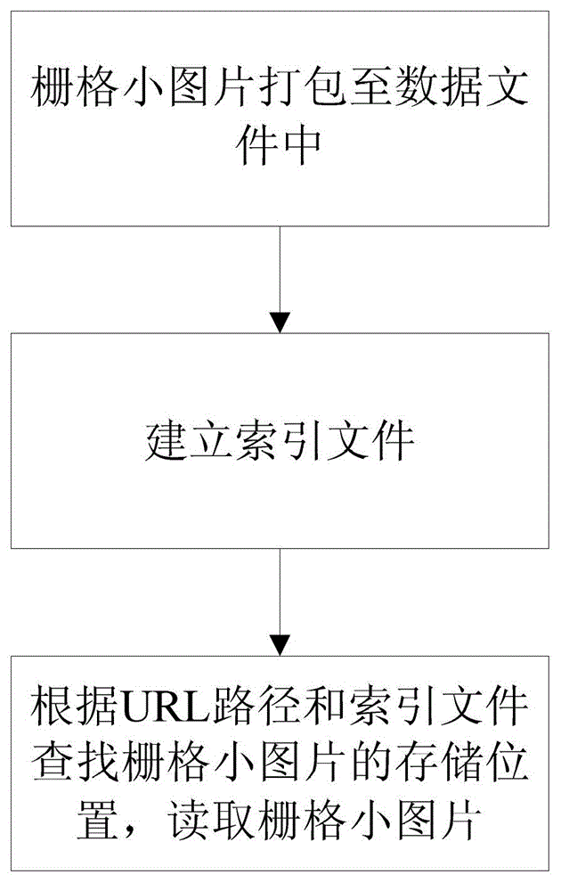
[0056] The massive raster tile map publishing method consists of the following steps, such as image 3 Shown:

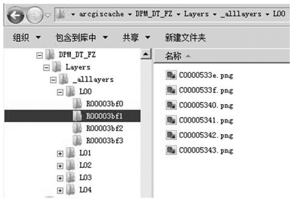
[0057] S1. Cutting the vector map into multiple small grid pictures and storing them in the map directory Root, traversing the small grid pictures in the map directory Root and packing them into data files.

[0058] The invention packs a large number of small grid pictures into data files, thereby reducing the occupation of disk space.

[0059] Take ESRI's ArcMap Server's sliced ​​image as an example to illustrate the map dir...


PUM


Abstract

The invention provides a mass raster tile graphic release method and belongs to the map release field. The method includes the following steps: S1, cutting a vector map into a plurality of small raster pictures and storing in a map directory Root, traversing the small raster pictures in the map directory Root and packaging into a data file to reduce the occupancy of a disk space; S2, constructing an index file which is used for expressing an index relationship between uniform resource locator (URL) paths and storing positions of corresponding small raster pictures in the data file; the index file performing compression storage through a method that the paths and file names are encoded respectively, so that loading to a memory once is achieved, a disk is not needed to access when the index file is used for searching the small raster pictures, and the searching efficiency is further improved; and S3, according to a URL path and an index file required by a client, searching the storing position of the small raster picture corresponding to the URL path in the data file, reading and sending the small raster picture to the client.

Description

technical field [0001] The invention relates to a method for issuing a map, in particular to a method for issuing a massive grid tile map. Background technique [0002] Web GIS is a geographic information system that Internet technology is applied to GIS development. Most of the static background maps used are pre-generated grid tile maps, and then published through HTTP (HyperText Transfer Protocol, Hypertext Transfer Protocol). This method reduces the calculation pressure of dynamically generating map pictures on the server side, and is one of the most widely used Web GIS technologies at present. [0003] grid tile land Figure 1 The general release method is: use tools to cut the vector map into small grid pictures of uniform size and store them in the map directory Root; then copy these small grid pictures to the web server and publish them; the client program according to Calculate the URL (Universal Resource Locator, Uniform Resource Locator) path of the small raster...

Claims


Application Information

Patent Timeline
Patent Type & Authority Patents(China)
IPC IPC(8): G06F17/30
Inventor 向泽君朱圣罗再谦龙川饶鸣汪明杨元李波罗勇
Owner CHONGQING SURVEY INST
Learn More