
Method and arrangement for carrying out an information flow and data flow for geodetic instruments

Active Publication Date: 2008-03-04
TRIMBLE JENA
View PDF22 Cites 44 Cited by
  • Summary
  • Abstract
  • Description
  • Claims
  • Application Information

AI Technical Summary

Benefits of technology

The invention is about a method and arrangement for carrying out an information flow and data flow in a geodetic instrument, particularly for video surveying instruments. The goal is to enable remote control with the same function features as the instrument. The invention includes a plurality of function groups, each with different functions, and the function modules can be implemented as hardware or software. The invention also includes a display control module for displaying the image data and a data input device for controlling the instrument. The technical effects of the invention include improved data processing and distribution, as well as better image display and control capabilities for geodetic instruments.

Problems solved by technology

It is disadvantageous that a plurality of devices must be set up, arranged relative to one another and connected via cables so that the entire device can operate or to arrange the information flow and data flow in such a way that remote control is possible with the same function features.

Method used


Image

  • Method and arrangement for carrying out an information flow and data flow for geodetic instruments
  • Method and arrangement for carrying out an information flow and data flow for geodetic instruments
  • Method and arrangement for carrying out an information flow and data flow for geodetic instruments

Examples


Embodiment Construction

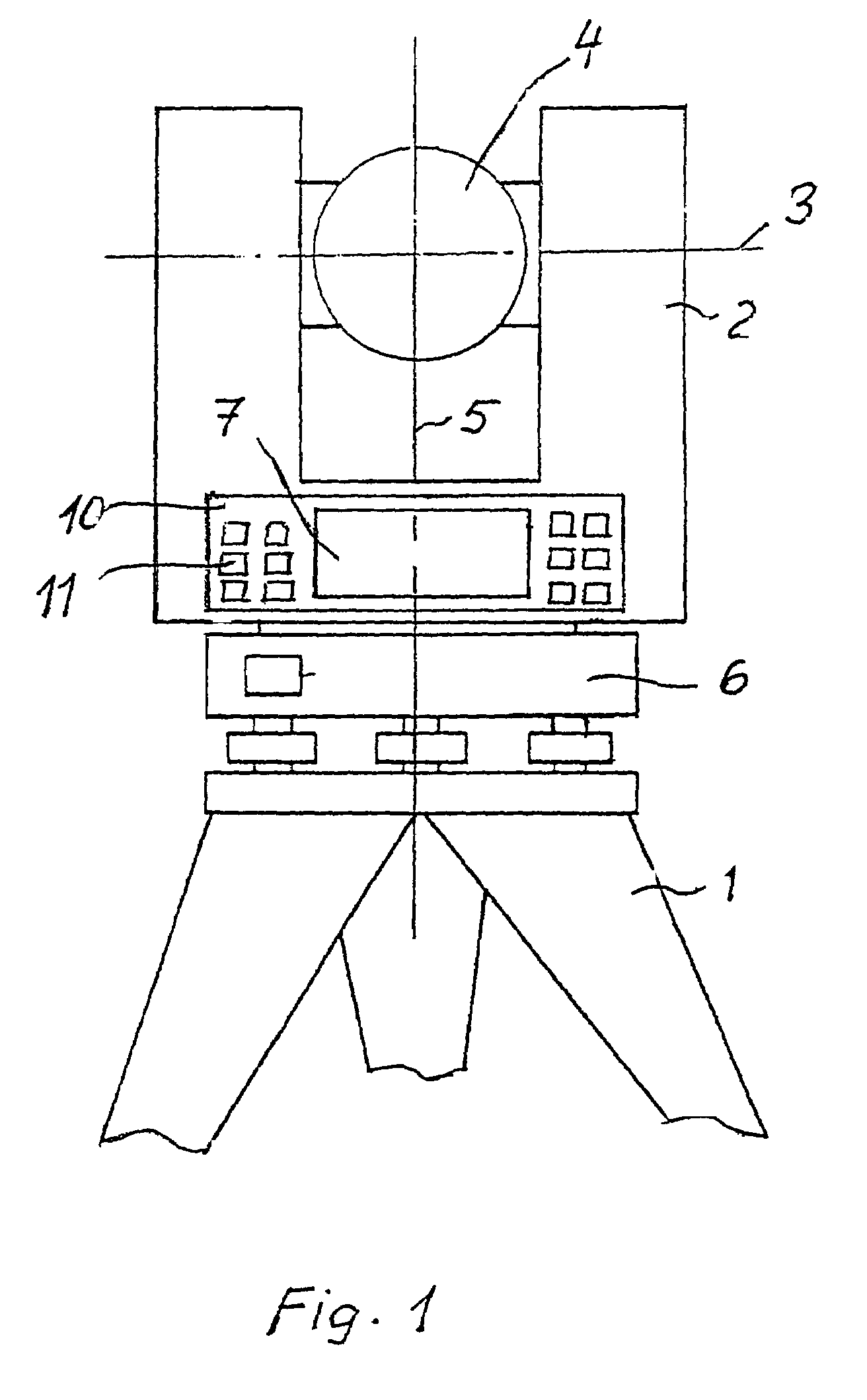
[0022]FIG. 1 shows a geodetic instrument, e.g., a video theodolite or video tachymeter, on a tripod 1 comprising a telescope body 4 which is mounted in the support 2 so as to be swivelable about a horizontal tilting axis 3. The entire geodetic instrument is mounted on a base body 6 so as to be rotatable about a vertical standing axis 5. A display unit 7 is advantageously provided in the lower part of the instrument.

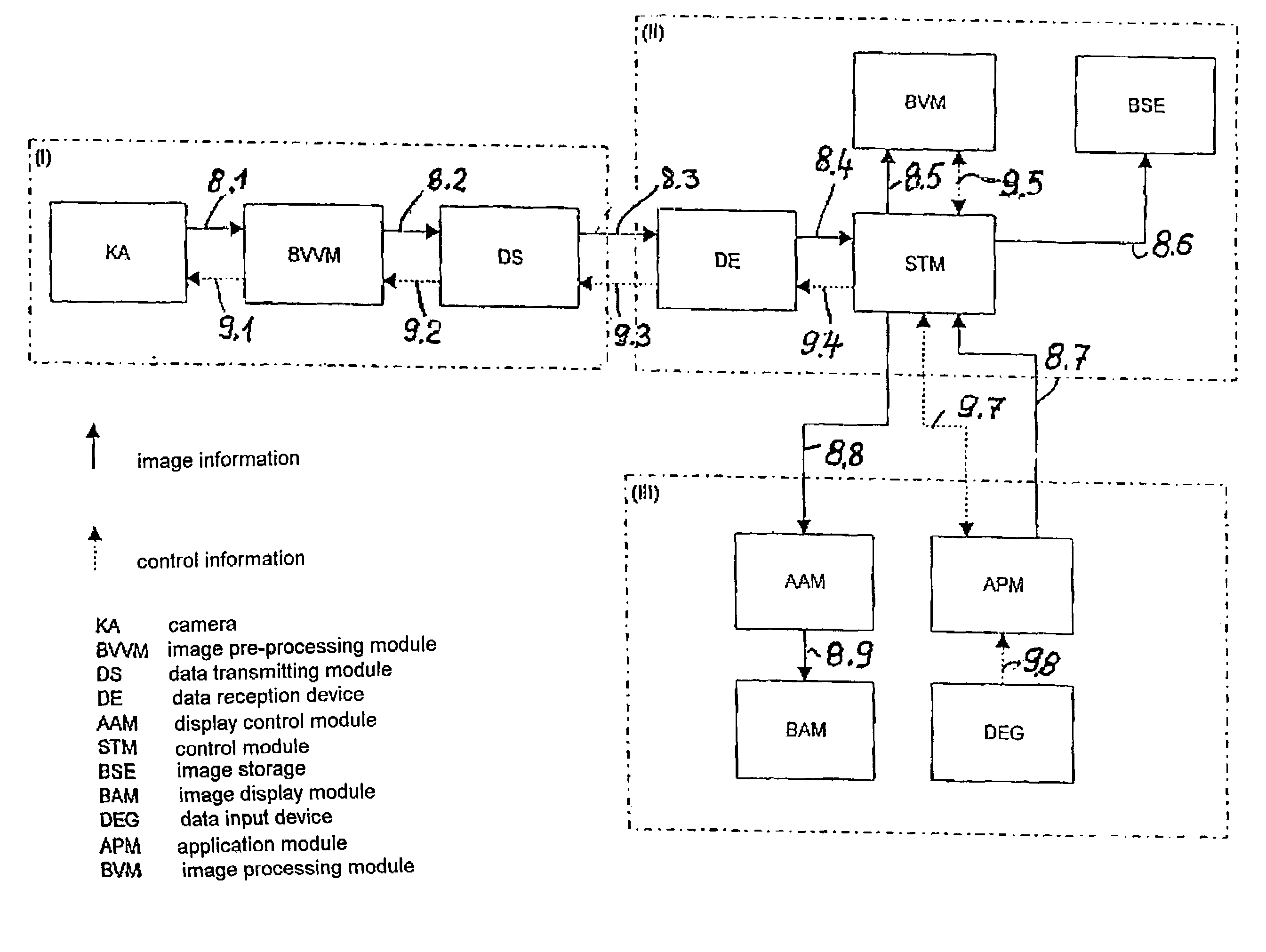
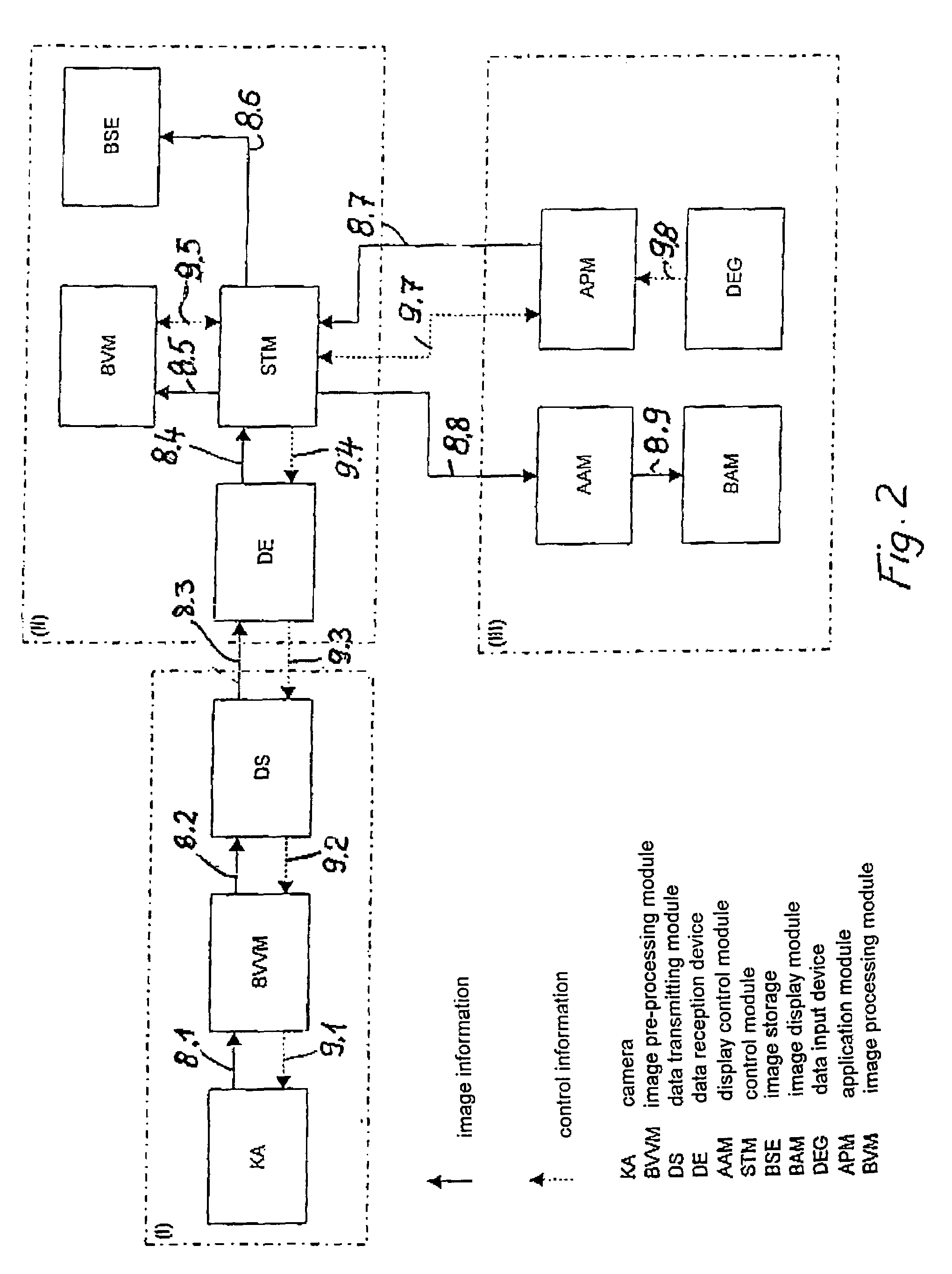
[0023]FIG. 2 shows a function group (I) comprising the camera module or camera KA, image pre-processing module BVVM and data transmitting device DS as function modules. These function modules are connected with one another via data lines 8 (shown as a solid line in FIGS. 2 and 3) and control lines 9 (shown as dashed lines in FIGS. 2 and 3) which can also be arranged in the form of a bidirectional bus. The data lines 8 transmit the image information and the control lines 9 transmit commands to the function modules. For purposes of a compact construction, these function mod...


PUM


Abstract

A method and an arrangement for carrying out an information flow and data flow in a geodetic instrument with image processing is disclosed. For this purpose, the data flow and information flow needed for image processing are distributed to a plurality of function modules which are arranged in the instrument and which comprise function groups and are carried out by means of these function groups. The arrangement includes a plurality of function groups which are arranged in the instrument at locations determined by its construction design. These function groups are composed of a plurality of function modules.

Description

BACKGROUND OF THE INVENTION[0001]a) Field of the Invention[0002]The invention is directed to a method and an arrangement for carrying out a flow of information and data for geodetic instruments, particularly for video surveying instruments such as digital video tachymeters.[0003]b) Description of the Related Art[0004]It is known to outfit a theodolite or a tachymeter with an image sensor. DE 31 24 945 describes a recording theodolite with a video camera and image recording. For this purpose, the video camera is mounted on the theodolite and is operated together with the associated electronics, including the monitor and video recorder.[0005]DE 195 28 465 describes a method and an arrangement for signal evaluation which is, however, specialized only for detecting the position of a target mark by centroid formation of its electric signals. An image display is not provided.[0006]The subject matter of DE-GM 90 07 731 relates to an angle measuring and distance measuring instrument with tw...

Claims


Application Information

Patent Timeline
Patent Type & Authority Patents(United States)
IPC IPC(8): H04N5/225G01C15/00
CPCG01C15/00
Inventor MAROLD, THOMASSEEBER, MARCELTAEGE, EYKUSBECK, CHRISTIAN
Owner TRIMBLE JENA
Learn More