
Hybrid translator in a global positioning system (GPS)

a global positioning system and translator technology, applied in satellite radio beaconing, measurement devices, instruments, etc., can solve problems such as loss of development time, difficulty in tracking with precision, and safety officers may decide to destroy test planes

Inactive Publication Date: 2007-02-27
L 3 COMM CORP
View PDF9 Cites 32 Cited by
  • Summary
  • Abstract
  • Description
  • Claims
  • Application Information

AI Technical Summary

Benefits of technology

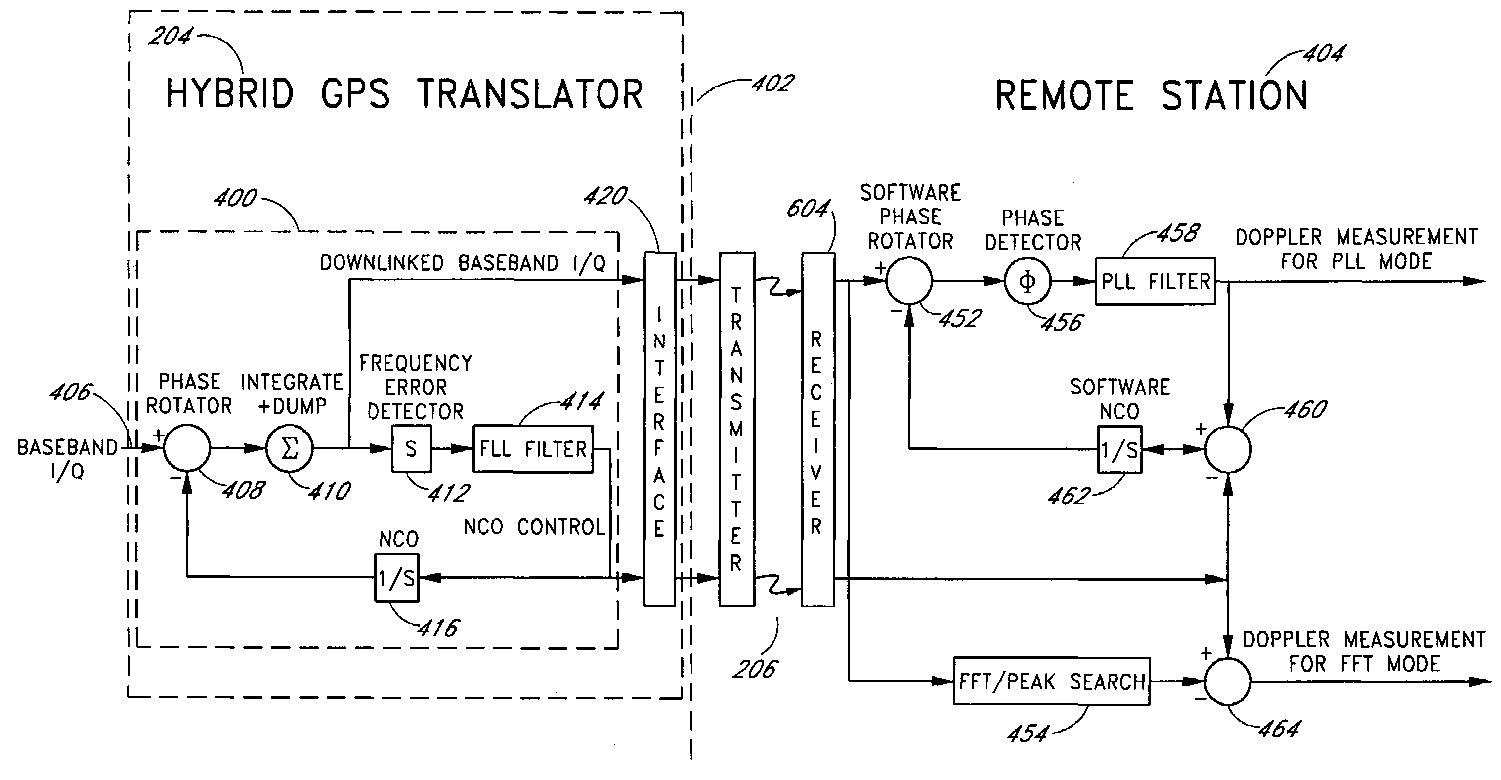
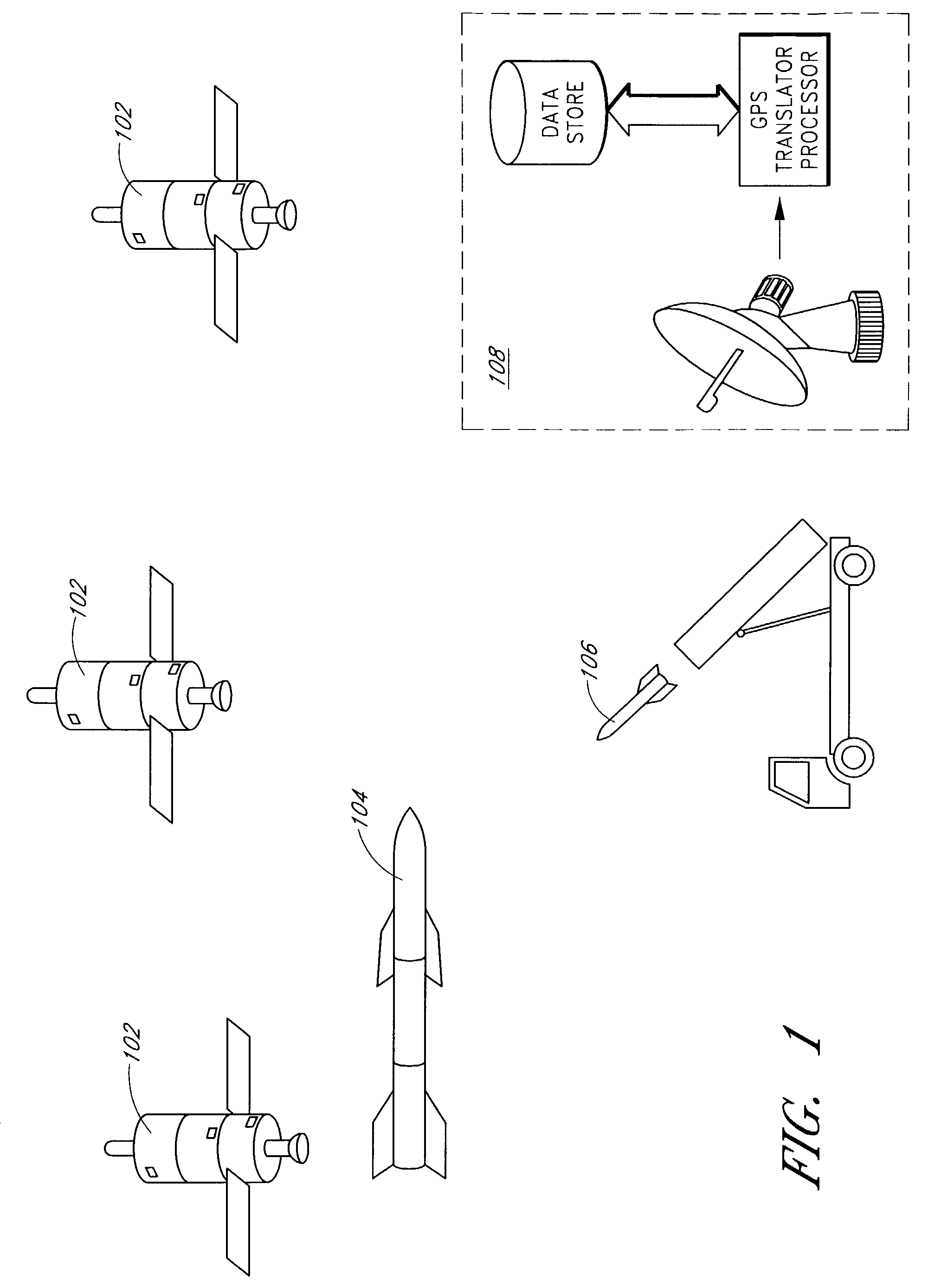
[0013]Embodiments of the invention advantageously overcome the disadvantages of the prior art. Embodiments of the invention provide for hybrid GPS translation that can advantageously provide position tracking in high dynamic environments without the need for large and expensive inertial measurement units (IMUs) and without the consumption of large amounts of data bandwidths. Such tracking devices can advantageously be used for a variety of purposes, such as the testing of missile defense systems. The GPS tracking devices provide tracking data that can be used for a variety of purposes, such as range safety, test scoring, locating air vehicles after flight, and the like.
[0026]One embodiment includes a method of processing a GPS translator message in non-real time such that a trajectory of corresponding vehicle can be precisely calculated, where the method further includes: retrieving downlinked baseband I / Q signals and NCO control word signals from a data store; estimating a trajectory from a combination of phase locked loop (PLL) Doppler measurements and Fourier Transform Doppler measurements; estimating a vehicle motion vector based on the estimated trajectory; projecting the vehicle motion vector onto at least one of the received satellite ray paths; estimating an effect of a change in vehicle trajectory on a PLL measurement computation; and steering the PLL measurement computation in response to the estimated effect such that more of the trajectory can be estimated from the PLL Doppler measurement and less from the Fourier Transform Doppler measurement.

Problems solved by technology

Some vehicles present high-dynamic environments to the GPS receiver and are difficult to track with precision.
Should the tracking provided by the GPS receiver indicate that the test plane is out of control or is lost, a range safety officer may decide to destroy the test plane due to safety concerns.
An inaccurate or unreliable GPS receiver may also evoke a similar response from the range safety officer, which can undesirably result in the needless waste of expensive prototypes and loss of development time.
Standard, off-the-shelf GPS receivers do not perform well in high-dynamic environments.
Due to the relatively great distance between a GPS receiver and a GPS satellite, the received GPS signal strength is low, and a carrier phase locked loop (PLL) in a GPS receiver typically has relatively narrow bandwidth.
Relatively high dynamics induce tracking errors in these narrow-band carrier phase locked loops.
When these loop tracking errors are large enough, carrier cycles may be missed, which can lead to errors in position tracking.
Under extreme conditions, the tracking errors can result in a complete loss of lock.
These tracking errors render it impractical to use a standard unaided GPS receiver in an environment with more than about 12 g's of acceleration.
Disadvantageously, such IMUs are large, expensive, and heavy.
Disadvantageously, conventional translation techniques occupy relatively large amounts of bandwidth, thereby rendering conventional translation techniques impractical.

Method used


Image

  • Hybrid translator in a global positioning system (GPS)
  • Hybrid translator in a global positioning system (GPS)
  • Hybrid translator in a global positioning system (GPS)

Examples


Embodiment Construction

[0036]Although this invention will be described in terms of certain preferred embodiments, other embodiments that are apparent to those of ordinary skill in the art, including embodiments that do not provide all of the benefits and features set forth herein, are also within the scope of this invention. Accordingly, the scope of the invention is defined only by reference to the appended claims.

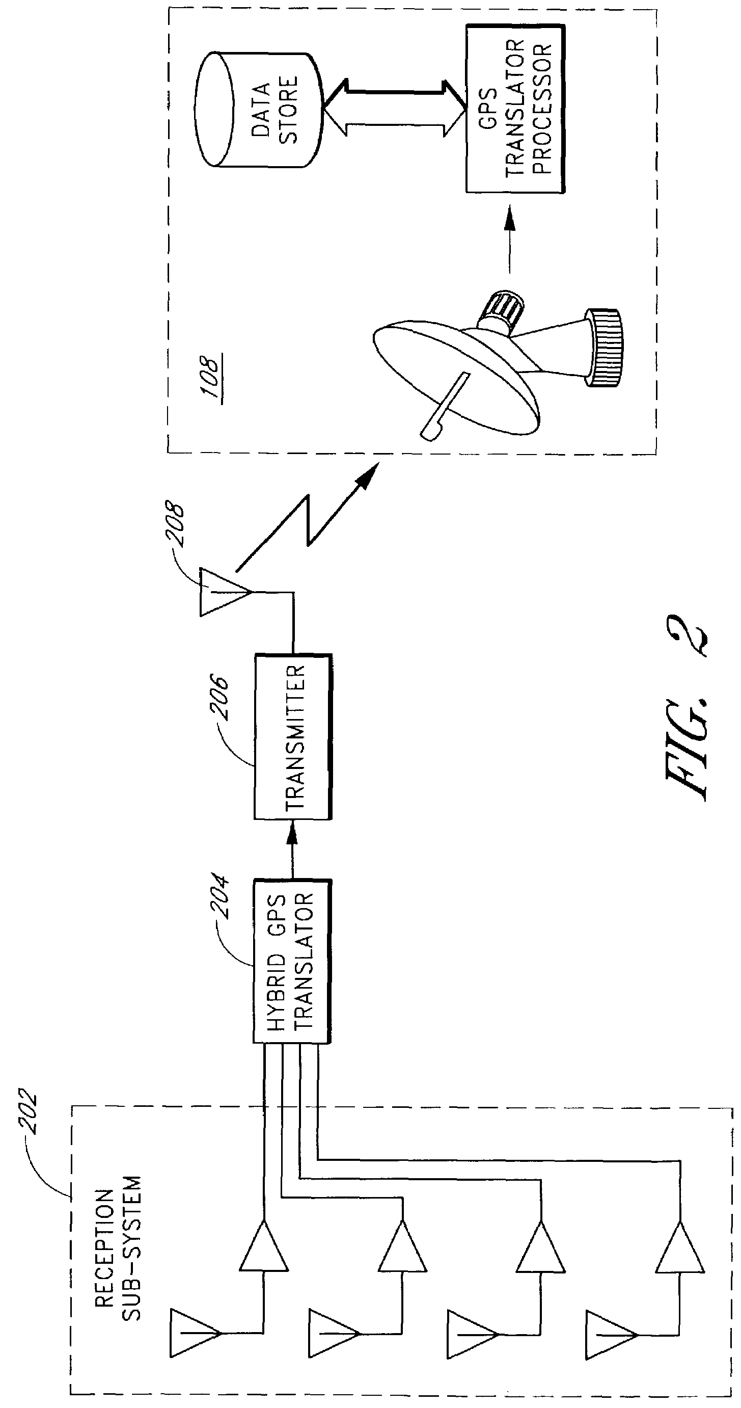
[0037]Embodiments provide tracking of high-dynamic targets without a large and expensive inertial measurement unit (IMU) and providing GPS signals to a remote signal processing station in a relatively small and efficient bandwidth. One embodiment of the invention includes a hybrid translator that is a hybrid between a full GPS navigation system and a conventional translator system. The modulated GPS signals, such as modulated C / A codes, are pre-processed to compress the amount of information needed to at least partially reconstruct the GPS carrier Doppler received by the hybrid translator.

[0038...


PUM


Abstract

A system for tracking high-dynamic targets by relaying semi-processed GPS signals to a remote signal processing station with a relatively small and efficient bandwidth is described. Such processed GPS signals can be provided in a high-dynamic environment without the assistance of an inertial measurement unit (IMU). One embodiment includes a hybrid translator that is a hybrid between a full GPS navigation system and a translator system. The modulated GPS signals, such as modulated C / A codes, are pre-processed to reduce the amount of information required to reconstruct the GPS signal received by the hybrid translator. For example, the GPS signals can be processed to a pseudo-range measurement and an indication of an amount of corruption of delta range in the pseudo-range measurement, which are then provided to signal processing at a remote location, such as at a ground station, via a wireless downlink.

Description

RELATED APPLICATION[0001]This application claims the benefit under 35 U.S.C. § 119(e) of U.S. Provisional Application No. 60 / 325,361, filed Sep. 26, 2001, the entirety of which is hereby incorporated by reference.BACKGROUND OF THE INVENTION[0002]1. Field of the Invention[0003]The invention is generally related to Global Positioning System (GPS) receivers, and in particular, to partial processing of a GPS signal for relaying to a remote processing station.[0004]2. Description of the Related Art[0005]The Global Positioning System (GPS) Operational Constellation nominally comprises 24 earth orbiting satellites. Each satellite radiates a spread spectrum, pseudorandom noise (PN) signal indicating the satellite's position and time. A GPS receiver tuned to receive the signals from the satellites can compute the distance to the satellites and calculate the receiver's position, velocity, and time. The receiver calculates the distance to a satellite by multiplying the propagation rate of the ...

Claims


Application Information

Patent Timeline
Patent Type & Authority Patents(United States)
IPC IPC(8): G01S5/14G01S19/09G01S19/39
CPCG01S5/0036G01S19/39G01S19/09G01S19/393
Inventor LLOYD, RICK R.WELLS, LAWRENCE L.REDHEAD, RICHARD
Owner L 3 COMM CORP
Learn More