
Method of determining and monitoring a distance travelled by a marine vessel connected to anchor

a technology of a marine vessel and a distance, applied in the direction of waterborne vessels, vessel parts, instruments, etc., can solve the problems of inadequate anchor design, poor ground holding, inadequate rode design,

Inactive Publication Date: 2009-05-07
MICHIE BRIAN EDWARD +1
View PDF3 Cites 15 Cited by
  • Summary
  • Abstract
  • Description
  • Claims
  • Application Information

AI Technical Summary

Benefits of technology

[0009]It is an object of the present invention to provide an improved method of determining and monitoring when a marine vessel has drifted from its intended position.

Problems solved by technology

This can be a result of a number of factors including: changed tide and wind conditions; poor ground holding; inadequate anchor design; inadequate rode design; anchor or rode failure; and poor seamanship.
The consequences of a moored vessel inadvertently moving from its intended position can be catastrophic, with a potential for loss of the vessel and loss of life.
However, the above described anchor monitoring systems are limited in application.
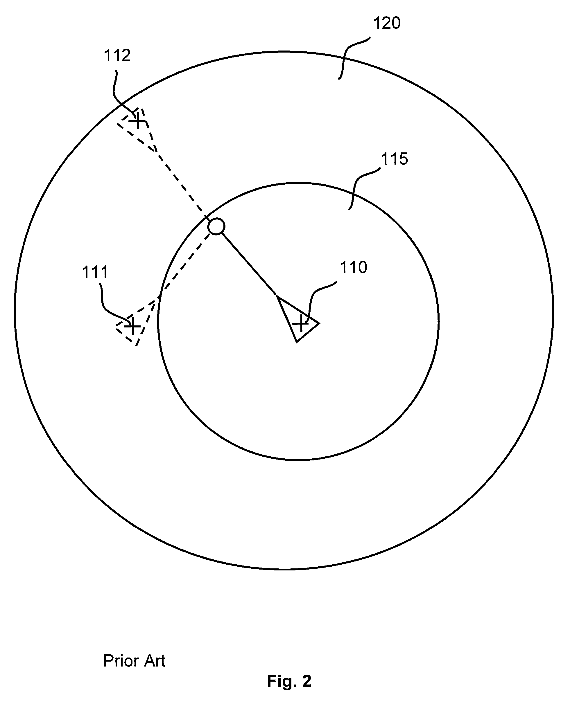
In tight locations, the circular safe zone has to be decreased, which in turn results in frequent false alarms as the vessel swings around its anchor due to wind and tide changes.

Method used


Image

  • Method of determining and monitoring a distance travelled by a marine vessel connected to anchor
  • Method of determining and monitoring a distance travelled by a marine vessel connected to anchor
  • Method of determining and monitoring a distance travelled by a marine vessel connected to anchor

Examples


Embodiment Construction

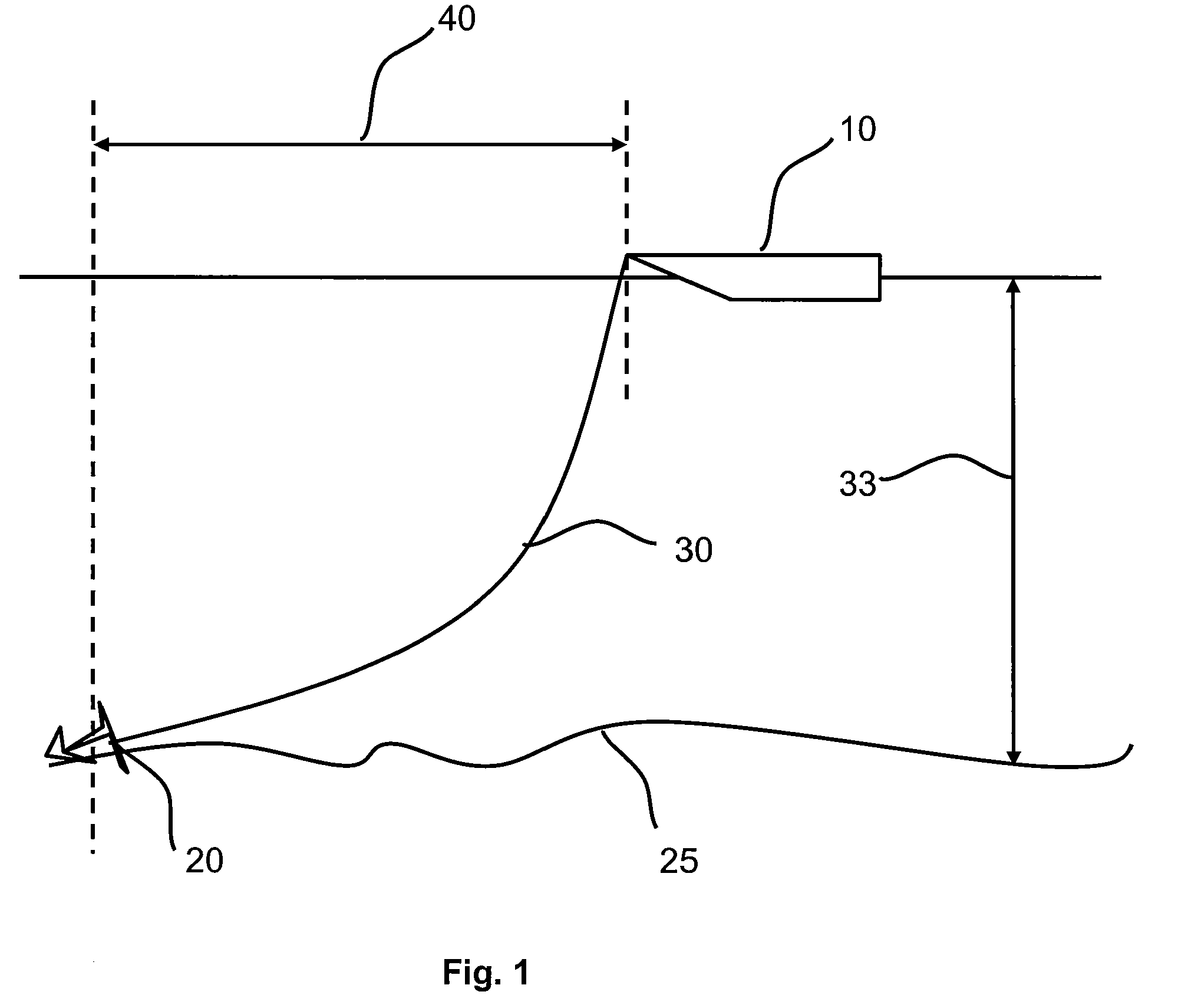
[0030]FIG. 1 illustrates a marine vessel 10 connected to an anchor 20 by rode 30. The anchor 20 is set in the seabed 25. Due to wind and tide forces on the marine vessel 10, the vessel 10 is positioned at a horizontal distance 40 from the anchor 20. The water in which the vessel is anchored has a depth 33.

[0031]FIG. 2 illustrates a top view of the vessel 10 connected to the anchor 20 by the rode 30. In an existing anchor monitoring systems, a safe zone is set around an initial position 110 of the vessel. A desirable safe zone is relatively small, such as safe zone 115. However, when the vessel 10 swings to position 111 for example, existing anchor monitoring systems would sound an alarm as the vessel 10 is outside the defined safe zone. In order to avoid false alarms caused by the vessel 10 swinging around its anchor 20 due to wind and tide forces, a relatively large safe zone 120 has to be set in order to include position 112.

[0032]The inventors have realized that a major shortcomi...


PUM


Abstract

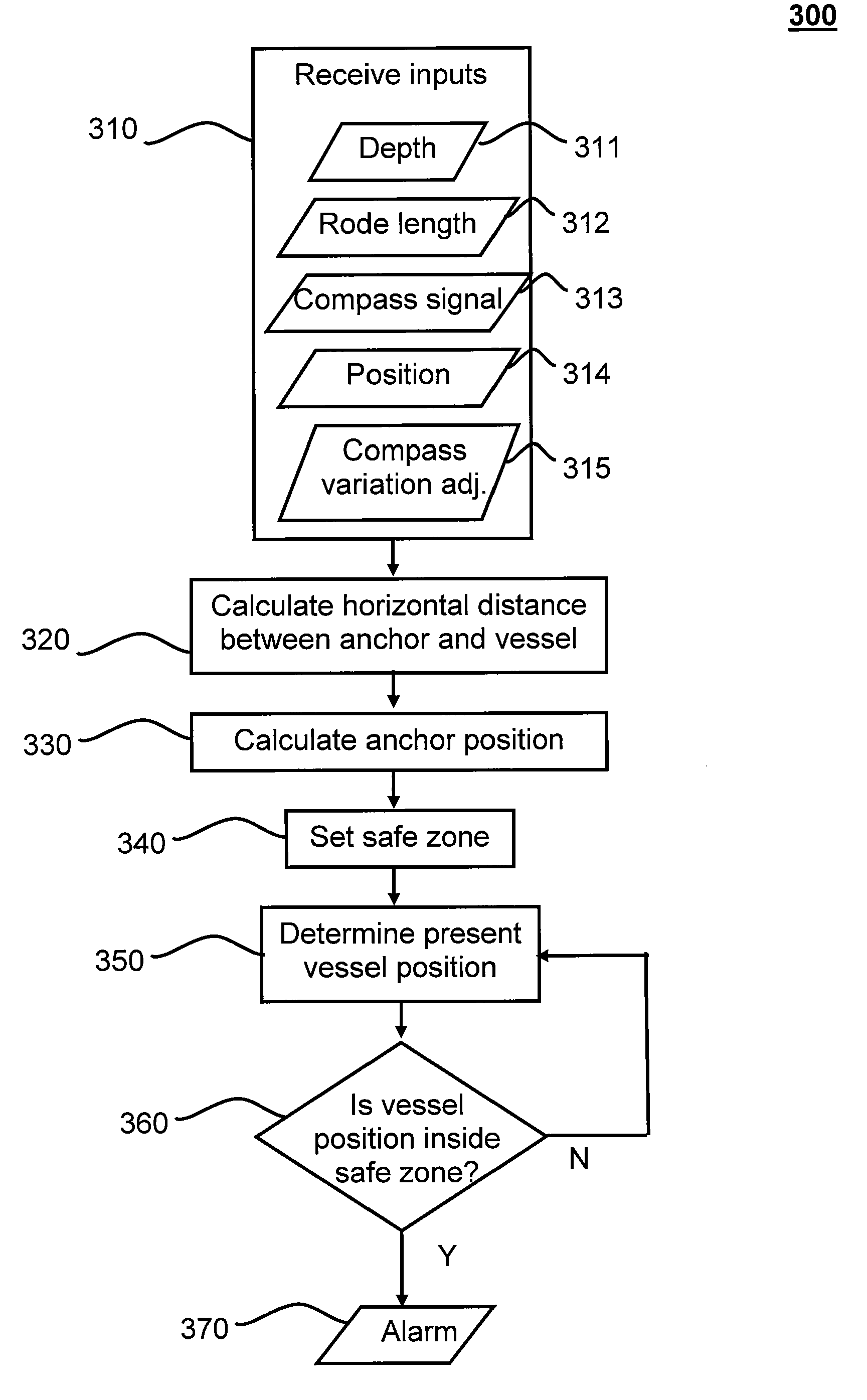
A method is disclosed for monitoring the position of a floating object. The method starts by receiving as input at least a position of the floating object, and an orientation of the floating object. A horizontal distance between the floating object and an anchor coupled to the floating object is then calculated. A position of the anchor is then calculated from the position of the floating object and the orientation. An area is set based upon the position of the anchor, and it is determined whether a present position of the floating object is within that area. An alarm signal is provided when the present position of the floating object is outside the area.

Description

STATEMENT OF CORRESPONDING APPLICATIONS[0001]This application is based on the Provisional specification filed in relation to New Zealand Patent Application Number 562819, the entire contents of which are incorporated herein by referenceTECHNICAL FIELD[0002]This invention relates to a method of determining and monitoring a distance traveled by a marine vessel connected to an anchor, and in particular, though not solely, to a method of alerting the vessel operator through an alarm which indicates the breaking loose or slippage of an anchor.BACKGROUND[0003]Marine vessels, for a variety of reasons, moor by means of an anchor and a rode (the cable, chain and / or rope connecting the vessel to its anchor). It is common for a moored vessel to drift from their position when its anchor breaks loose or slips. This can be a result of a number of factors including: changed tide and wind conditions; poor ground holding; inadequate anchor design; inadequate rode design; anchor or rode failure; and ...

Claims


Application Information

Patent Timeline
IPC IPC(8): G08B21/00
CPCB63B21/22B63B2021/009B63B2021/008
Inventor MICHIE, BRIAN EDWARDWILSON, BRUE JOHN
Owner MICHIE BRIAN EDWARD
Learn More