Dynamic compaction foundation visual management system based on virtual reality
A virtual reality and ground-based technology, applied in the field of virtual reality, can solve the problems of incapable of visual management, inapplicability, low accuracy, etc., to achieve the effect of improving the effect, ensuring intelligence, and improving efficiency
- Summary
- Abstract
- Description
- Claims
- Application Information
AI Technical Summary
Problems solved by technology
Method used
Image
Examples
Embodiment 1
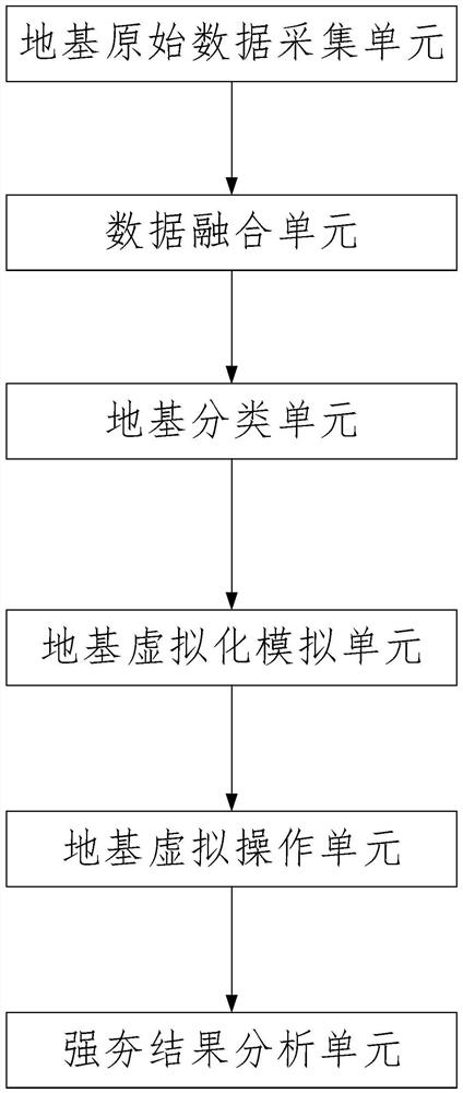
[0023] like figure 1 As shown in the figure, a virtual reality-based dynamic compaction foundation visualization management system, the system includes: a foundation original data acquisition unit, configured to collect the original data of the foundation, the original data at least includes: area, foundation surface unevenness, natural Severity, dry weight, specific gravity, saturation, void ratio, porosity, liquid gap, and plastic limit; data fusion unit, configured to perform data fusion on collected raw data to generate data using preset data fusion models Fusion results; the foundation classification unit, configured to classify the foundation based on the data fusion result and use the preset classification rules to obtain the foundation category; the foundation virtualization simulation unit, configured to generate and classify the foundation based on the obtained foundation category. Corresponding at least three virtual reality models; a foundation virtual operation un...
Embodiment 2
[0027]On the basis of the previous embodiment, the ground-based raw data acquisition unit includes: an on-site acquisition unit and a remote image acquisition unit; the on-site acquisition unit is configured to obtain at least natural gravity, dry weight, specific gravity, saturation, void ratio, porosity, liquid gap and plastic limit; the remote image acquisition unit is configured to remotely acquire image data of the foundation through a camera, and perform image recognition on the image data to obtain The area of the foundation and whether there are bumps on the foundation.
[0028] Specifically, compared with the prior art, the present invention, through the construction of a virtual reality model, takes into account the unevenness of the foundation in the construction process, thereby improving the effect of the dynamic foundation.
Embodiment 3
[0030] On the basis of the previous embodiment, the camera of the remote image acquisition unit remotely acquires the image data of the foundation, and performs image recognition on the image data to obtain the area of the foundation and the method for whether there are concavities and convexities on the foundation: based on the acquired The area of the image data is calculated to obtain the area of the foundation; the image feature information of the image data is then extracted, and based on a preset recognition model, the image feature information of the image data is used as an input parameter to obtain the concavity and convexity of the image data. Recognition result; wherein, the recognition model is to use a training foundation image sample set including at least strong label training foundation image samples to train to the strong supervision objective function convergence of the recognition model, so as to determine the concave-convex recognition result; strong la...
PUM
 Abstract
Description
Claims
Application Information
 - R&D Engineer
- R&D Manager
- IP Professional
- Industry Leading Data Capabilities
- Powerful AI technology
- Patent DNA Extraction
Browse by: Latest US Patents, China's latest patents, Technical Efficacy Thesaurus, Application Domain, Technology Topic, Popular Technical Reports.
© 2024 PatSnap. All rights reserved.Legal|Privacy policy|Modern Slavery Act Transparency Statement|Sitemap|About US| Contact US: help@patsnap.com


