Urban hydrologic station network layout method and system based on 3S technology

A technology for hydrological stations and cities, applied in design optimization/simulation, instruments, data processing applications, etc., to save time and manpower, and to achieve accurate and reliable results

Pending Publication Date: 2022-05-24
NANJING AUTOMATION INST OF WATER CONSERVANCY & HYDROLOGY MINIST OF WATER RESOURCES
View PDF0 Cites 1 Cited by
  • Summary
  • Abstract
  • Description
  • Claims
  • Application Information

AI Technical Summary

Problems solved by technology

However, there is still a lack of more accurate and effective hydrological station network layout methods in the existing technology.

Method used


Image

  • Urban hydrologic station network layout method and system based on 3S technology
  • Urban hydrologic station network layout method and system based on 3S technology
  • Urban hydrologic station network layout method and system based on 3S technology

Examples


Embodiment Construction

[0037] The technical solutions provided by the present invention will be described in detail below in conjunction with specific embodiments, and it should be understood that the following specific embodiments are only used to illustrate the present invention and not to limit the scope of the present invention. The methods provided by the present invention may be performed in a computer system, such as a set of computer-executable instructions.

[0038] The method for laying out an urban hydrological station network based on 3S technology provided by the present invention includes the following steps

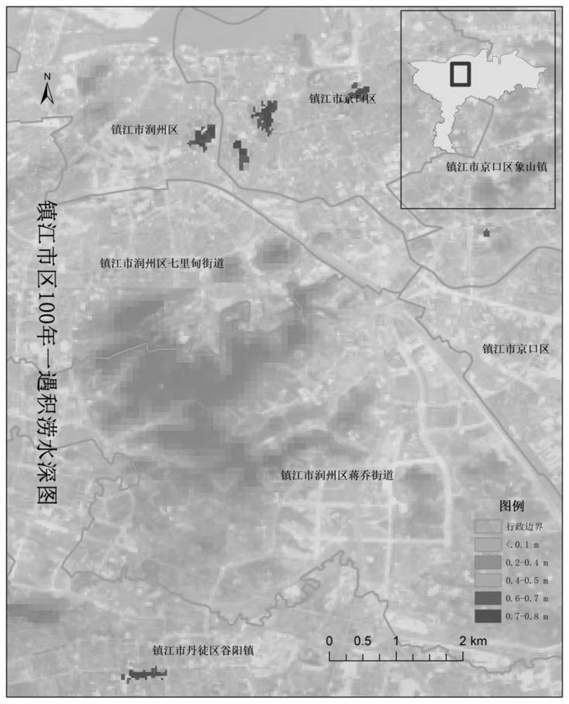
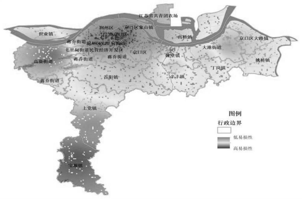
[0039] Step 1: High-risk zoning of urban rainstorms

[0040] The expansion of urban impervious surface will increase the high heat storage bodies such as buildings and roads in the city, and at the same time, accompanied by the reduction of vegetation and green space, this will increase the temperature in the urban area and cause the "urban heat island" effect. In urban sprawl a...


PUM


Abstract

The invention provides an urban hydrologic station network layout method and system based on a 3S technology. The method comprises the following steps: establishing an urban rainstorm high-risk model; establishing an urban flood risk model; establishing an urban disaster-bearing body vulnerability model; and establishing an urban hydrologic station network planning demand index model. Based on remote sensing data, land utilization type data, historical disaster situation data and a 3S technology, detailed analysis is performed from three aspects of urban rainstorm high-risk zoning, flood risk zoning and disaster-bearing body vulnerability, and then a hydrological station network layout demand index model is comprehensively considered from the perspective of data fusion to perform overall optimization layout of a hydrological station network. The specific layout position of the hydrologic station network can be accurately, rapidly and intelligently determined, compared with a traditional hydrologic station network layout method, much time and manpower needed by field investigation are saved, and the result is accurate and reliable.

Description

technical field [0001] The invention belongs to the technical field of hydrological monitoring, and in particular relates to a method and system for laying out a network of urban hydrological stations based on 3S technology. Background technique [0002] The network of hydrological stations is the basis of hydrological monitoring work, which directly provides necessary water and rain information for hydrological work and even water conservancy work. At present, my country has initially established a network of hydrological element observation stations for understanding the hydrological laws of river basins. Various hydrological stations have grown from 353 at the beginning of the founding of New China to 119,914 by the end of 2020, providing a large amount of hydrological information for national economic construction. , has played an important role, and has achieved comprehensive coverage of hydrological monitoring of large rivers and their main tributaries, and small and me...

Claims


Application Information

Patent Timeline
IPC IPC(8): G06F30/18G06F30/20G06Q10/06
CPCG06F30/18G06F30/20G06Q10/0635Y02A10/40
Inventor 张利茹李辉贺永会韩继伟谷莹莹戴佳琦邵军唐跃平符伟杰王岩智永明王岑晔
Owner NANJING AUTOMATION INST OF WATER CONSERVANCY & HYDROLOGY MINIST OF WATER RESOURCES
Why Eureka
Try Eureka