Surveying and mapping unmanned aerial vehicle with GPS system

An unmanned aerial vehicle and GPS system technology, applied in the field of surveying and mapping, can solve the problems of falling into grass, rock crevices or hanging on trees, drone falling, etc., and achieves the effects of convenient disassembly, simple connection, and improved surveying and mapping accuracy.

Inactive Publication Date: 2022-03-18
宋如飞 +4
View PDF0 Cites 0 Cited by
  • Summary
  • Abstract
  • Description
  • Claims
  • Application Information

AI Technical Summary

Problems solved by technology

[0004] In addition, when the drone encounters strong winds or trees and grass during its use, the drone will sometimes fall. Because the working environment is aligned with the wilderness and jungle, there is a high probability that the drone will fall into the grass and rock gaps Or hanging on trees, therefore, an efficient retrieval system after a fall or loss has become an urgent need for surveying and mapping of unmanned aerial vehicles

Method used


Image

  • Surveying and mapping unmanned aerial vehicle with GPS system
  • Surveying and mapping unmanned aerial vehicle with GPS system
  • Surveying and mapping unmanned aerial vehicle with GPS system

Examples


Embodiment Construction

[0053] In order to have a clearer understanding of the technical features, purposes and effects of the present invention, the specific implementation manners of the present invention will now be described in detail with reference to the accompanying drawings.

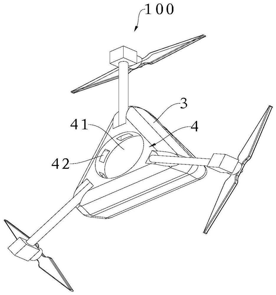
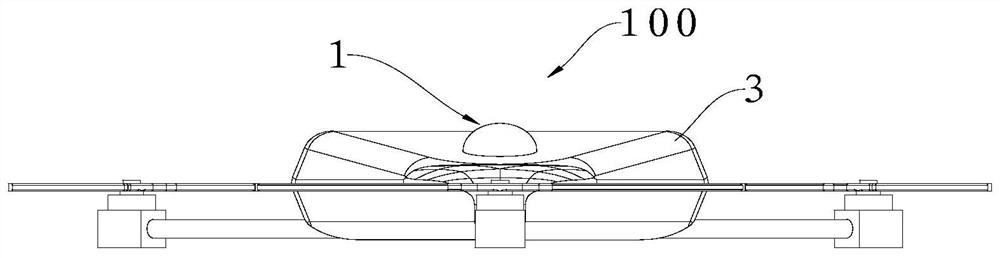
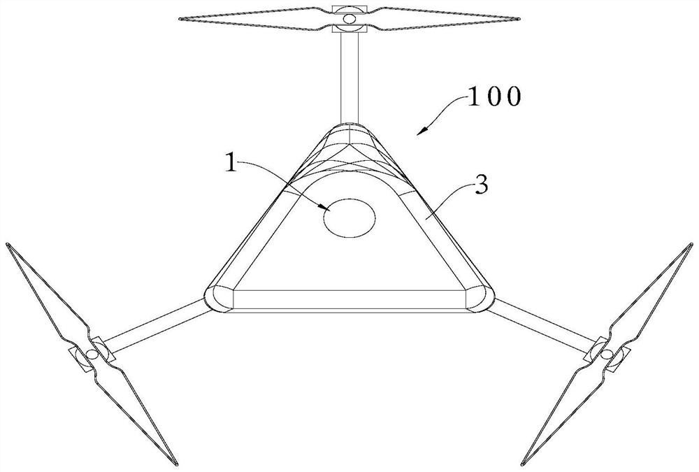
[0054] Such as Figure 1-19 As shown, the surveying and mapping unmanned aerial vehicle with GPS system includes a fuselage 3, a pylon 4 and a cloud platform 5, the pylon 4 is fixedly connected to the fuselage 3, and the platform 5 is connected to the pylon 4 for connecting the camera equipment . The unmanned aerial vehicle body 3 is provided with a first PCB board 23, the first PCB board 23 is electrically connected to the GPS module, the control module, and the communication module, and the control module is electrically connected to the GPS module and the communication module respectively. The UAV 100 is also equipped with a control terminal 200 for remotely controlling the UAV 100 , and the control terminal 200 can...


PUM


Abstract

The invention discloses a surveying and mapping unmanned aerial vehicle with a GPS system, and relates to the technical field of surveying and mapping, the surveying and mapping unmanned aerial vehicle comprises a fuselage, a hanger, a holder, a GPS module, a control module and a communication module, and the control module is electrically connected with the GPS module and the communication module; the hanging rack comprises a shell, a containing groove is formed in the bottom of the shell, and an inserting hole is formed in the containing groove along the side wall; the holder comprises a fixed disc, a telescopic sliding rod mechanism which is arranged in the fixed disc and can stretch out and retract relative to the fixed disc, a support fixedly connected to the lower end of the fixed disc, and a clamping mechanism which is arranged at the lower end of the support and used for clamping the camera equipment. The telescopic sliding rod mechanism comprises a driving wheel, a driving mechanism used for driving the driving wheel to rotate and toothed rods arranged on the two sides of the driving wheel and meshed with the driving wheel. The toothed rods are driven by the driving wheel to slide and stretch out and draw back along the fixing disc, and the tail ends of the toothed rods can be inserted into or disengaged from the inserting holes. The hanging frame and the holder are simple in connection and convenient to disassemble, and the connection strength of the unmanned aerial vehicle and the holder is greatly improved.

Description

technical field [0001] The invention relates to the technical field of surveying and mapping, in particular to a surveying and mapping unmanned aerial vehicle with a GPS system. Background technique [0002] UAV pan / tilt is a supporting device for UAVs to install and fix mission loads such as cameras. Due to the different functions and uses of drones, various sensors or cameras will be mounted on the drone platform, so the drone platform is also designed with different structures according to needs. [0003] UAVs for surveying and mapping are limited to the load capacity of the UAV. It is usually required to reduce the weight and volume of the gimbal structure and increase the load capacity of the gimbal under the premise of ensuring the normal operation of the gimbal. Surveying and mapping UAVs are generally used in less populated areas or on jungle wastelands. Therefore, the first choice when using the gimbal must be fixed and reliable, and it can resist relatively harsh ...

Claims


Application Information

Patent Timeline
Patent Type & Authority Applications(China)
IPC IPC(8): B64C39/02B64D47/08B64D47/06
CPCB64C39/024B64D47/08B64D47/06B64U2101/30
Inventor 宋如飞刘博张鹏张元胡鑫
Owner 宋如飞
Why Eureka
Try Eureka