Shale oil and gas combustion extraction method based on multi-source time sequence remote sensing image
A shale oil and gas, time series technology, applied in the field of remote sensing geology application, can solve problems such as low resolution, achieve the effect of simple execution steps, easy execution steps, and reduced manual participation
- Summary
- Abstract
- Description
- Claims
- Application Information
AI Technical Summary
Problems solved by technology
Method used
Image
Examples
Embodiment Construction
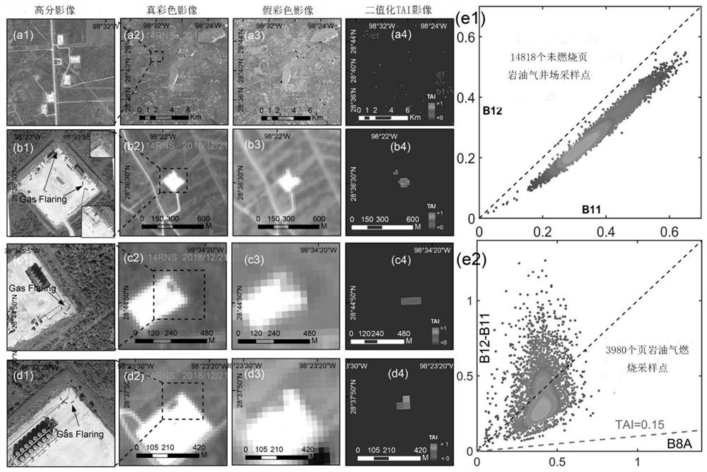
[0032] The present invention will be described in detail below according to the accompanying drawings, so as to make the technical route and operation steps of the present invention clearer. The data used in the examples of the present invention are Landsat-8 OLI and Sentinel-2 MSI data covering the Texas region of the United States. The time span of the data is from March 2013 to May 2020.
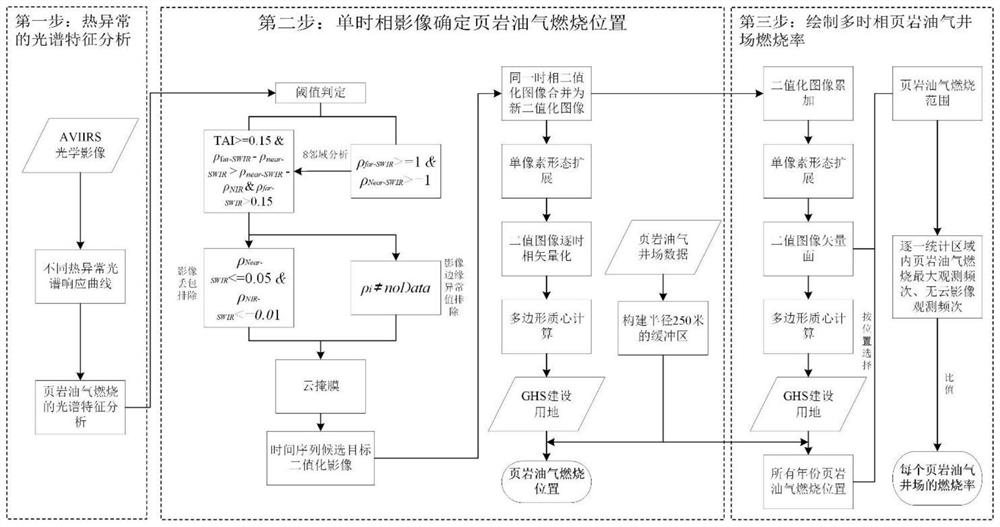
[0033] figure 1 It is a flowchart of a shale oil and gas combustion extraction method based on multi-source time series remote sensing images of the present invention, and the specific steps are as follows:
[0034] The first step is to prepare multi-source remote sensing optical images and construct time series band data sets respectively. Specifically, it includes the following aspects:
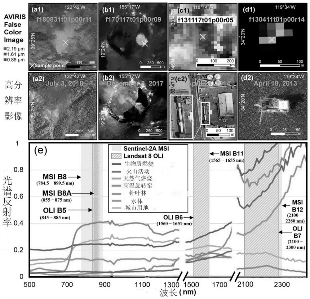
[0035] a. Select part of the high-temperature thermal anomaly locations obtained from on-site investigations as sample points, obtain AVIRIS images at the sample points, and perform statistics on th...
PUM
 Abstract
Description
Claims
Application Information
 - R&D Engineer
- R&D Manager
- IP Professional
- Industry Leading Data Capabilities
- Powerful AI technology
- Patent DNA Extraction
Browse by: Latest US Patents, China's latest patents, Technical Efficacy Thesaurus, Application Domain, Technology Topic, Popular Technical Reports.
© 2024 PatSnap. All rights reserved.Legal|Privacy policy|Modern Slavery Act Transparency Statement|Sitemap|About US| Contact US: help@patsnap.com


