System and method for constructing soil available phosphorus analysis model based on satellite images
A satellite image and analysis model technology, applied in neural learning methods, biological neural network models, character and pattern recognition, etc., can solve the problems of high uncertainty in parameter adjustment, large randomness of BP neural network, and insufficient stability of training, etc. Achieve the effects of reducing production costs, high precision, and reducing the consumption of manpower and material resources
- Summary
- Abstract
- Description
- Claims
- Application Information
AI Technical Summary
Problems solved by technology
Method used
Image

Examples
specific Embodiment approach 1
[0041] Specific implementation mode 1: This embodiment proposes a soil available phosphorus analysis model construction technology system and method based on satellite images. It is far from meeting the large-area acquisition demand for soil available phosphorus on the "surface". However, it is time-consuming, labor-intensive and costly to guide fertilization through a large number of tests of soil available phosphorus content, and it is often impossible to achieve accurate and comprehensive fertilization, which may cause excessive fertilization. Excessive cost investment, polluting the environment, too little fertilization leads to soil compaction and affects crop growth
[0042] Before the crops are sown, on-site soil samples are collected in the target area, and the collected sample data is sent to the laboratory for analysis to determine the available phosphorus content in the soil samples, and at the same time obtain image data during the sample collection period.
[0043...
specific Embodiment approach 2
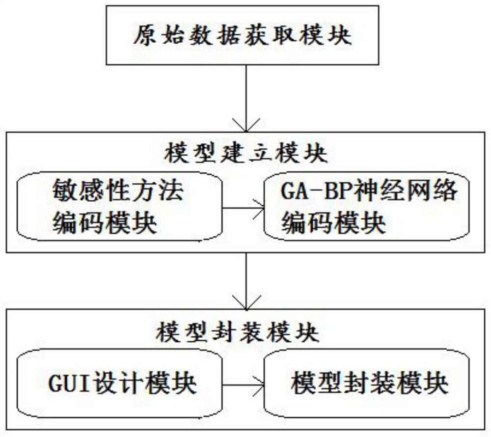
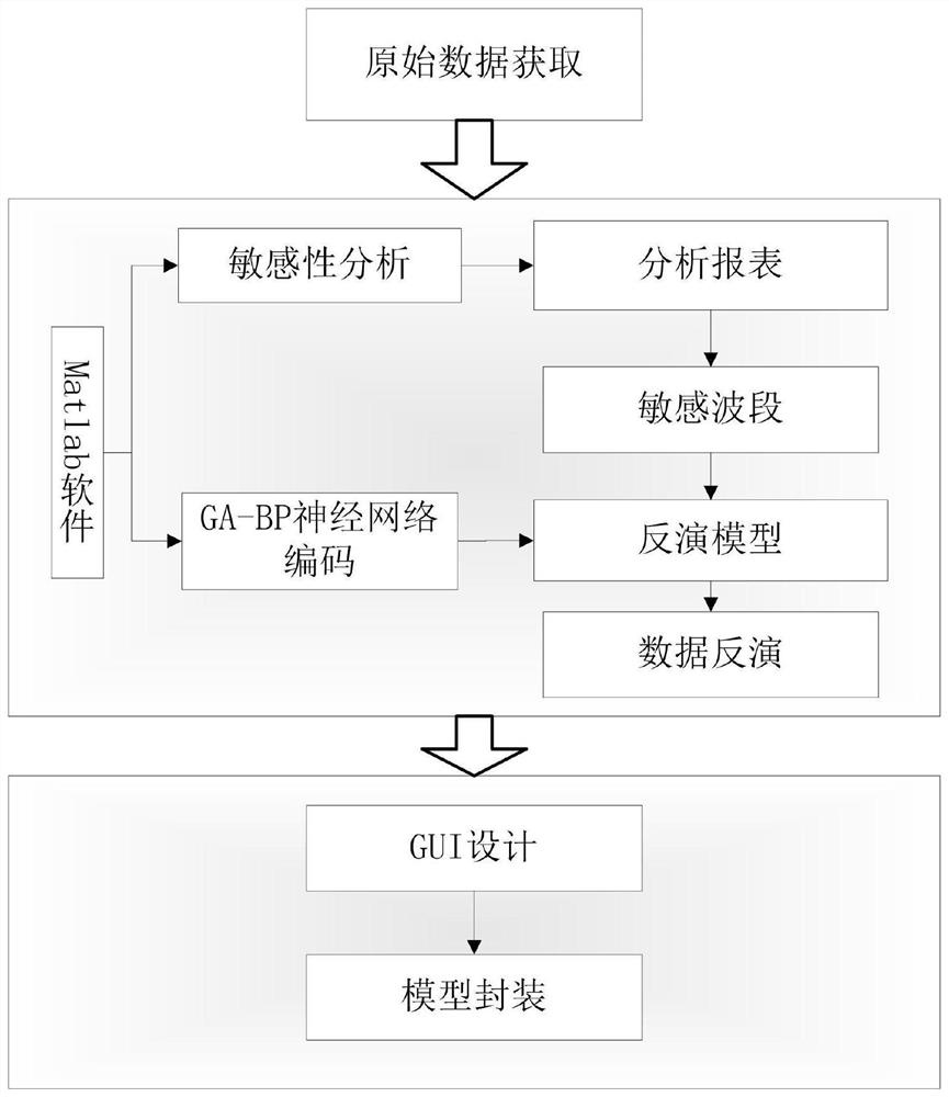
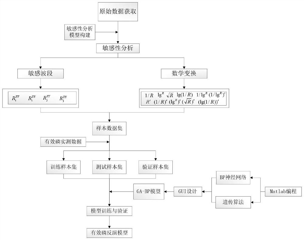
[0047] Specific implementation mode 2: This embodiment is divided into 7 stages: the original data acquisition stage, sensitivity analysis model construction and image sensitivity analysis stage, sensitive band mathematical transformation stage, transformed band sensitivity analysis stage, model training input and target parameter determination stage, GA-BP neural network model construction stage, model training and verification stage, the specific process is as follows:
[0048] 1. Raw data acquisition stage:
[0049] In accordance with the requirements of the "Technical Specifications for Soil Sample Collection", the soil samples in the target area were collected, packaged and calibrated. The soil sample points in the target area were collected, and the 0-20cm plow layer soil in the operation area was collected by the equidistant sampling method. Take 1kg of soil after fully mixing and evenly. The sampling interval is determined according to the size of the operation range. ...
specific Embodiment approach 3
[0062] Specific implementation mode three: this implementation mode takes the farmland of a certain farm in a certain province as an example, adopts the method of this embodiment, and finally obtains the distribution map of available phosphorus content in cultivated land soil as follows image 3 Shown:
[0063] A farm has an experimental field of 475 mu. According to the actual local conditions, soil samples are collected, the latitude and longitude coordinates of each sampling point and the number of soil samples are recorded, and the soil samples are sent to a professional third-party soil testing laboratory for testing. Available phosphorus content, measured content (mg / kg) and location exhibition points such as Figure 4 Location distribution (note: the marked data on the figure is the available phosphorus content value);
[0064] Query and download remote sensing images. This example downloads Sentinel-1 with a resolution of 10 meters. The image time is May 29 and June 1...
PUM
 Abstract
Description
Claims
Application Information
 - R&D
- Intellectual Property
- Life Sciences
- Materials
- Tech Scout
- Unparalleled Data Quality
- Higher Quality Content
- 60% Fewer Hallucinations
Browse by: Latest US Patents, China's latest patents, Technical Efficacy Thesaurus, Application Domain, Technology Topic, Popular Technical Reports.
© 2025 PatSnap. All rights reserved.Legal|Privacy policy|Modern Slavery Act Transparency Statement|Sitemap|About US| Contact US: help@patsnap.com