
Unmanned aerial vehicle path and action planning algorithm for indoor positioning information collection

A technology for information collection and indoor positioning, which is applied to services, computing, and wireless communications based on specific environments to save energy and improve scalability.

Inactive Publication Date: 2021-02-09
NANJING UNIV OF AERONAUTICS & ASTRONAUTICS
View PDF5 Cites 1 Cited by
  • Summary
  • Abstract
  • Description
  • Claims
  • Application Information

AI Technical Summary

Problems solved by technology

[0014] The purpose of the present invention is to design a UAV path and action planning algorithm for indoor positioning information collection, in order to solve the problem of minimum energy consumption for UAVs to perform tasks

Method used


Image

  • Unmanned aerial vehicle path and action planning algorithm for indoor positioning information collection
  • Unmanned aerial vehicle path and action planning algorithm for indoor positioning information collection
  • Unmanned aerial vehicle path and action planning algorithm for indoor positioning information collection

Examples


Embodiment Construction

[0031] The invention will be described in further detail below in conjunction with the accompanying drawings.

[0032] (1) Indoor environment and basic motion modeling of UAV

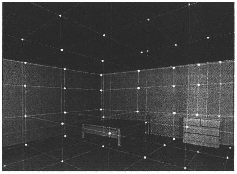
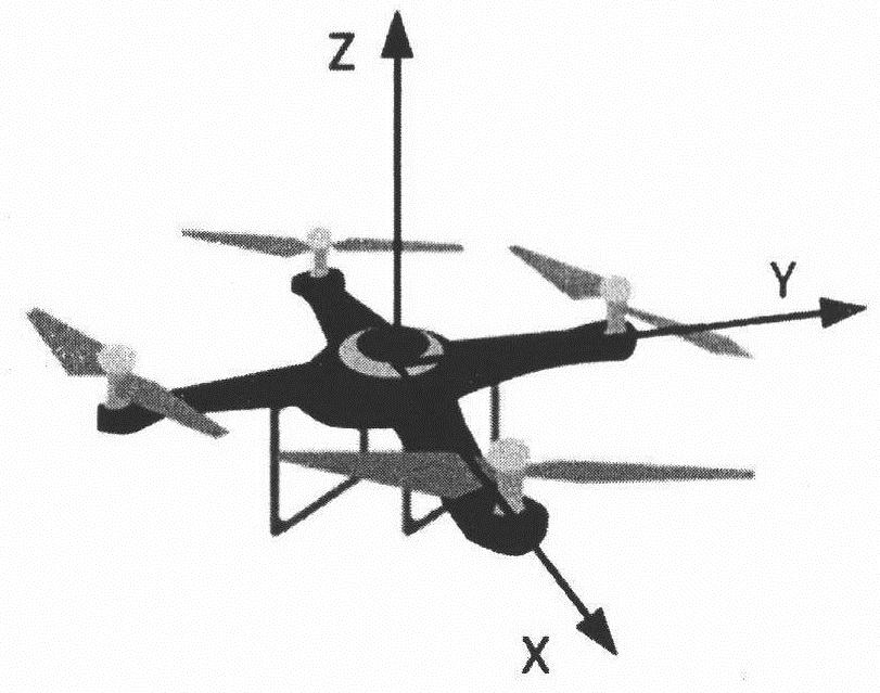
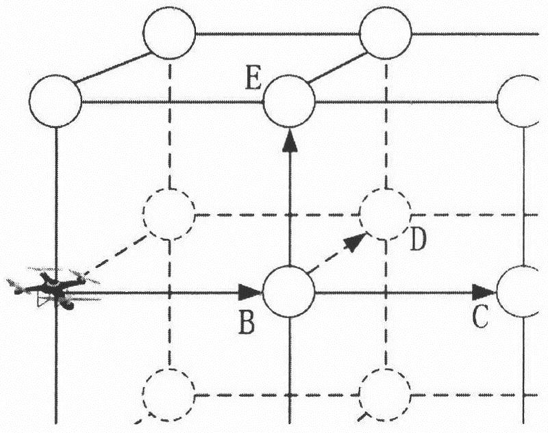
[0033] Divide the indoor environment into cubes of equal volume, and a cube represents a unit space, such as figure 1 . Use a point located in the center of the cube to represent this unit space. If two unit spaces are adjacent and there is no obstacle blocking them, there is a connecting line between their points. Usually the indoor environment is relatively complex. In order to avoid the UAV from colliding with indoor obstacles to a greater extent and reduce the energy consumption generated by the UAV avoiding obstacles, we set the movement direction of the UAV to six. The axis can be represented by the positive and negative directions of the three coordinate axes, such as figure 2 . like image 3 , the UAV can move on the edge of the graph.

[0034] (1) Establishing the motion energy model of ...


PUM


Abstract

The invention relates to an unmanned aerial vehicle path and action planning algorithm for indoor positioning information collection, and belongs to the field of Internet of Things. Actions and pathsare planned for an unmanned aerial vehicle carrying signal collection equipment (wireless network card), and channel state information (CSI) signals in a three-dimensional space are detected, so thatthe invention is used for establishing an indoor positioning information fingerprint map. Compared with manual CSI signal detection, the unmanned aerial vehicle reduces signal disturbance, and path and action planning avoids indoor collision of the unmanned aerial vehicle and greatly reduces energy consumption. After an indoor environment, unmanned aerial vehicle motion and energy are modeled, a planning problem is converted into a generalized traveling salesman problem (GTSP), so that a GLNS solver is used for optimization.

Description

technical field [0001] The invention relates to an unmanned aerial vehicle path and action planning algorithm for indoor positioning information collection, which belongs to the field of the Internet of Things in the field of computers. Background technique [0002] Indoor positioning refers to the use of various technologies such as wireless communication, base station positioning, and inertial navigation positioning to determine the specific location of people and objects indoors at a certain moment. Indoor positioning has great application prospects and economic value in many fields such as medical assistance, underground rescue, smart home and smart teaching because it can accurately perceive the indoor position of people and objects. Current indoor positioning technologies include UWB, Bluetooth, RFID, Zigbee, infrared, ultrasonic and WiFi. Among them, CSI fingerprint positioning based on WiFi technology has very high accuracy, and CSI signals are easy to collect [1, 2...

Claims


Application Information

Patent Timeline
Patent Type & Authority Applications(China)
IPC IPC(8): H04W4/33H04W64/00G01C21/20G06T17/00G16Y40/60
CPCG01C21/206G06T17/00G16Y40/60H04W64/00H04W4/33Y02D30/70
Inventor 刘亮王子杰曾力李鑫
Owner NANJING UNIV OF AERONAUTICS & ASTRONAUTICS
Learn More