Slope vegetation configuration method suitable for loess hilly region
A configuration method and slope technology, applied in the fields of botanical equipment and methods, sowing, and grassland sowing, can solve the problems of soil erosion, sparse vegetation on slopes, low soil nutrients, etc., to prevent water loss, improve infiltration, improve Effects of soil structure
- Summary
- Abstract
- Description
- Claims
- Application Information
AI Technical Summary
Problems solved by technology
Method used
Image
Examples
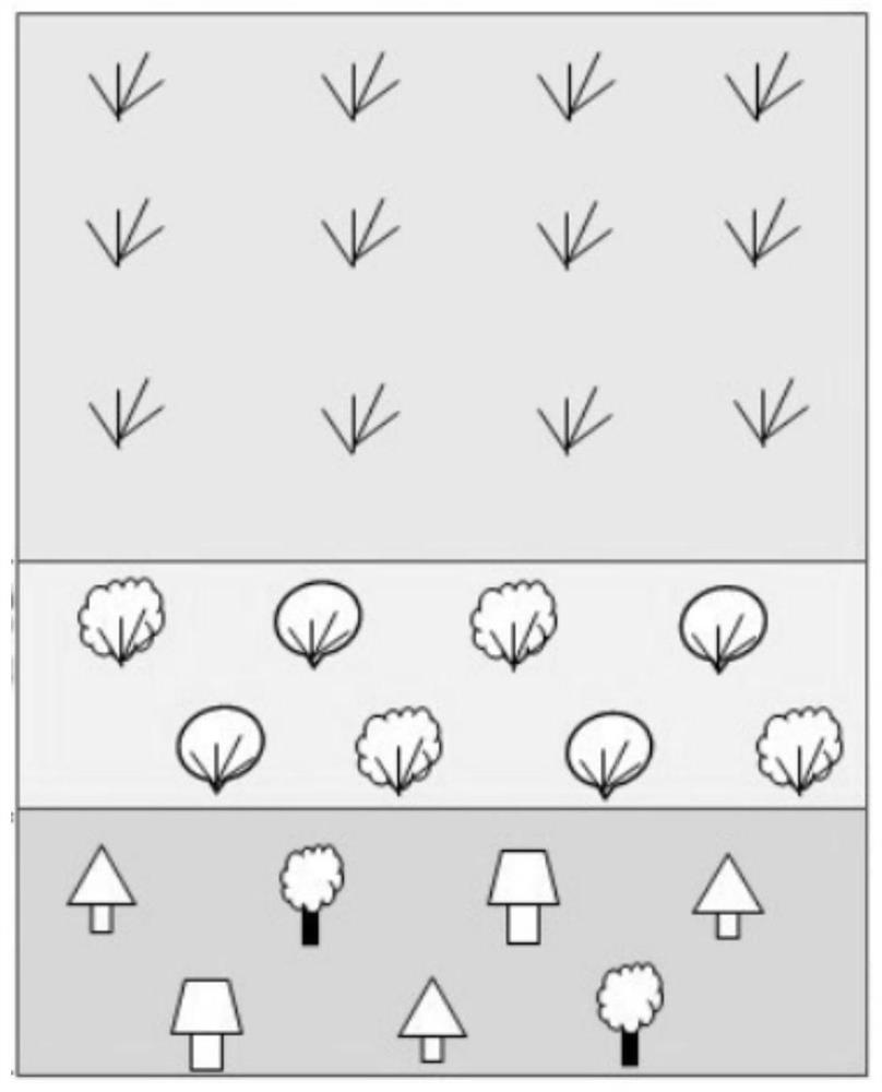
Embodiment 1
[0049] Site selection: Slope 1 of the Nangou River Basin in Ansai County, Shaanxi Province.
[0050] A slope vegetation configuration method suitable for loess hilly areas. First, the selected slope is classified into slope grades, and the slope is divided into flat slopes with a slope of 0-10°, gentle slopes with a slope of 10-20°, and slopes with a slope of 20-30°. ° slopes, steep slopes with a slope of 30-40° and steep slopes with a slope >40°;
[0051] After the slope is graded, the slope position is classified, and the slope is divided into three parts according to the length: uphill, middle and downhill. Each part accounts for 1 / 3 of the entire slope length; above the middle of the slope, it occupies the entire 1 / 2 of the slope length is the mid-upper slope position, and below the middle of the slope surface, accounting for 1 / 2 of the entire slope length is the mid-down slope position.
[0052] After the slope and slope are graded, the vegetation configuration is follow...
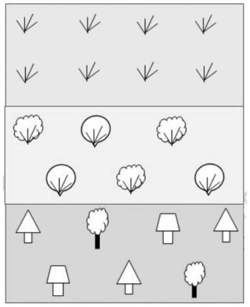
Embodiment 2
[0090] Site selection: Slope 2 of Nangou River Basin, Ansai County, Shaanxi Province.
[0091] Slope and slope classification are the same as in Example 1.
[0092] A slope vegetation configuration method suitable for loess hilly areas, the steps are:
[0093] 1. Plant configuration method
[0094] (1) Measurement of slope site conditions: First, use a compass to measure the slope of the vegetation building slope, measure the length of the slope, and delineate the boundary line of the slope.
[0095] After measurement, the actual slope of the slope in this embodiment is 15°, which belongs to a gentle slope with a slope length of 150m and a semi-sunny slope. The original vegetation on the slope surface is the secondary natural grassland with the dominant community of Artemisia spp. Osmanthus osmanthus is a companion species.
[0096] According to the slope length and slope conditions, take the upslope position (above the middle of the slope, accounting for 1 / 3 of the slope l...
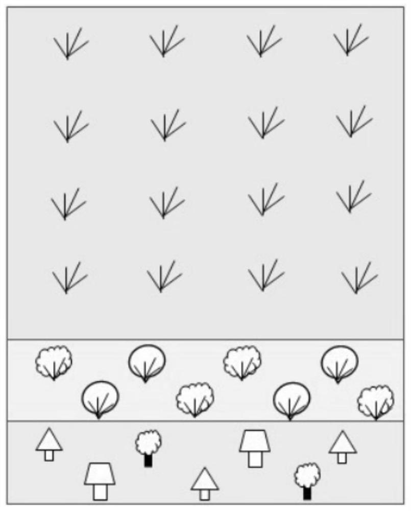
Embodiment 3
[0124] Site selection: Slope of Nangou River Basin in Ansai County, Shaanxi Province 3.
[0125] Slope and slope classification are the same as in Example 1.
[0126] A slope vegetation configuration method suitable for loess hilly areas, the steps are:
[0127] 1. Plant configuration method
[0128] (1) Measurement of slope site conditions: First, use a compass to measure the slope of the vegetation building slope, measure the length of the slope, and delineate the boundary line of the slope.
[0129] After measurement, the actual slope of the slope in this embodiment is 37°, which belongs to a steep slope with a slope length of 78m and a semi-sunny slope. The original vegetation on the slope surface is the secondary natural grassland with the dominant community of Artemisia spp. Osmanthus osmanthus is a companion species.
[0130] According to the slope length, adopt the upslope and mid-slope positions (the upper and middle parts of the slope, accounting for 2 / 3 of the sl...
PUM
 Abstract
Description
Claims
Application Information
 - R&D Engineer
- R&D Manager
- IP Professional
- Industry Leading Data Capabilities
- Powerful AI technology
- Patent DNA Extraction
Browse by: Latest US Patents, China's latest patents, Technical Efficacy Thesaurus, Application Domain, Technology Topic, Popular Technical Reports.
© 2024 PatSnap. All rights reserved.Legal|Privacy policy|Modern Slavery Act Transparency Statement|Sitemap|About US| Contact US: help@patsnap.com


