Method for determining railway space line position in karst mountainous area
A space and karst technology, applied in geometric CAD, special data processing applications, etc., can solve the problem of less theories and methods of railway disaster reduction and route selection, and achieve economical and rationality, reduce the cost of route selection, and save the survey construction period. Effect
- Summary
- Abstract
- Description
- Claims
- Application Information
AI Technical Summary
Problems solved by technology
Method used
Image
Examples
Embodiment
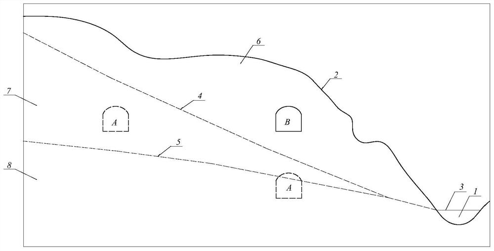
[0028] Take the determination of the railway space line position of the Shaziguan-Liangwu section and the Paihuadong Tunnel of Yuli Railway as an example.
[0029] The Shaziguan-Liangwu section of the Yuli Railway crosses the Qiyaoshan Mountains. The main geological problem controlling the line plan for this section is the karst and karst water in the Qiyaoshan anticline section. The line passes through the water-resisting boundary formed by the soluble rock strata in the core of the regional anticline and the non-dissolvable rock strata in the northwest wing, forming a complete karst hydrogeological unit. Since Liangwu is a karst depression with a low elevation, the line must be lowered as much as possible due to the slope limit of the tunnel. Due to the difference in discharge conditions, the elevations of the karst water discharge points on the two wings of the anticline differ by nearly 200m (the Northwest wing is represented by the Mancaodong Underground River at an eleva...
PUM
 Abstract
Description
Claims
Application Information
 - R&D
- Intellectual Property
- Life Sciences
- Materials
- Tech Scout
- Unparalleled Data Quality
- Higher Quality Content
- 60% Fewer Hallucinations
Browse by: Latest US Patents, China's latest patents, Technical Efficacy Thesaurus, Application Domain, Technology Topic, Popular Technical Reports.
© 2025 PatSnap. All rights reserved.Legal|Privacy policy|Modern Slavery Act Transparency Statement|Sitemap|About US| Contact US: help@patsnap.com


