
Clustering method based on local direction centrality measurement

A centrality measurement and local direction technology, applied in the field of spatial agglomeration pattern analysis, can solve problems such as weak connections, uneven density distribution, and inaccurate analysis, and achieve the effect of solving uneven cluster density distribution

Pending Publication Date: 2020-06-16
WUHAN UNIV
View PDF7 Cites 0 Cited by
  • Summary
  • Abstract
  • Description
  • Claims
  • Application Information

AI Technical Summary

Problems solved by technology

[0007] In view of this, the present invention provides a clustering method based on a local directional centrality measure to solve, or at least partly solve, insufficient analysis due to weak connections and uneven density distribution in the data. accurate technical questions

Method used


Image

  • Clustering method based on local direction centrality measurement
  • Clustering method based on local direction centrality measurement
  • Clustering method based on local direction centrality measurement

Examples


Embodiment Construction

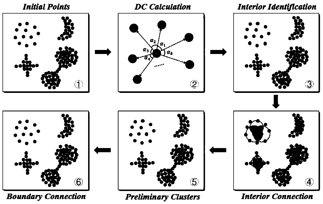
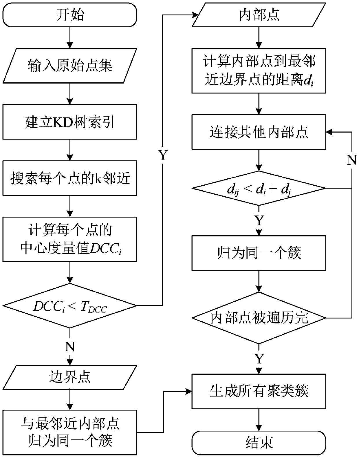
[0055] A clustering method based on the local direction centrality measure provided by the present invention includes: S1. According to the spatial distribution of POI position data of the enterprise, establish a two-dimensional spatial index of KD-Tree, so as to quickly search for the spatial nearest point object of POI ; S2. Traversing each POI point, searching its spatial K nearest neighbor based on the backtracking operation of KD-Tree; S3. Computing the angle variance formed by each point and its KNN neighborhood, and normalizing it; S4. According to the specified Divide all points into internal points and boundary points; S5, connect internal points into multiple clusters according to the connection rules, until all internal points have clusters to which they belong; S6, divide all boundary points The points are classified into the clusters of the inner points closest to them; S7. Visualize all the clustering results on the map.

[0056] Aiming at the problem that tradit...


PUM


Abstract

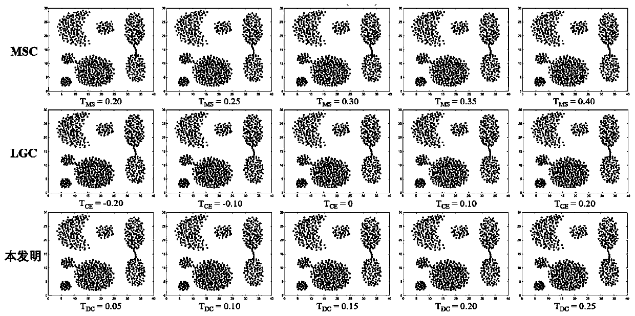
The invention discloses a clustering method based on local direction centrality measurement, and the method comprises the steps: S1, building a two-dimensional spatial index of KD-Tree according to the spatial distribution of POI position data of an enterprise; S2, traversing each POI point, and searching the nearest neighbor of the space K of the POI point based on the backtracking operation of the KD-Tree; S3, calculating an angle variance formed by each point and the KNN neighborhood of the point, and normalizing the angle variance; S4, dividing all the points into internal points and boundary points according to a specified angle variance threshold; S5, connecting the internal points into a plurality of clustering clusters according to a connection rule until all the internal points have the clustering clusters to which the internal points belong; and S6, classifying all the boundary points to the clustering cluster of the internal point closest to the boundary points. The two problems can be effectively solved by adopting the core thought based on the KNN and the direction, dense and sparse clustering clusters can be accurately identified at the same time, and a plurality of connected different clusters can be reasonably segmented.

Description

technical field [0001] The invention relates to the technical field of spatial agglomeration pattern analysis of POI position data, in particular to a clustering method based on local direction centrality measurement. Background technique [0002] Spatial clustering is a classic and effective method for analyzing point aggregation patterns. It measures the similarity by calculating the spatial distance of geographical objects, and divides geographical objects with high similarity into one category. This method is widely used in traffic , geology, economics and medicine and other fields. [0003] Traditional clustering methods can be divided into five categories: partition-based, density-based, hierarchy-based, grid-based and model-based clustering methods. [0004] In the process of implementing the present invention, the inventor of the present application found that the method of the prior art has at least the following technical problems: [0005] Traditional methods ar...

Claims


Application Information

Patent Timeline
IPC IPC(8): G06F16/9537G06K9/62
CPCG06F16/9537G06F18/231G06F18/24147G06F18/22
Inventor 彭德华桂志鹏吴华意
Owner WUHAN UNIV
Learn More