Three-dimensional space planning and paying-off method
A three-dimensional space, planning technology, applied in image data processing, 3D modeling, instruments, etc., can solve the problems of simple content, influence, incomplete information, etc.
- Summary
- Abstract
- Description
- Claims
- Application Information
AI Technical Summary
Problems solved by technology
Method used
Image
Examples
Embodiment 1
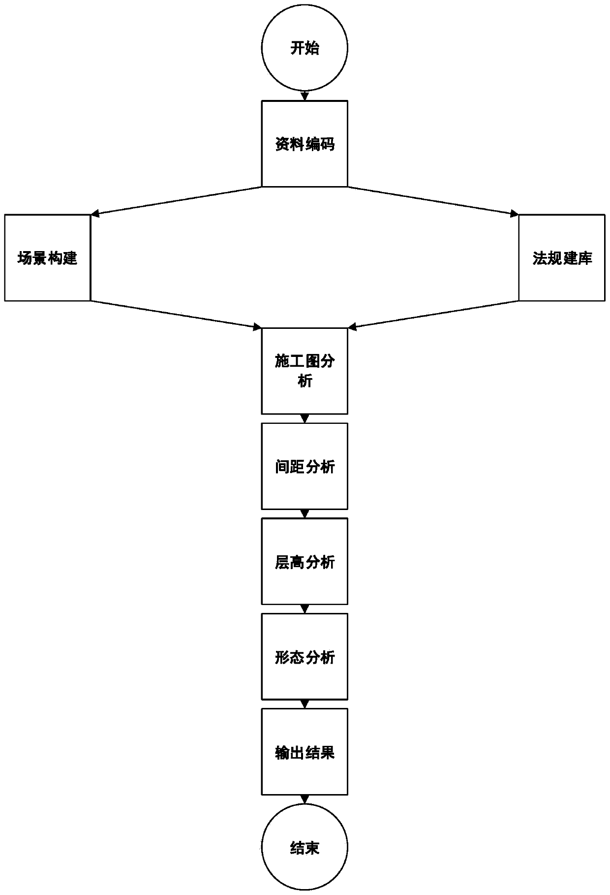
[0108] figure 1 A schematic diagram of the overall process for a method of laying out wires in a three-dimensional space, such as figure 1 As shown, the method includes the following steps:
[0109] Data coding: Coding and classifying the spatial data required by the project, industry regulations and other materials, and sorting out various raw data materials;
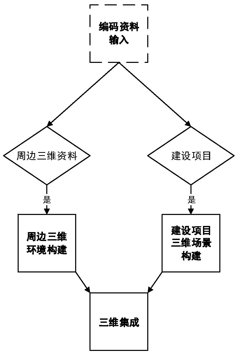
[0110] Scene construction: extract the original data after encoding, make a three-dimensional space analysis model according to the requirements of regulations, name and code each three-dimensional model constructed, and finally form a three-dimensional space analysis scene;
[0111] Building a legal database: extract the original data after coding, extract the relevant regulatory index data for planning and laying out, and build a legal and regulatory database;
[0112] Construction drawing analysis: extract the original data after encoding, extract the planning and design renderings, identify and calculate the posi...
Embodiment 2
[0192] figure 1 A schematic diagram of the overall process for a method of laying out wires in a three-dimensional space, such as figure 1 As shown, the method includes the following steps:
[0193] Data coding: Coding and classifying the spatial data required by the project and the surrounding above-ground structures, building feature attribute data, construction rendering data, and planning industry regulations, and sorting out various raw data. Spatial data include: aboveground 3D point cloud data code DY-DS-00001.las, ground image data code YX-DS-00001.jpg, ground house vector data code FW-DS-00001.shp, ground topographic map data code DX- DS-00001.dwg, project construction drawing data code XM-SG-00001.dwg, project construction rendering data code XM-XGT-00001.jpg. Planning regulations data include: construction project spatial analysis model drawing technical specification data code JSXM-JSGF-DB12-00001.doc, construction project planning lay-out measurement technical r...
PUM
 Abstract
Description
Claims
Application Information
 - R&D
- Intellectual Property
- Life Sciences
- Materials
- Tech Scout
- Unparalleled Data Quality
- Higher Quality Content
- 60% Fewer Hallucinations
Browse by: Latest US Patents, China's latest patents, Technical Efficacy Thesaurus, Application Domain, Technology Topic, Popular Technical Reports.
© 2025 PatSnap. All rights reserved.Legal|Privacy policy|Modern Slavery Act Transparency Statement|Sitemap|About US| Contact US: help@patsnap.com


