Shield tunneling machine risk source crossing three-dimensional simulation and monitoring system based on BIM and GIS
A monitoring system and shield machine technology, applied in resources, structured data retrieval, instruments, etc., can solve problems such as inability to collect monitoring data, increase construction safety risks, and monitor personnel safety hazards, and achieve the effect of increasing measurement frequency
- Summary
- Abstract
- Description
- Claims
- Application Information
AI Technical Summary
Problems solved by technology
Method used
Image
Examples
Embodiment 1
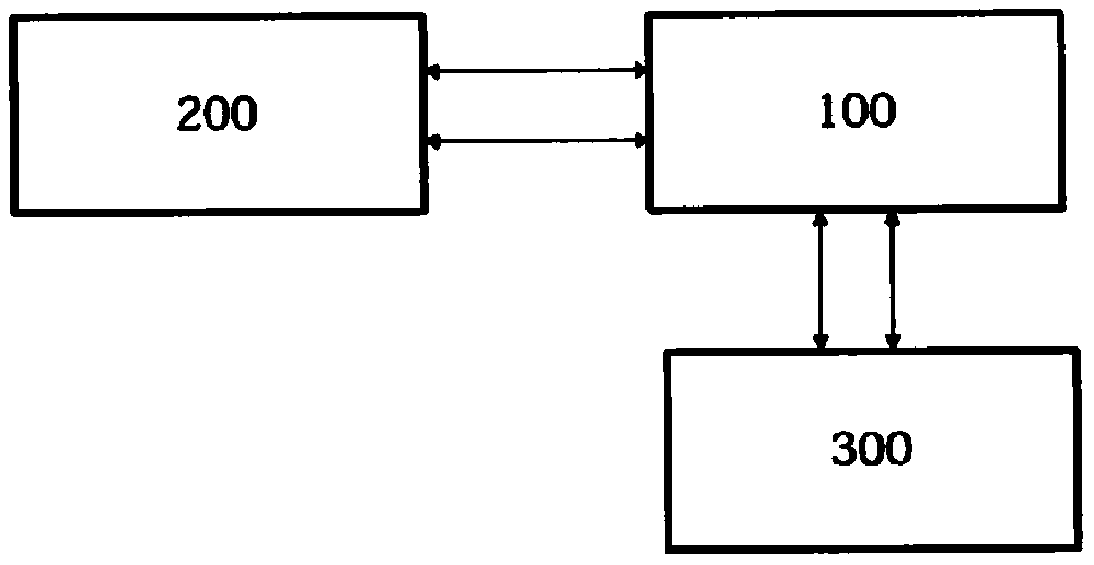
[0036] This embodiment discloses a three-dimensional simulation and monitoring system for shield machine risk source crossing based on BIM and GIS. Such as figure 1 A preferred system is shown. It includes a monitoring platform 100 and a laser scanning monitoring platform 200 . The laser scanning monitoring platform 200 and the BIM sub-module realize the transmission of deformation data in a wireless manner. Both the BIM sub-module and the GIS sub-module can be installed on a computing device. The supervisory platform 100 can also be installed on the same computing device for fusing model data of at least one risk sub-source and geographic information spatial data of its surrounding environment. The supervision platform is a platform that integrates the data of the BIM sub-module and the data of the GIS sub-module to simulate the dynamic changes of the risk sub-source when the shield machine passes through the risk sub-source.
[0037] Model data includes deformation data ...
Embodiment 2
[0061] This embodiment may be a further improvement and / or supplement to Embodiment 1, and repeated content will not be repeated here. In the case of no conflict or contradiction, the whole and / or part of the content of the preferred implementations of other embodiments may serve as supplements to this embodiment.
[0062]Preferably, the geographic information spatial data includes spatial location data for describing geographic location relationships between risk sub-sources. In a shield tunnel construction project, especially in an urban tunnel construction project, the number of risk sub-sources that need to be monitored is large, and the distance between the risk sub-sources is generally small. Therefore, in order to enable the command center or the command sub-center to implement on-site monitoring data acquisition, preferably, the GIS sub-module includes spatial position data for describing the geographic location relationship between risk sub-sources for the monitoring ...
PUM
 Abstract
Description
Claims
Application Information
 - R&D
- Intellectual Property
- Life Sciences
- Materials
- Tech Scout
- Unparalleled Data Quality
- Higher Quality Content
- 60% Fewer Hallucinations
Browse by: Latest US Patents, China's latest patents, Technical Efficacy Thesaurus, Application Domain, Technology Topic, Popular Technical Reports.
© 2025 PatSnap. All rights reserved.Legal|Privacy policy|Modern Slavery Act Transparency Statement|Sitemap|About US| Contact US: help@patsnap.com


