GIS-based data regional processing method

A processing method and data technology, applied in the field of geographic information, can solve problems such as abnormal data, complex data structure, and unsatisfactory system performance, and achieve the effect of meeting disposal requirements and high computing efficiency

Inactive Publication Date: 2020-01-17
ZHEJIANG UNIV OF TECH
View PDF5 Cites 0 Cited by
  • Summary
  • Abstract
  • Description
  • Claims
  • Application Information

AI Technical Summary

Problems solved by technology

[0003] The user's real GIS data structure is complex, and the data will contain four major information items: latitude and longitude, user name, sending time, and altitude. In some special cases, the data cannot be used as the basis for judging whether the user is in a specific area, such as the collection device. Data anomalies caused by faults, noise fluctuations caused by cloud occlusion, and system performance not meeting the requirements, because in these special cases it is necessary to recalculate whether the user actually exists in a specific area
[0004] With the increasing number of mobile phones, the full display of data has a certain impact on the utilization rate of system computing resources and system effective performance of the GIS supervision system. There are certain defects, and it is difficult to support the further optimization of the supervision efficiency of the system

Method used


Image

  • GIS-based data regional processing method
  • GIS-based data regional processing method
  • GIS-based data regional processing method

Examples


Embodiment Construction

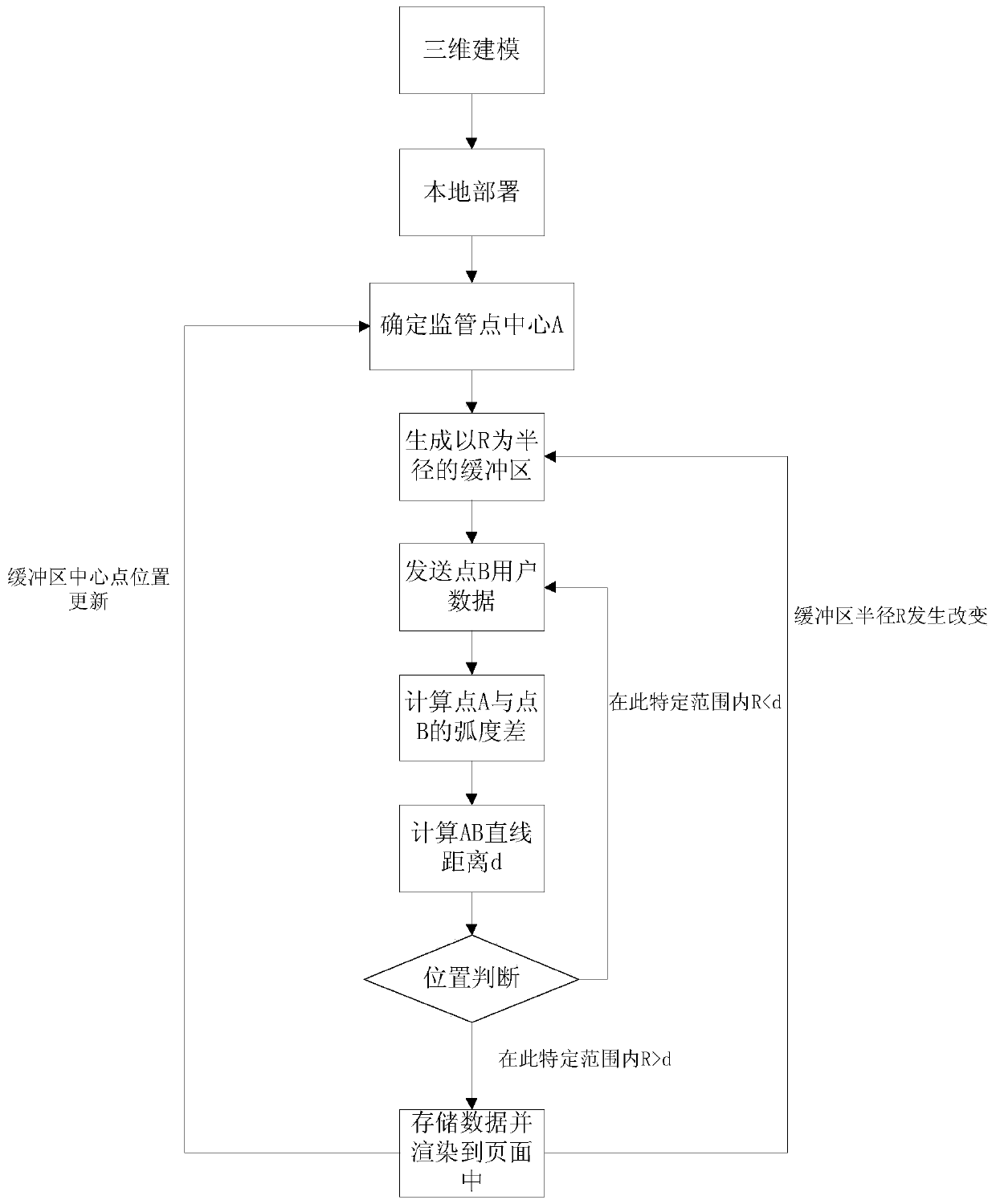
[0031] The present invention will be further described below in conjunction with the accompanying drawings.

[0032] refer to figure 1 and figure 2 , a GIS-based data subregional processing method, comprising the following steps:

[0033] 1) After completing the 3D modeling and confirming the establishment of the buffer zone, deploy it to the local server and display it through the web page;

[0034] 1.1) 3D modeling, import the base map into ArcGISPro, import urban building data, use the imported urban data to build a 3D visualization model, and publish it to the server for display by user equipment and data analysis by the background server;

[0035] 1.2) Deploy JavaScript for ArcGIS API on the local computer, and load it in the local browser after deployment;

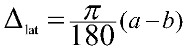
[0036] 1.3) Determine a buffer center point A, the abscissa is the longitude a of point A, and the ordinate is the latitude b of point A;

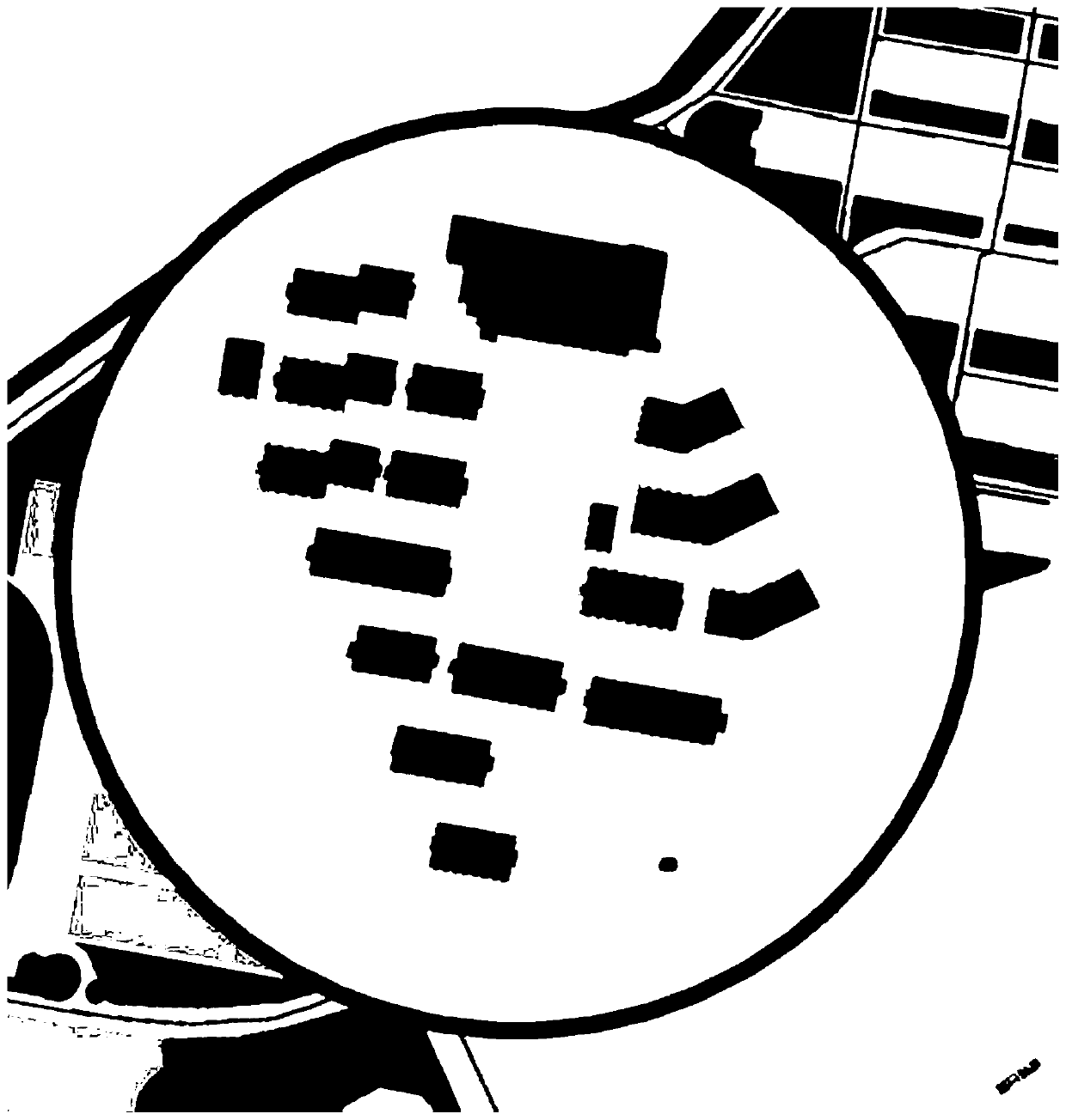
[0037] 1.4) With A as the center, generate a circular buffer zone with ...


PUM


Abstract

A GIS-based data regional processing method comprises the steps of firstly introducing a base map into ArcGISPro, introducing urban building data, and establishing a three-dimensional visualization model by using the introduced urban building data; deploying a JavaScript for ArcGIS API on a local computer, and loading the JavaScript for ArcGIS API in a local browser after the deployment is finished; then, determining a supervision area center point A, and generating a circular buffer area with the radius R with A as the center; further, gradually receiving user data sent by the point B mobileterminal by means of a WebSocket protocol; calculating the radian difference by using longitude and latitude data, calculating the linear distance between A and B by using the relationship between the radian difference and the radius of the equator of the earth, judging the spatial relationship between two points according to the linear distance and the radius of the buffer area, and carrying outcorresponding final disposal at a webpage end. The system is high in calculation resource utilization rate, high in system effective performance rate and high in supervision efficiency.

Description

technical field [0001] The invention relates to the field of geographic information and the field of computer application, in particular to a GIS-based data sub-area processing method. Background technique [0002] In recent years, with the acceleration of my country's informatization process, the number of mobile phone users has increased sharply, and the amount of GIS data transmitted has become increasingly large. The system load when receiving and displaying GIS data from online users is too large. Intelligent disposal helps to ensure the smooth flow of data, improve the efficiency of GIS supervision of specific areas, achieve the purpose of alleviating system load, and solve social problems such as data congestion, weak supervision and energy consumption to a certain extent. Among them, mobile phone users The subregional collection of GIS data is the basis for intelligent processing. [0003] The user's real GIS data structure is complex, and the data will contain four...

Claims


Application Information

Patent Timeline
Patent Type & Authority Applications(China)
IPC IPC(8): G06F16/29G06F16/26G06T17/05G06T7/62
CPCG06F16/29G06F16/26G06T17/05G06T7/62G06T2200/04
Inventor 张贵军张晨卢升荣李亭秦子豪
Owner ZHEJIANG UNIV OF TECH
Why Eureka
Try Eureka