Satellite remote sensing cloud computing platform and system
A cloud computing platform and satellite remote sensing technology, applied in the field of remote sensing satellite data processing, can solve the problems of resource and energy waste, single point of failure, low resource utilization rate, etc.
- Summary
- Abstract
- Description
- Claims
- Application Information
AI Technical Summary
Problems solved by technology
Method used
Image
Examples
Embodiment 1
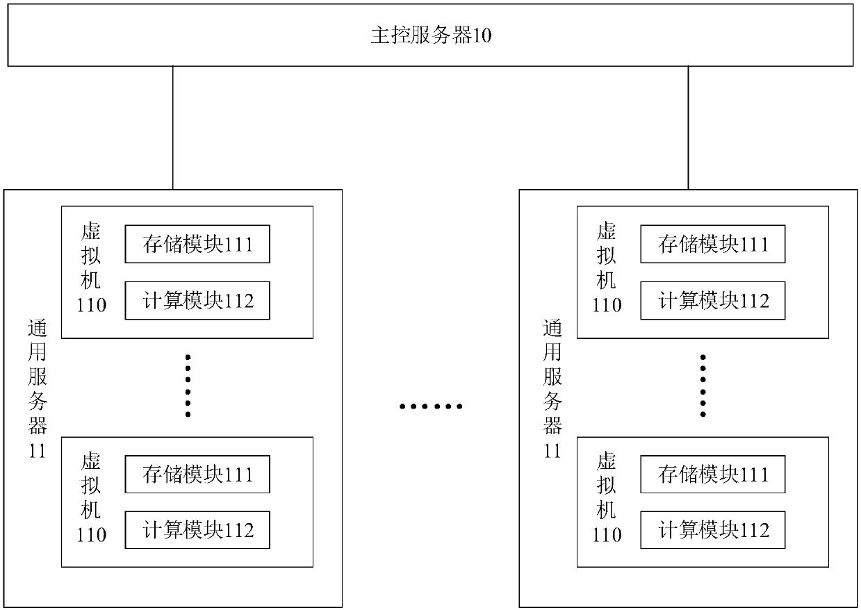
[0036] figure 2 A schematic structural diagram of a satellite remote sensing cloud computing platform provided by an embodiment of the present invention is shown. Such as figure 2 As shown, the satellite remote sensing cloud computing platform includes a main control server 10, and a plurality of general servers 11 connected to the main control server 10, and one or more virtual machines 110 are all created on the general server; the virtual machine includes a storage module 111 and computing module 112. In a possible embodiment, the general server is an x86 general server.
[0037] The main control server is used to receive the satellite data downloaded by the data receiver; push the satellite data to the corresponding virtual machine according to the predefined workflow. The satellite data is the original data classified according to the order of observation. The workflow can be to write a job definition file (*.def) in a business description script language, complete ...
Embodiment 2
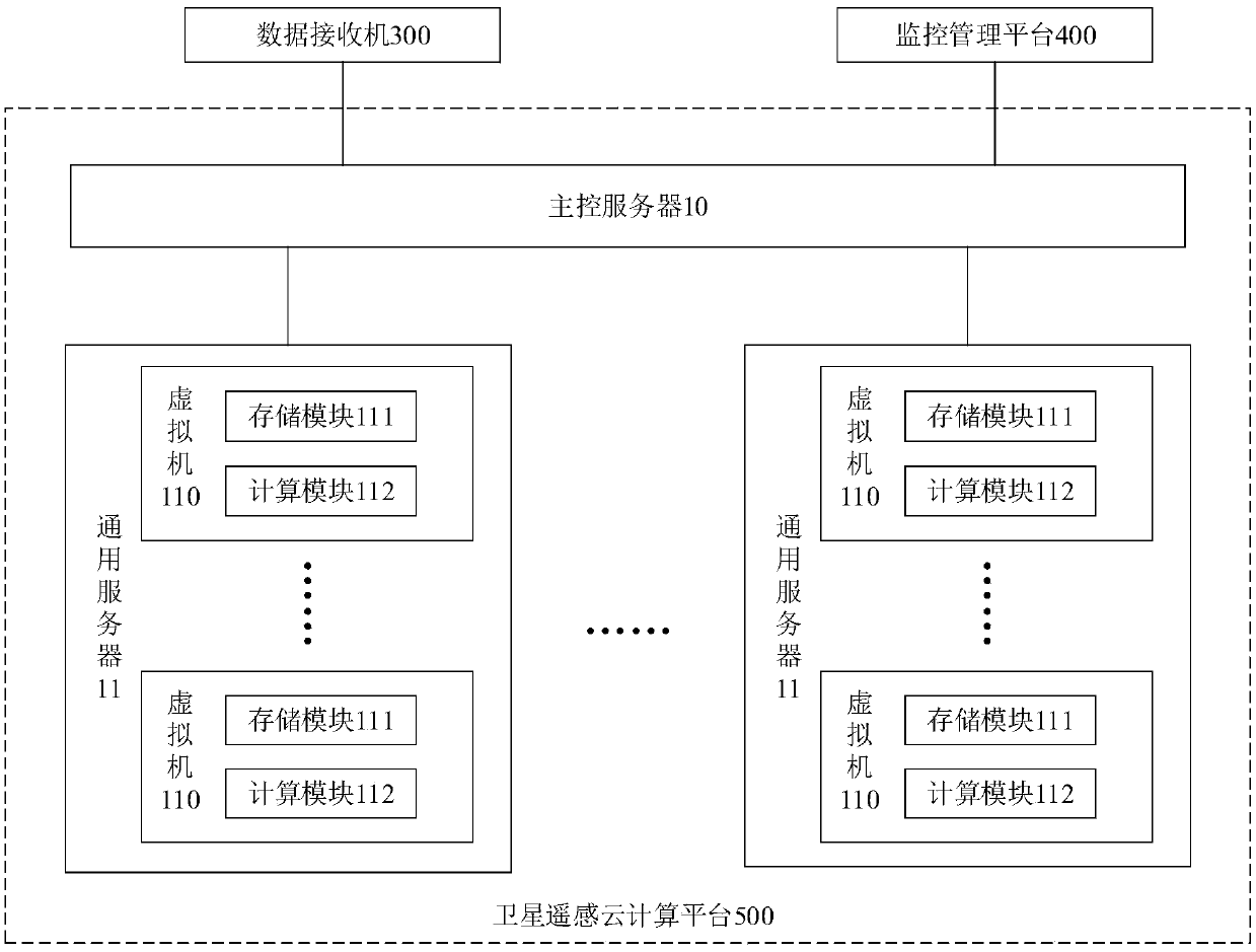
[0057] image 3 A schematic structural diagram of a satellite remote sensing cloud computing system provided by an embodiment of the present invention is shown. Such as image 3 As shown, the satellite remote sensing cloud computing system includes a data receiver 300, a monitoring and management platform 400, and a satellite remote sensing cloud computing platform 500 in Embodiment 1, wherein the data receiver and the monitoring and management platform are respectively connected to the main control server.
[0058] The data receiver downloads satellite monitoring data in real time, such as NPP (net primary productivity) data, reads data from the receiving buffer area, directly saves the most original remote sensing data, and extracts satellite data that needs further processing as a zero-level data product. The satellite data is sent to the satellite remote sensing cloud computing platform for analysis to realize real-time quick-view monitoring and quality statistics of NPP ...
PUM
 Abstract
Description
Claims
Application Information
 - R&D
- Intellectual Property
- Life Sciences
- Materials
- Tech Scout
- Unparalleled Data Quality
- Higher Quality Content
- 60% Fewer Hallucinations
Browse by: Latest US Patents, China's latest patents, Technical Efficacy Thesaurus, Application Domain, Technology Topic, Popular Technical Reports.
© 2025 PatSnap. All rights reserved.Legal|Privacy policy|Modern Slavery Act Transparency Statement|Sitemap|About US| Contact US: help@patsnap.com


