
Point cloud plane segmentation method based on rapid adjacent voxel query

A technology of plane segmentation and voxel connection, applied in the field of 3D reconstruction, can solve the problem of high computational efficiency, achieve high computational efficiency, little influence of point cloud noise, and improve accuracy

Active Publication Date: 2019-11-12
BEIJING UNIV OF CIVIL ENG & ARCHITECTURE
View PDF7 Cites 8 Cited by
  • Summary
  • Abstract
  • Description
  • Claims
  • Application Information

AI Technical Summary

Problems solved by technology

[0005] An object of the present invention is to provide a point cloud plane segmentation method based on fast adjacent voxel query, which is less affected by point cloud noise, has high computational efficiency, and effectively reduces the problems of over-segmentation and under-segmentation of point cloud planes. Improve the recall rate and accuracy of point cloud plane segmentation, aiming to solve the problem of efficient plane segmentation of large data volume point cloud

Method used


Image

  • Point cloud plane segmentation method based on rapid adjacent voxel query
  • Point cloud plane segmentation method based on rapid adjacent voxel query
  • Point cloud plane segmentation method based on rapid adjacent voxel query

Examples


experiment example 1

[0074] Comparison of Experimental Example 1 and Point-Based Plane Segmentation Algorithm

[0075] In order to compare the method of the present invention with the traditional point-based plane segmentation algorithm, two data sources are selected as experimental data, which are ground lidar scanning data and vehicle-mounted lidar scanning data.

[0076] 1.1 Ground lidar scan data

[0077] The first set of terrestrial lidar scanning data is the color point cloud data of a certain building. This data is scanned by a FAROLaser Scanner Focus3D X 130 terrestrial 3D laser scanner. Before the experiment, some non-buildings were removed by simple cutting objects and noise points, and thinned out. The processed data contains a total of 1,720,457 points, including many planar features, and there are phenomena of occlusion and uneven data density, such as Figure 5 (a) shown. Standard data by manual segmentation such as Figure 5 (b) shown. Three algorithms are used to process the e...

experiment example 2

[0089] Comparison of Experimental Example 2 and Voxel-based Segmentation Algorithm

[0090] The superiority of the algorithm of the present invention is verified by comparing with the traditional point-based plane segmentation algorithm. At the same time, we also compare it with the currently more advanced voxel-based segmentation algorithm VGS to verify the algorithm of the present invention. First, the experimental data 1 with a small amount of data is selected for testing. In addition, we hope that the algorithm of the present invention can quickly divide the point cloud data with a large amount of data. Therefore, the data with a large amount of data is selected as Figure 10 (a) is shown as experimental data, which is part of the large-scale point cloud data classification benchmark dataset sg27_10 released by ETH Zurich in 2016, which contains a total of 28,112,328 three-dimensional points. The set of point clouds Containing objects such as the ground, walls, roofs, wind...


PUM


Abstract

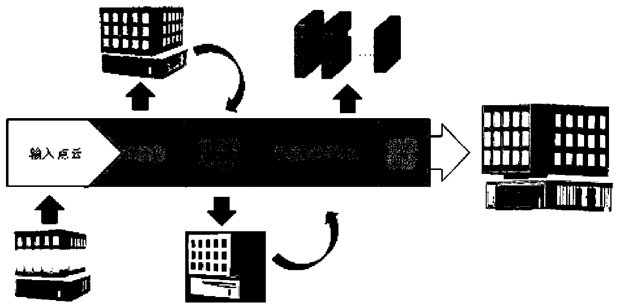
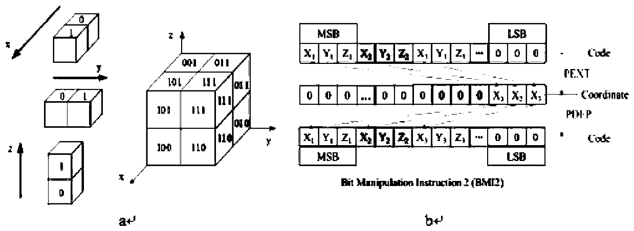
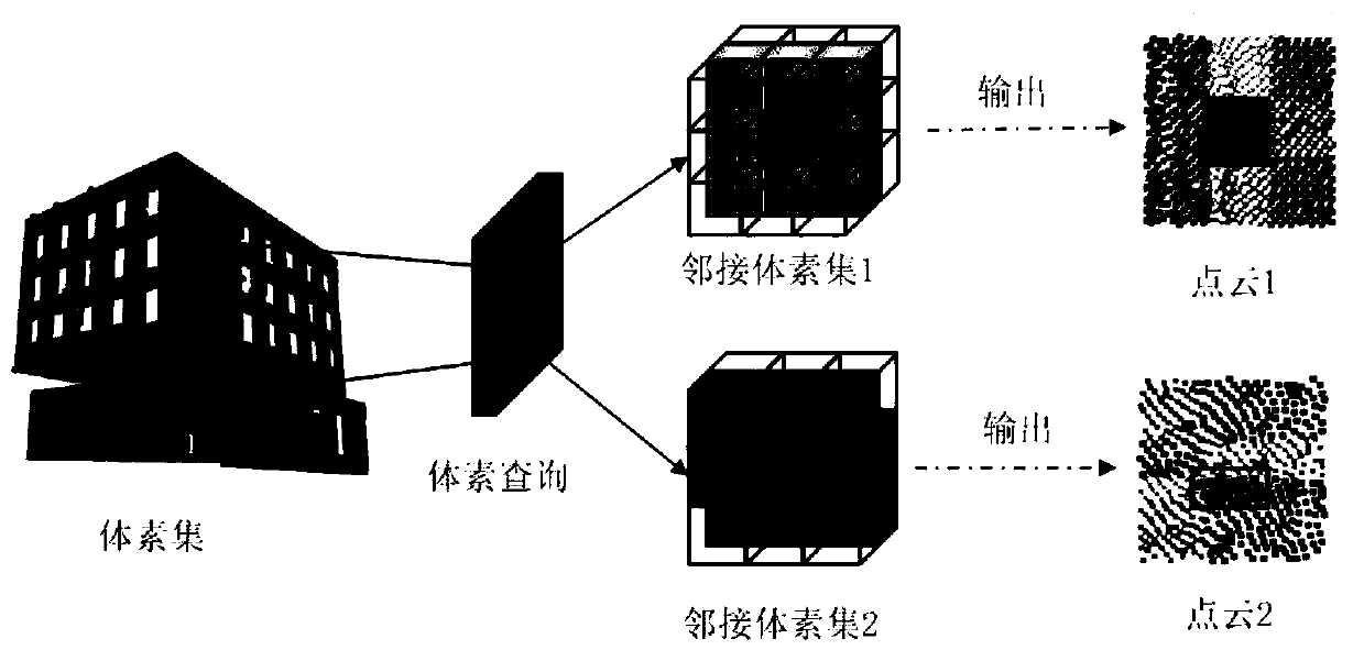
The invention discloses a point cloud plane segmentation method based on quick adjacency voxel query, which comprises the following steps: constructing an octree according to point cloud data, puttingeach point into a corresponding octree node according to a coordinate value, wherein each node corresponds to a voxel; coding nodes of the octree by adopting a binary coding mode, and quickly querying adjacent voxels according to voxel codes; calculating the significance characteristic of each voxel; carrying out coarse segmentation on voxels by using a region growing algorithm; and performing fine segmentation on each point in the unsegmented voxel according to the distance from the point in the unsegmented voxel to the nearest plane in the adjacent voxel. According to the method, the problems of over-segmentation and under-segmentation of the point cloud plane are effectively reduced, the recall rate and accuracy of point cloud plane segmentation are improved, the influence of point cloud noise is small, and the calculation efficiency is high.

Description

technical field [0001] The invention relates to the field of three-dimensional reconstruction. More specifically, the present invention relates to a point cloud planar segmentation method based on fast neighbor voxel query. Background technique [0002] With the continuous development and progress of 3D laser scanning equipment, it becomes easier and more accurate to obtain point cloud data, which makes 3D laser scanning technology gain important roles in 3D reconstruction, cultural heritage protection, navigation and positioning, urban planning, etc. application. Whether indoors or outdoors, planar features occupy the main part in 3D scenes. In large-scale 3D scene reconstruction, 3D reconstruction of complex objects can be better completed by segmenting and recognizing planar shapes. The traditional plane segmentation algorithm is limited by the huge amount of point cloud data and the neighborhood point search method, resulting in slow calculation efficiency. Most segmen...

Claims


Application Information

Patent Timeline
IPC IPC(8): G06T7/11G06T7/187
CPCG06T7/11G06T7/187G06T2207/10028
Inventor 黄明韦朋成
Owner BEIJING UNIV OF CIVIL ENG & ARCHITECTURE
Learn More