Satellite-borne sparse voyage over SAR three-dimensional imaging method under large orbit distribution range

A distribution range, three-dimensional imaging technology, applied in the direction of reflection/re-radiation of radio waves, utilization of re-radiation, measurement devices, etc., can solve problems such as image distortion, limited super-resolution, and inability to meet centimeter-level resolution requirements, and achieve Avoid distance migration, solve the problem of blurring in the height direction, and solve the effect of low resolution in the height direction of the image

Active Publication Date: 2019-11-12
BEIJING INST OF ENVIRONMENTAL FEATURES
View PDF5 Cites 3 Cited by
  • Summary
  • Abstract
  • Description
  • Claims
  • Application Information

AI Technical Summary

Problems solved by technology

At present, in order to maintain the same phase relationship of signals between different passages, the 3D imaging method based on compressed sensing theory requires orbits to be distributed within 1 km, and the corresponding cross-orbit theoretical resolution is tens of meters, and the super-resolution is limited. Meet centimeter-level resolution requirements
In addition, current imaging methods usually ignore the coupling of echo signals in the cross-track and distance directions, which will cause image distortion under large apertures.

Method used


Image

  • Satellite-borne sparse voyage over SAR three-dimensional imaging method under large orbit distribution range
  • Satellite-borne sparse voyage over SAR three-dimensional imaging method under large orbit distribution range
  • Satellite-borne sparse voyage over SAR three-dimensional imaging method under large orbit distribution range

Examples


Embodiment Construction

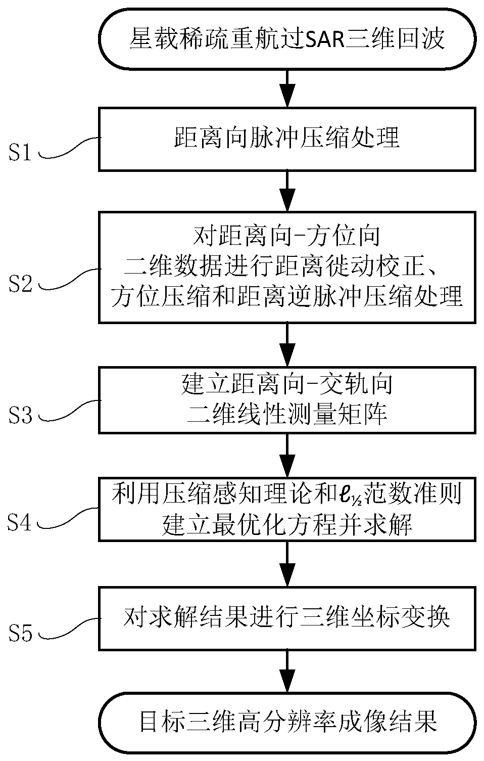
[0045] In order to make the purpose, technical solutions and advantages of the embodiments of the present invention clearer, the technical solutions in the embodiments of the present invention will be clearly and completely described below in conjunction with the drawings in the embodiments of the present invention. Obviously, the described embodiments It is a part of embodiments of the present invention, but not all embodiments. Based on the embodiments of the present invention, all other embodiments obtained by persons of ordinary skill in the art without making creative efforts belong to the protection scope of the present invention.

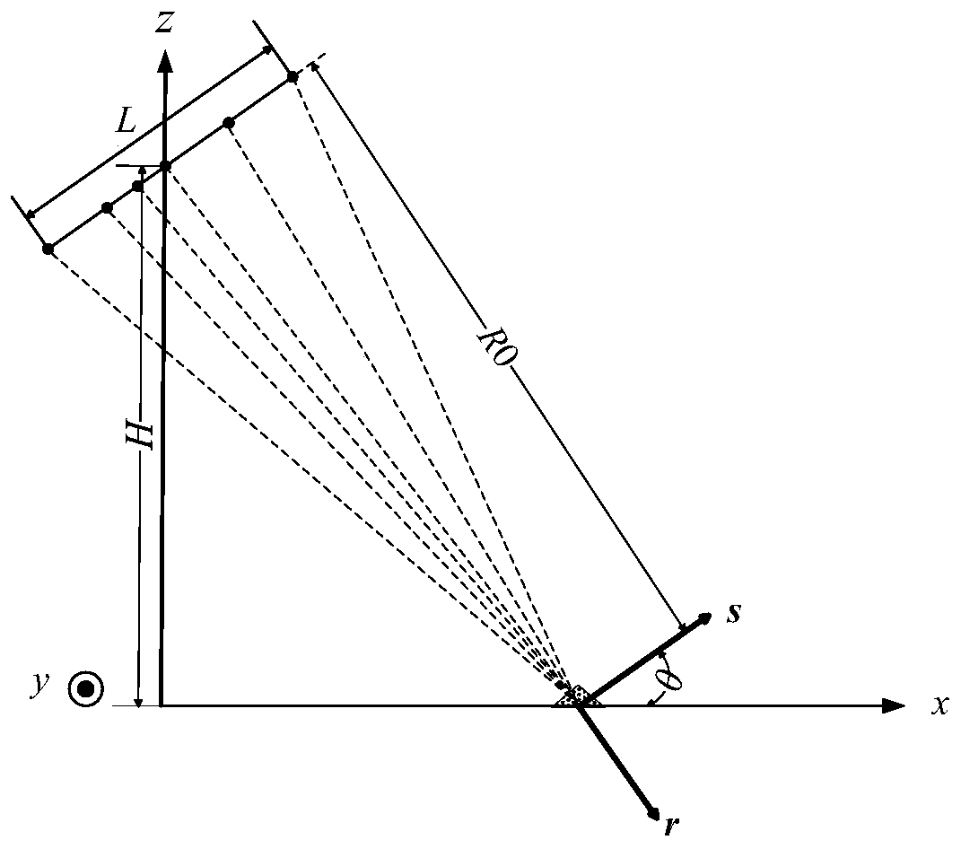
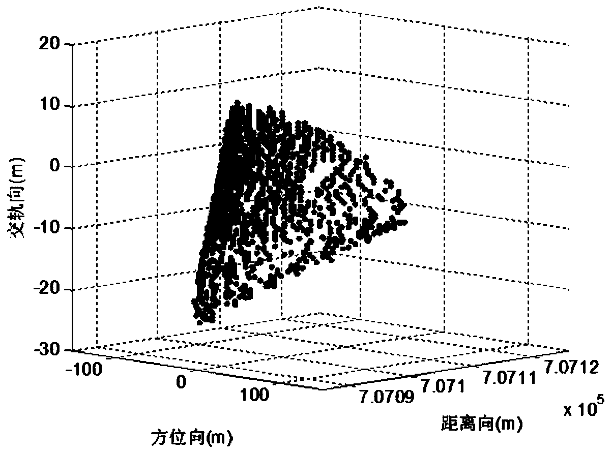
[0046] Spaceborne synthetic aperture radar (SAR) three-dimensional imaging technology uses spaceborne SAR to transmit and observe the observation target in the scene, obtain the echo signal containing the information of the target scattering center, and process the echo signal to realize three-dimensional imaging. Such as figure 1 as shown, ...


PUM


Abstract

The present invention relates to a satellite-borne sparse voyage over SAR three-dimensional imaging method under a large orbit distribution range. The method comprises: acquiring an echo signal, and performing pulse compression processing in a range direction to obtain range direction-focused data; performing distance migration correction, azimuth compression and range inverse pulse compression processing on the range direction-azimuth direction two-dimensional data corresponding to each orbital direction sampling unit to obtain azimuth direction-focused data; establishing a range direction-orbital direction two-dimensional linear measurement matrix for range direction-orbital direction two-dimensional data corresponding to each azimuth direction resolution unit; using the compressed sensing theory and the l1/2 norm optimal criterion to establish the optimal equation and solving the optimal equation to obtain a backscattering coefficient of the target in the range direction-orbital direction; and performing three-dimensional coordinate transformation to obtain three-dimensional imaging results. According to the method provided by the present invention, the problem of image aliasingcaused by sparse voyage oversampling, and the problem of range direction-orbital direction data coupling under the large orbit distribution range are solved, and the image quality can be effectivelyimproved.

Description

technical field [0001] The invention relates to the technical field of radar imaging, in particular to a three-dimensional imaging method for space-borne sparse retravel SAR under a large orbital distribution range. Background technique [0002] Spaceborne SAR (Synthetic Aperture Radar) 3D imaging technology has important application value in fields such as terrain mapping and battlefield reconnaissance. Due to the limitation of the satellite platform, the cross-track to re-travel is non-uniform and under-sampled, and the traditional imaging method will cause serious blurring of the image. With the wide application of compressive sensing theory and sparse signal processing methods in the field of radar sparse imaging, the SAR imaging method based on compressive sensing theory can realize unambiguous three-dimensional imaging of targets under sparse sampling. At present, in order to maintain the same phase relationship of signals between different passages, the 3D imaging me...

Claims


Application Information

Patent Timeline
Patent Type & Authority Applications(China)
IPC IPC(8): G01S13/90
CPCG01S13/90G01S13/9004
Inventor 田鹤
Owner BEIJING INST OF ENVIRONMENTAL FEATURES
Why Eureka
Try Eureka