An available land resource analysis system based on high-resolution satellite remote sensing data
A technology of satellite remote sensing data and land resources, applied in the field of land analysis system, can solve the problem of large amount of data, achieve high precision and enhance the effect of recognition ability
- Summary
- Abstract
- Description
- Claims
- Application Information
AI Technical Summary
Problems solved by technology
Method used
Image
Examples
Embodiment 1
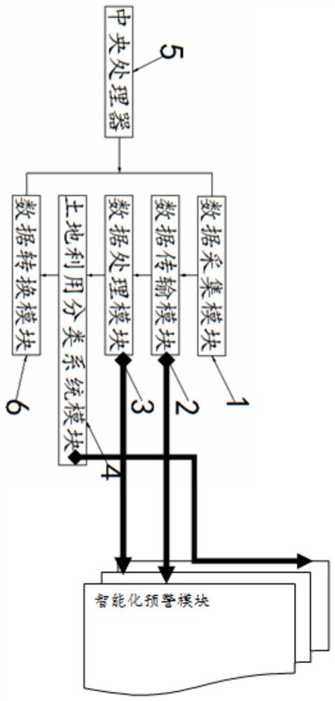
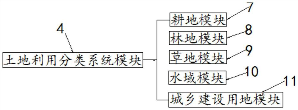
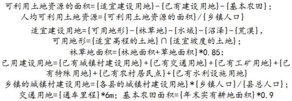
[0032] Example 1, such as Figure 1 to Figure 3As shown, the present invention provides a kind of available land resources analysis system based on high-resolution satellite remote sensing data, including data collection module 1, data transmission module 2, data processing module 3, land use classification system module 4, central processing unit 5 And data conversion module 6, described data acquisition module 1, data transmission module 2, data processing module 3, land use classification system module 4 and data conversion module 6 are all connected with described central processing unit 5, and described data acquisition module The output end of 1 is connected to the input end of the data transmission module 2, the output end of the data transmission module 2 is connected to the input end of the data processing module 3, and the output end of the data processing module 3 is connected to the land Utilize the input end of classification system module 4 to be connected, the o...
Embodiment 2
[0043] Embodiment 2, the data acquisition module 1 is used to acquire remote sensing image raster data and basic data of land spatial configuration.
Embodiment 3
[0044] Embodiment 3, the data processing module 3 refers to feature extraction, remote sensing scale selection and remote sensing image classification to remote sensing images, remote sensing image feature extraction refers to the extraction of spectrum, texture and shape features, the selection of the remote sensing scale Including the local variance method and variation function method, the methods of remote sensing image classification include methods based on statistical analysis and methods based on multi-source data fusion.
PUM
 Abstract
Description
Claims
Application Information
 - R&D
- Intellectual Property
- Life Sciences
- Materials
- Tech Scout
- Unparalleled Data Quality
- Higher Quality Content
- 60% Fewer Hallucinations
Browse by: Latest US Patents, China's latest patents, Technical Efficacy Thesaurus, Application Domain, Technology Topic, Popular Technical Reports.
© 2025 PatSnap. All rights reserved.Legal|Privacy policy|Modern Slavery Act Transparency Statement|Sitemap|About US| Contact US: help@patsnap.com


